5 Hiking Trails near Pavilion Point / Silverdale / Silver Creek / Empire Pass - Free Arenas
Pavilion Point / Silverdale / Silver Creek / Empire Pass
39.71517836, -105.69585726
Add Location

Embed Search

Place this code in your website's html where you'd like to see these results.

Where do you plan to embed this code?

<script src="https://www.freearenas.com/embed/s449"></script>

Want to customize this plugin? Copy Code Snippet

5 Hiking Trails near Pavilion Point / Silverdale / Silver Creek / Empire Pass

first prev 1 next last

Showing Hiking Trails within 50 miles Distance miles Go of 1491 Argentine St, Georgetown, CO 80444, USA City, Zip, or Address Go
Add Location

Herman Gulch

Silver Plume, Colorado

8.5 miles W

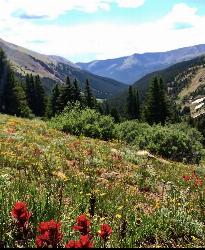
Herman Gulch is a well traveled trail, right off of I-70. It gets busy quickly. This trail is about a 6 mile out and back trail that starts with a sharp incline and runs along a river. This hike is...

Backpack, Hike

hike Hiking Trail

backpack Backpacking Trail

Saint Mary's Glacier

Idaho Springs, Colorado

8.7 miles N

Saint Mary's Glacier (or Saint Marys) is a semi-permanent snowfield located in Arapaho National Forest in the U.S. state of Colorado. Saint Mary's Glacier is 2.5 mi (4.0 km) southeast of...

Hike

hike Hiking Trail

Braille Trail / Beaver Brook Trail

Golden, Colorado

20.2 miles E

Beaver Brook Trail is actually a small system of trails that sit very close to the front range of the Denver Metro area. A few small loops can be done, but for the most part most people will do this...

Hike

hike Hiking Trail

0.1-0.9 mi

Clear Creek Whitewater Park

Golden, Colorado

25.1 miles E

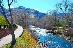
Dedicated in 1998 and located in Golden, Colorado, Clear Creek Park is one of the most unique parks in Colorado filled with water activities such as kayaking and canoeing. It reaches a quarter...

Canoe, Hike, Kayak, Mountain Bike, Swim, Whitewater

hike Hiking Trail

mountain bike Mountain Bike Trail

swim Swimming Hole

canoe Canoeing Area

kayak Kayaking Area

whitewater Whitewater Rapid

Mallory Cave

Boulder, Colorado

28.0 miles NE

This hike starts at the NCAR parking lot. Head west to the Mesa trail and cross it by the information sign. There are lots of offshoot trails, be sure to follow the signs to the final 100 ft rock...

Cave, Hike

hike Hiking Trail

cave Cave

Look Further
×
loading...

Edit Your Experience

Log Your Visit to This Location

We've logged that you went. Is there anything else you want to add?

Thank you for your review/comment

We've recorded your comments. Is there anything else you want to add?

By recording your visit on FreeArenas.com, you'll have a collection of all the great places you've been and provide valuable information for yourself and others in the future.

Have you been to this location?

/5
Cancel

Donate to the Cause

Help us inspire and inform every person to enjoy life and the great outdoors in a responsible way. There's a lot of ways to do this. Here's a few ways we're working on our mission right now: Providing information, Building and maintaining local trails, Helping and teaching kids to fix their bikes, Cleaning up local parks to provide safe and clean places to enjoy nature. Learn More

Update Review

/5

New Collection

Add an Arena

Just some quick info about this location to get started...