


10 Hiking Trails near Liberty Skatepark
Showing Hiking Trails within 50 miles Distance miles of 13930 Monroe St, Westminster, CA 92683, USA City, Zip, or Address
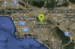
laguna lake park trail
Fullerton, California
10.4 miles NLaguna Lake Park encompasses 450 acres, including a 25 acre natural lake and a large undeveloped open space with hiking trails. The area was once used by the Chumash Indians for hunting and fishing....
Hike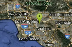
Arroyo Pescadero Park
Whittier, California
14.2 miles NLocated in the Puente Hills, and managed by the Puente Hills Habitat Preservation Authority, Arroyo Pescadero serves as a link in a wildlife corridor that connects lands that reach from the Whittier...
Hike
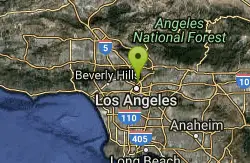
Elysian Park
Los Angeles, California
26.6 miles NWElysian Park is the name of a municipal park and of an adjacent neighborhood in Central Los Angeles, California. Encompassing Chavez Ravine, where Dodger Stadium is located, the neighborhood is...
Hike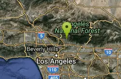
Sam Merrill Trailhead
Altadena, California
31.7 miles NThe Sam Merrill Trail is a major hiking trail in the Las Flores Canyon of the San Gabriel Mountain Range north of Altadena, California, which leads to the top of Echo Mountain. It was built by...
Hike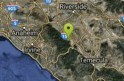
Horse Thief Canyon
Corona, California
31.9 miles EHorse Thief Canyon is a hidden play location in Lake Elsinore/Corona, California. This is an Awesome place to play off of the side of the road. Rocks, Trees, Sandpits, and more to make your game...
Airsoft, Hike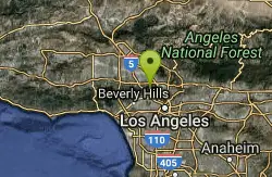
Hollywood Sign on Mt. Lee
Los Angeles, California
32.2 miles NWMount Lee is a peak in the Santa Monica Mountains, located in Griffith Park in Los Angeles, California, USA. The famous Hollywood Sign is located on its southern slope. The sign is visible north of...
Hike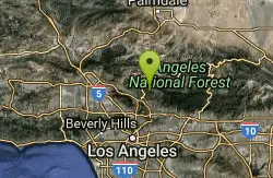
Switzer Falls
Los Angeles-Long Beach-Santa Ana, CA, California
35.6 miles NThis is a relatively easy hike into one of the loveliest sections of the San Gabriel mountains. The hike meanders back and across the stream running down the spectacular Arroyo Seco Canyon. The...
Hike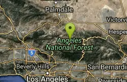
Bandido Group Campground
Pearblossom, California
40.4 miles NGroups of all types will enjoy staying at the Bandido Group Campground, which boasts beautiful scenery in a relaxing, rustic atmosphere. The site accommodates groups of up to 150 campers, but is...
Camp, Hike, Horseback 0.3-1.0 mi
Rock Pool
Agoura Hills, California
48.6 miles NWRock Pool is a gem that can be found in the heart of Malibu State Creek Park. This swimming hole can be reached using multiple trails, making this the perfect choose your own adventure. Parking and...
Camp, Hike, Swim
Malibu Creek State Park
Calabasas, California
48.7 miles NWMalibu Creek State Park has something for everyone! Just 25 miles from downtown Los Angeles, the park features hiking, fishing, bird watching and horseback riding opportunities. There are 15 miles of...
Camp, Hike, Horseback, Mountain Bike, Rock Climb


