


21 Hiking Trails near Lariat caves
first prev 1 2 next lastShowing Hiking Trails within 50 miles Distance miles of AM FALLS, ID 83211, USA City, Zip, or Address
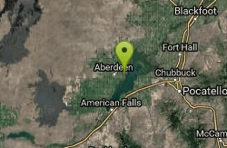
Sportsman's Park American Falls Reservoir
Aberdeen, Idaho
21.1 miles EThis beautiful 30-acre park is a multi-use area with facilities and activities for a variety of recreational uses. Situated adjacent to the American Falls Reservoir, it provides primary access to...
Camp, Canoe, Hike 0.2-9.7 mi
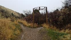
City Creek
Pocatello, Idaho
37.9 miles EThe City Creek Management Area (CCMA) Trail System is a vast network of trails maintained by the City of Pocatello. There are trails to go up and others to come down. Most trails come back to the...
Hike, Horseback, Mountain Bike 8.8 mi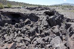
Wilderness Trail
Visitors Center, Craters of the Moon National Monument
39.5 miles NWYou will have a sense of solitude as you travel into the Craters of the Moon Wilderness. Begin the trail on the sidewalk that parallels the roadway and turn right to follow the direct route across a...
Cave, Hike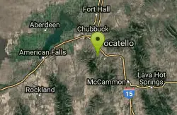
Slate Mountain/Gibson Jack Trail
Pocatello, Idaho
39.5 miles EThe Gibson Jack trail offers great views of Southeastern Idaho and a favorite trail among moutain bikers. This trail is a continuation of the West Fork Mink Creek trail and takes travelers further...
Hike, Horseback, Mountain Bike 1.9 mi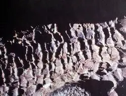
Tree Molds Trail
Visitors Center, Craters of the Moon National Monument
39.5 miles NWWhen molten lava advanced through this area it flowed through a grove of living trees. As the trees burned, moisture was released as steam, cooling the hot lava just enough to leave an impression of...
Hike 1.7 mi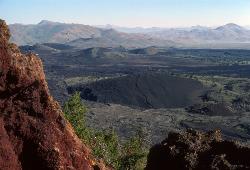
Broken Top Loop Trail
Visitors Center, Craters of the Moon National Monument
39.5 miles NWThe Broken Top Loop Trail provides an opportunity to hike over, under and around the youngest volcano on the Snake River Plain. The event that created this cinder cone and associated lava flows...
Cave, Hike 1.0-1.3 mi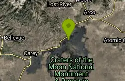
Caves Trail
Visitors Center, Craters of the Moon National Monument
40.3 miles NWCave and Hike near Visitors Center, Craters of the Moon National Monument
Cave, Hike 0.4 mi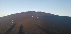
Inferno Cone
Visitors Center, Craters of the Moon National Monument
40.5 miles NWCinder cones form when gas-rich volcanic froth erupts high into the air and then piles into a mound. Climb Inferno Cone, if you wish, but don't be disappointed if you are unable to locate the...
Hike 0.1 mi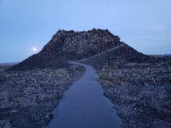
Spatter Cones
Visitors Center, Craters of the Moon National Monument
40.6 miles NWThese miniature volcanoes formed when blobs of molten lava were lobbed into the air during the last gasp of an eruption sequence that ended about 2,100 years ago. Craters of the Moon is well known...
Hike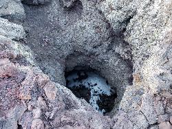
Snow Cone
Visitors Center, Craters of the Moon National Monument
40.6 miles NWHike near Visitors Center, Craters of the Moon National Monument
Hike 1.8 mi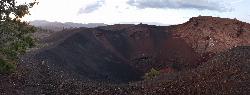
North Crater Trail
Visitors Center, Craters of the Moon National Monument
40.6 miles NWThis one-way trail is especially interesting for its variety. The trail traverses North Crater and drops into the crater mouth, the vent for the North Crater flow. Notice that the northwest flank of...
Hike 0.5 mi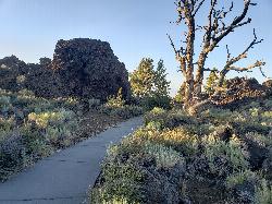
Devil's Orchard Trail
Visitors Center, Craters of the Moon National Monument
40.8 miles NWThis paved trail explores an area of cinder beds scattered with pieces of the North Crater wall. Exhibits along the trail challenge you to consider the difficulties of protecting this fragile...
Hike
West Fork Mink Creek Trail
Pocatello, Idaho
41.5 miles EA popular trail in the Eastern Idaho area for horseback riding, hiking, and mountain biking. The trail is a little over three and a half miles of single track riding. For the majority of the trail...
Hike, Horseback, Mountain Bike
Valve House Draw
Pocatello, Idaho
41.5 miles EThis trail is a motorized, doubletrack trail, as well as a great place to go hiking. For the most part, the trail is all uphill through a forest. There are some technical sections of the route as...
Cross-country Ski, Hike, Horseback, Mountain Bike
North Crater Flow
Arco, Idaho
41.6 miles NWHike near Arco, Idaho
Hike
South Fork Of Mink Creek Trail
Pocatello, Idaho
41.7 miles ECross Country Ski, Hike, Mountain Bike, and Snowshoe near Pocatello, Idaho
Cross-country Ski, Hike, Mountain Bike, Snowshoe
East Fork Mink Creek Trail
Pocatello, Idaho
41.7 miles EIf it's early in the season and you're anxious to dust off the skis, the East Fork Road is a good starting place. The East Fork road to Justise Park Rec Area joins the Bannock Highway about...
Cross-country Ski, Hike, Horseback, Mountain Bike 3.2 mi
Kinney Creek Trail
Pocatello, Idaho
41.8 miles EKinney Creek Trail is in the Caribou-Targhee National Forest near Pocatello. This is a 6.4 out-and-back trail that takes you to the Indian Mountain Summit. It gives you views of Idaho...
Hike
Cherry Springs
Pocatello, Idaho
42.1 miles EJust a short distance from Pocatello, the Cherry Springs Nature Area has thick green vegetation, an abundance of birds and viewing other wildlife. Take a picnic and a camera and head out on the...
Hike
Scout Mountain Campground
Pocatello, Idaho
45.1 miles EScout Mountain Campground is located on beautiful Scout Mountain at an elevation of 6,900 feet, just 13 miles south of Pocatello, Idaho. Scout Mountain is part of the Mink Creek area, a popular...
Camp, Hike


