34 Hiking Trails near Groveland Wave
first prev 1 2 next lastShowing Hiking Trails within 50 miles Distance miles of 430 Macdonaldville Rd, Blackfoot, ID 83221, USA City, Zip, or Address

Blackfoot, ID 83221, United States
Blackfoot, Idaho
5.2 miles SHike and Mountain Bike near Blackfoot, Idaho
Hike, Mountain Bike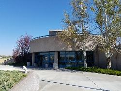
Hell's Half Acre Northbound Rest Stop
Blackfoot, Idaho
6.2 miles NEThis is a well maintained rest area with facilities to keep you happy as you travel through Idaho. This rest stop on Interstate 15 about 9 miles north of Blackfoot Idaho has nice picnic tables and...
Hike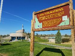
Hell's Half Acre Southbound Rest Stop
Blackfoot, Idaho
6.2 miles NEThis is a well maintained rest area with facilities to keep you happy as you travel through Idaho. This rest stop on Interstate 15 about 15 miles South of Idaho Falls has nice picnic tables and...
Hike
Firth River Bottoms
Firth, Idaho
9.6 miles EWhether you like to ride horses, picnic, camp, fish, learn about the past, or play baseball, this park has something for everyone. The Parks & Recreation Department and the IDaho Education...
Camp, Canoe, Hike
17 Mile Cave
Idaho Falls, Idaho
19.5 miles NSeventeen Mile Cave is a lava tube, a cave created by the pocket in which lava used to flow and was left empty when the volcano became inactive. The cave gets its name from its location, just 17...
Cave, Hike 0.9 mi
Hell's Half Acre Lava Walk
Blackfoot, Idaho
20.5 miles NThe Lava Trails traverse the desert of the Snake River Plain through contorted landscapes created from multiple lava flows. These Hawaiian-type lava flows are associated with the stretching of the...
Hike 0.1 mi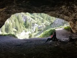
40 Horse Cave
Firth, Idaho
21.6 miles EThe naming of the cave comes from a story of two men who were caught in a bad storm. Upon hiking, these two guys were able to find the cave. One of them commented to the other, "This cave could...
Cave, Hike 1.0-7.5 mi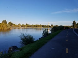
Idaho Falls Greenbelt
Idaho Falls, Idaho
23.4 miles NEThe Idaho Falls Greenbelt is one of Idaho Falls charms located in the heart of Idaho Falls, next to the historic Idaho Falls downtown. The paved foot-trail is approximately 6 miles around,...
Hike 0.2-9.7 mi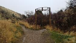
City Creek
Pocatello, Idaho
28.4 miles SThe City Creek Management Area (CCMA) Trail System is a vast network of trails maintained by the City of Pocatello. There are trails to go up and others to come down. Most trails come back to the...
Hike, Horseback, Mountain Bike
Sportsman's Park American Falls Reservoir
Aberdeen, Idaho
29.5 miles SWThis beautiful 30-acre park is a multi-use area with facilities and activities for a variety of recreational uses. Situated adjacent to the American Falls Reservoir, it provides primary access to...
Camp, Canoe, Hike
Slate Mountain/Gibson Jack Trail
Pocatello, Idaho
32.5 miles SThe Gibson Jack trail offers great views of Southeastern Idaho and a favorite trail among moutain bikers. This trail is a continuation of the West Fork Mink Creek trail and takes travelers further...
Hike, Horseback, Mountain Bike 3.2 mi
Kinney Creek Trail
Pocatello, Idaho
34.6 miles SKinney Creek Trail is in the Caribou-Targhee National Forest near Pocatello. This is a 6.4 out-and-back trail that takes you to the Indian Mountain Summit. It gives you views of Idaho...
Hike
Cherry Springs
Pocatello, Idaho
35.2 miles SJust a short distance from Pocatello, the Cherry Springs Nature Area has thick green vegetation, an abundance of birds and viewing other wildlife. Take a picnic and a camera and head out on the...
Hike
Valve House Draw
Pocatello, Idaho
37.2 miles SThis trail is a motorized, doubletrack trail, as well as a great place to go hiking. For the most part, the trail is all uphill through a forest. There are some technical sections of the route as...
Cross-country Ski, Hike, Horseback, Mountain Bike
West Fork Mink Creek Trail
Pocatello, Idaho
37.3 miles SA popular trail in the Eastern Idaho area for horseback riding, hiking, and mountain biking. The trail is a little over three and a half miles of single track riding. For the majority of the trail...
Hike, Horseback, Mountain Bike 2.1-2.3 mi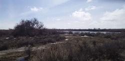
Market Lake Wildlife Management Area
Roberts, Idaho
37.3 miles NMallards, Canada geese, canvasbacks, cinnamon and green-winged teal, northern shovelers and ruddy ducks are common waterfowl species nesting and raising broods on the WMA. Several thousand...
Hike, Horseback
South Fork Of Mink Creek Trail
Pocatello, Idaho
38.4 miles SCross Country Ski, Hike, Mountain Bike, and Snowshoe near Pocatello, Idaho
Cross-country Ski, Hike, Mountain Bike, Snowshoe
East Fork Mink Creek Trail
Pocatello, Idaho
38.4 miles SIf it's early in the season and you're anxious to dust off the skis, the East Fork Road is a good starting place. The East Fork road to Justise Park Rec Area joins the Bannock Highway about...
Cross-country Ski, Hike, Horseback, Mountain Bike
Scout Mountain Campground
Pocatello, Idaho
39.3 miles SScout Mountain Campground is located on beautiful Scout Mountain at an elevation of 6,900 feet, just 13 miles south of Pocatello, Idaho. Scout Mountain is part of the Mink Creek area, a popular...
Camp, Hike 0.6-2.0 mi
North Menan Butte ('R' Mountain)
Menan, Idaho
41.1 miles NEThe North Menan Butte is more commonly known to the locals and college students as R Mountain. Many kids know it better as Ou'R' Mountain. The butte is a rare and unique geological area and provides...
Camp, Cave, Hike


