


135 Hiking Trails near Goodyear Skatepark
first prev 1 2 3 4 5 6 7 next lastShowing Hiking Trails within 50 miles Distance miles of 2983 N Litchfield Rd, Goodyear, AZ 85395, USA City, Zip, or Address

Baseline Trail
Goodyear, Arizona
6.9 miles SThe Baseline trail is a 2.6 mile loop at Estrella Mountain Regional Park. This listing is based on access from a spur trail (33.378981, -112.371072) off of the Gila trail. Access is...
Hike 1.0 mi
Quail Trail
Goodyear, Arizona
6.9 miles SQuail Trail is the access trail from the Nature Center to the main trail system. It is a pretty steep climb, but smooth and steady. Quail Trail is a spur trail in the Estrella Mountain...
Hike, Horseback, Mountain Bike 13.8 mi
Butterfield to Gadsen Loop Trail
Goodyear, Arizona
7.6 miles SAs with other trails in Estrella, the trail is wide and the surface tends to be rather benign, varying from mostly smooth, to occasionally strewn with small rocks, sandy in the washes. Butterfield...
Hike, Horseback, Mountain Bike 2.9 mi
Coldwater Trail
Goodyear, Arizona
7.7 miles SThe Cold Water Trail #27 is a seldom visited, remote backcountry destination along the backdrop of the rugged Verde Rim with healthy mixed vegetation and unique geology. The trail was originally used...
Hike, Horseback, Mountain Bike
Rainbow Valley to Toothaker Loop Trail
Goodyear, Arizona
7.7 miles SEstrella Mountain Regional Park has many trails within it, a great beginner to intermediate friendly trail is the Rainbow Valley to Toothaker Loop Trail. This 6.6 mile hike is mostly flat with a few...
Hike, Horseback, Mountain Bike
Dysart Trail
Goodyear, Arizona
7.7 miles S$6 entry fee per car.
Hike, Horseback, Mountain Bike 3.6 mi
Toothaker Trail
Goodyear, Arizona
7.7 miles SToothaker is an easy roller coaster of a trail. It crosses numerous washes ranging from small to large and can be a tad loose and/or rocky in some sections. The end reward is a nice view of Rainbow...
Hike, Horseback, Mountain Bike 8.3 mi
Estrella Mountains Competitive Track
Tolleson, Arizona
8.3 miles SThe third competitive track in the Maricopa County Regional Park system, located in Estrella Mountain Regional Park, was completed in February 2000. The track consists of two loops totaling 13 miles....
Hike, Horseback, Mountain Bike 4.8 mi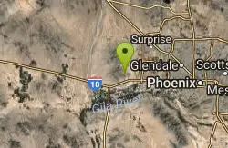
Lost Creek Petroglyph Trail
Buckeye, Arizona
9.8 miles WStarting at Verrado's trailhead, the trail heads a short ways to a petroglyph site. While a little rocky at times, the trail is easy. To deter vandals, a very necessary fence with barbed-wire has...
Hike, Mountain Bike
South, Bajada, Mule Deer Loop Trail
Waddell, Arizona
10.1 miles NWSouth - Bajada - Mule Deer Loop is a 4.1 mile loop trail located near Waddell, Arizona that offers the chance to see wildlife. The trail is rated as moderate and is accessible from...
Hike, Horseback, Mountain Bike
Goat Camp Trail
Buckeye, Arizona
10.4 miles NWGoat Camp Trail is a well-liked mountain biking and hiking trail in White Tank Mountain Regional Park. This is a 16 mile out-and-back trail that is rated as advanced due to the length, as well as the...
Hike, Mountain Bike
Black Rock Loop Trail
Waddell, Arizona
10.9 miles NWBlack Rock Trail is a 1.3 mile loop trail located near Waddell, Arizona and is good for all skill levels. The trail is primarily used for hiking and is accessible year round. Black...
Hike
Wildlife Trail
Waddell, Arizona
10.9 miles NWA short trail which terminates at a small pond.
Hike, Horseback
Mule Deer Trail (Maricopa Trail)
Waddell, Arizona
11.0 miles NWMule Deer trail is a 3.5 mile out-and-back trail that it part of the Maricopa Trail within White Tank Mountain Regional Park. This is a beginner to moderate friendly trail for both hikers and...
Hike, Horseback, Mountain Bike

Glendale Canal
Glendale, Arizona
13.6 miles NEHike, Horseback, and Mountain Bike near Glendale, Arizona
Hike, Horseback, Mountain Bike 23.0 mi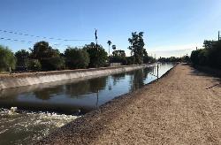
Grand Canal Trail
Phoenix, Arizona
14.2 miles EThe Grand Canal Trail is a 23-mile long system of paved and unpaved trails located in Glendale, Phoenix and Tempe that travels through...
Hike 12.6 mi
National Trail
Phoenix, Arizona
16.2 miles SENational Trail is the gem of South Mountain and home to the infamous Waterfall. It’s a local favorite as well as a destination trail for MTB snowbirds. Like most trails in the Sonoran...
Hike, Mountain Bike
Alta Trail And Bajada Trail
Phoenix, Arizona
16.2 miles SEHike near Phoenix, Arizona
Hike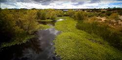
Rio Salado Habitat Restoration Area
Phoenix, Arizona
17.0 miles EHike near Phoenix, Arizona
Hike
Maxine Lakin Nature Trail
Phoenix, Arizona
17.3 miles NEHike near Phoenix, Arizona
Hike


