


136 Hiking Trails near Glendale Canal
first prev 1 2 3 4 5 6 7 next lastShowing Hiking Trails within 50 miles Distance miles of 6104 W Evans Dr, Glendale, AZ 85306, USA City, Zip, or Address
H-1 to H-4 Trails Loop
Glendale, Arizona
5.0 miles NThunderbird Park in Glendale, AZ consists of 5 H-Trails, named so because of the Hedgpeth Hills through which they wind. H-1: One-Way - 5.0 miles H-1a: Loop trail - 2.5 miles - 400...
Hike, Mountain Bike
Thunderbird H-1 H-2 H-3 Loop Trail
Glendale, Arizona
5.6 miles NHike and Mountain Bike near Glendale, Arizona
Hike, Mountain Bike
Thunderbird H-2 Trail
Glendale, Arizona
5.6 miles NThe trail is great for hiking and normally takes 1-3 hours. This is a nice, steady, non-strenuous, climb to the summit for anyone who is somewhat active. The type of incline where you...
Hike
Arrowhead Point Trail
Glendale, Arizona
5.6 miles NArrowhead Trail is a 2.4 mile hiking and mountain biking trail within Thunderbird Conservation Park. This trail is manageable enough for beginners, but offers enough challenge for more experienced...
Hike, Mountain Bike
Maxine Lakin Nature Trail
Phoenix, Arizona
6.7 miles SEHike near Phoenix, Arizona
Hike
Shaw Butte and Charles M Christiansen Loop Trail
Phoenix, Arizona
7.2 miles EWhen you say "North Mountain," I think most Arizonans know where it is or can find it. When you say "Shaw Butte," it seems like you get a lot more questioning glances and "huh?". Shaw...
Hike, Mountain Bike

North Mountain National Trail
Phoenix, Arizona
7.4 miles ENorth Mountain National Trail is a 2.3 mile moderate, loop trail near Phoenix. It's easy to travel on if you go up the paved sections. The inclines are steep in parts, making it a real...
Hike
Deem Hills Circumference Trail with Summit
Phoenix, Arizona
7.7 miles NDeem Hills is one of the newer parks in Phoenix to open (2010) and as such a lot of people still don't know it's there. This means that it has much more of a secluded feel then some of...
Hike
Deem Hills Circumference Trail
Phoenix, Arizona
7.8 miles NDeem Hills s a 10.5 mile loop trail located near Phoenix, Arizona. The trail is rated as moderate and primarily used for mountain biking.
Hike, Horseback, Mountain Bike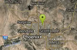
Lookout Mountain Circumference Trail
Phoenix, Arizona
8.1 miles EHike near Phoenix, Arizona
Hike
Lookout Mountain Summit Trail
Phoenix, Arizona
8.1 miles ELookout Mountain Summit Trail is a short, 1 mile trail in Phoenix, Arizona. The trail is steep, especially towards the summit, but it's manageable, and well worth the...
Hike
Deem Hills East Trail
Phoenix, Arizona
8.5 miles NDeem Hills is one of the newer parks in Phoenix to open (2010) and as such a lot of people still don't know it's there. This means that it has much more of a secluded feel then some of...
Hike
Deem Hills Inner Loop
Phoenix, Arizona
8.5 miles NHike and Mountain Bike near Phoenix, Arizona
Hike, Mountain Bike
Palisade to Basalt to Circumference Trail Loop
Phoenix, Arizona
8.5 miles NHike near Phoenix, Arizona
Hike
Sunrise Mountain Trail
Peoria, Arizona
8.5 miles NWThe Sunrise Mountain Trail can be found within the suburban area of Peoria, Arizona; it is made of up 3 sequential loops; each loop harder than the last. The trail is easy to find, as...
Hike, Mountain Bike
West Wing Mountain Advanced Trail
Peoria, Arizona
8.7 miles NWHike near Peoria, Arizona
Hike
Shadow Mountain Trail
Phoenix, Arizona
9.3 miles EThis particular route trailhead starts at 23rd place and Sweetwater rd it's a great wildlife trail.
Hike
Scarlett Canyon
Phoenix, Arizona
9.6 miles NEScarlett Canyon trail (not officially named) is an unmarked trail adjacent to the Scarlett Canyon residential neighborhood. This is a 3 mile loop trail considered to be easy to...
Hike, Horseback, Mountain Bike, Rock Climb 23.0 mi
Grand Canal Trail
Phoenix, Arizona
9.8 miles SEThe Grand Canal Trail is a 23-mile long system of paved and unpaved trails located in Glendale, Phoenix and Tempe that travels through...
Hike 1.3 mi
Dreamy Draw Loop Trail
Phoenix, Arizona
9.9 miles EThe Dreamy Draw Nature Trail is a short multi-access loop trail that provides a true Sonoran Desert experience. The trail crosses a number of desert washes and, at times, becomes somewhat rocky....
Hike, Horseback, Mountain Bike


