


6 Hiking Trails near Frog Creek Disc Golf Course at Shale City
first prev 1 next lastShowing Hiking Trails within 50 miles Distance miles of 400 Shale City Rd, Ashland, OR 97520, USA City, Zip, or Address
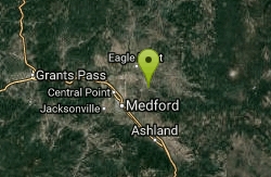
Upper Table Rock
Eagle Point, Oregon
13.1 miles NWUpper Table Rock and Lower Table Rock are two prominent volcanic plateaus located just north of the Rogue River in Jackson County, Oregon.
Hike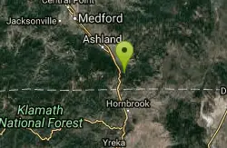
Pilot Rock
Ashland, Oregon
13.6 miles SVisible from much of the Shasta Valley in northern California, and parts of Oregon’s Rogue Valley, Pilot Rock provides viewers with a look at the inside of a volcano. Over time, the exterior...
Hike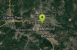
Lower Table Rock
Medford, Oregon
15.4 miles NWThe Lower Table Rock trail is a moderate hike/climb and gains about 800 feet of elevation in just over 2.7 miles. This area was originally part of an area signed into a treaty by the Rogue River...
Hike
Pinnacles Valley Trail
Chiloquin, Oregon
48.1 miles NEHike near Chiloquin, Oregon
Hike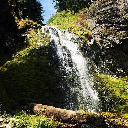
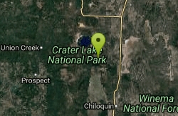
Plaikni Falls
Chiloquin, Oregon
49.8 miles NEThere's more to Crater Lake National Park than the lake itself. If you want to get away from the more popular hiking trails and scenic routes, Plaikni Falls trail is a great...
Hike 2.4 mi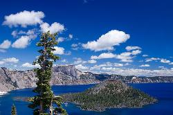
Wizard Island Summit Trail
Crater Lake National Park
49.8 miles NEWizard Island is one of the most interesting features of Crater Lake itself! It's considered one of the most magnificent volcanic cinder cones in the world. Take a boat tour to the island and...
Hike


