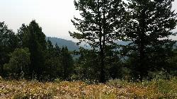
60 Hiking Trails near Flat Iron Trail
first prev 1 2 3 next lastShowing Hiking Trails within 50 miles Distance miles of Indian Creek, Swan Valley, ID 83449, USA City, Zip, or Address

Fall Creek Falls
Swan Valley, Idaho
3.7 miles NWFalls Campground is located next to the Snake River near beautiful Swan Valley, only 45 miles east of Idaho Falls, Idaho. Mixed growth cottonwood trees provide partial shade, and grassy meadows with...
Camp, Cave, Hike, Kayak, Swim 5.6-8.3 mi
Palisades Creek Trail / Lakes and Waterfall Canyon
Irwin, Idaho
5.5 miles EPalisades Creek Trail is located about 50 miles southeast of Idaho Falls and about 60 miles west of Jackson Hole WY in Swan Valley Idaho. The four mile hike up to lower Palisades Lake or the 6.2 mile...
Backpack, Camp, Hike, Horseback, Mountain Bike
Bear Creek Campground at Palisades
Irwin, Idaho
7.7 miles SEPalisades Reservoir is ideal for water skiing in the summer and features many picnic spots and boat docks. The area forest service hosts nine campgrounds containing 181 family units. Boat launch...
Camp, Hike, Horseback, Mountain Bike
Calamity Campground
Irwin, Idaho
7.7 miles SECalamity Campground is located just 55 miles east of Idaho Falls, Idaho. This is the perfect area to access the Palisades Reservoir and enjoy the water activities available there. The water here is...
Camp, Canoe, Hike, Kayak, Mountain Bike, Swim 3.3-10.0 mi
Sheep Creek Trail
Irwin, Idaho
7.9 miles SEHike and Mountain Bike near Irwin, Idaho
Hike, Mountain Bike 3.9 mi
Little Elk Creek Trail
Irwin, Idaho
10.0 miles SEBackpack, Hike, Horseback, and Mountain Bike near Irwin, Idaho
Backpack, Hike, Horseback, Mountain Bike 13.2-13.5 mi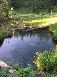
Bear Creek Hot Springs
Irwin, Idaho
10.1 miles SEBear Creek Hot Springs is a 15 mile out and back trail with a hot spring at the end. The trail is not well marked and is only recommended for very experienced outdoorsmen and primarily used for...
Backpack, Camp, Hike, Horseback, Hot Springs, Mountain Bike 13.8 mi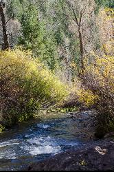
Big Elk Creek
Irwin, Idaho
11.9 miles SEBig Elk Creak Campground is a very versitile campground with plenty of activities to keep busy. Campgrounds are available, with three group sites that include picnic tables and campfire rings. There...
Backpack, Camp, Canoe, Hike, Horseback, Kayak
Burns Canyon
Ririe, Idaho
15.5 miles NWHike and Mountain Bike near Ririe, Idaho
Hike, Mountain Bike
Indian Creek Campground (Palisades)
Irwin, Idaho
16.4 miles SEPalisades Reservoir is a picturesque body of water in eastern Idaho on U.S. Highway 26 near the Idaho & Wyoming border and about 25 miles west of Jackson Hole Wyoming. The reservoir is nestled...
Camp, Hike, Horseback, Swim 4.6 mi
Coal Creek Trail
Alta, Wyoming
18.2 miles NEEnjoy outstanding views from upper Coal Creek Meadows, this hike description travels just beyond the meadows to the top of Coal-Mesquite Divide where you'll enjoy some rather dramatic views of...
Hike, Mountain Bike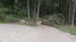
Poison Flats
Ririe, Idaho
20.8 miles NWHike near Ririe, Idaho
Hike 1.1 miHidden Vista / Pine Loop
Ririe, Idaho
21.3 miles NWCLOSED. This land is owned and managed by the US Forest Service and is not designated for use. As of July 2024, being caught mountain biking on this trail could recieve up to a $5000 fine and a...
Hike, Mountain Bike 1.7 mi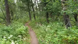
Buckskin Morgan Ridge
Ririe, Idaho
21.3 miles NWCLOSED. This land is owned and managed by the US Forest Service and is not designated for use. As of July 2024, being caught mountain biking on this trail could recieve up to a $5000 fine and a...
Hike, Mountain Bike 0.6-2.2 mi
Fish Creek Area
Ririe, Idaho
21.4 miles NWCLOSED. This land is owned and managed by the US Forest Service and is not designated for use. As of July 2024, being caught mountain biking on this trail could recieve up to a $5000 fine and a...
Hike, Mountain Bike 3.8 mi
Kelly Mountain Trail
Ririe, Idaho
21.5 miles NWKelly Canyon Trail is a moderate, uphill trail that can be used by hikers, mountain bikers, and ATV riders. The trail features views of hills, mountains, trees, wildflowers, and some wildlife. Dogs...
Cross-country Ski, Hike, Mountain Bike, Snowshoe 3.8 mi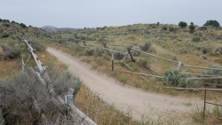
Stinking Springs
Ririe, Idaho
21.5 miles NWStinking Springs is a great early to late season trail. Being at the edge of the Big Hole range, it gets spring earlier and winter later than other trails in the range. It's closed from December...
Hike, Mountain Bike 0.5-3.5 mi
Webster's Dam
Ririe, Idaho
24.3 miles NWAlso known as Manmade Falls or the Woodmansee Dam, Webster Dam is an abandoned dam located deep in Moody Creek canyon, the dam was abandoned when sediment built up behind the dam which then...
Camp, Hike, Mountain Bike 0.6 mi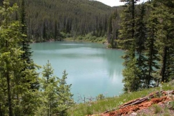
Packsaddle Lake
Tetonia, Idaho
25.4 miles NPacksaddle is one of the less well known lakes/trails in the area. If you've got a good offroad vehicle, you can probably make it all the way to the end of the road, otherwise, it's just an...
Dive, Hike, Mountain Bike, Snowshoe, Swim 4.5 mi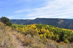
Aspen Trail
Alta, Wyoming
26.0 miles NEAspen Trail (tr 034) is single track trail for 4.35 miles along 6,800 ft contour to Darby Canyon (tr 012). Spring Creek Trail (tr 032) is double track trail for 3.68 miles to end. The trail starts...
Hike, Mountain Bike


