


144 Hiking Trails near Cave Creek Park
first prev 1 2 3 4 5 6 7 8 next lastShowing Hiking Trails within 50 miles Distance miles of 6037 E Cave Creek Rd, Cave Creek, AZ 85331, USA City, Zip, or Address

Go John Trail
Cave Creek, Arizona
2.9 miles WThe Go John Trail is a 5.8 mile loop trail outside of Cave Creek, Arizona, that is moderately trafficked, used by both hikers and mountain bikers. It is an excellent opportunity to view the desert...
Hike, Horseback, Mountain Bike
Clay Mine Trail
Cave Creek, Arizona
4.0 miles WClay Mine Trail is a 1.6 mile out-and-back, beginner friendly trail in Cave Creek Regional Park. This is a trail that is very close to the Visitor Center. It's not too difficult but there...
Hike

Ocotillo/Ridgeback/Sidewinder Loop Trail
Phoenix, Arizona
7.0 miles SWGreat moderate loop which includes a summit, great views and Classic Sonoran Desert scenery. Multiple access points and other connecting trails allows for the loop to be changed if...
Hike, Horseback, Mountain Bike
Sidewinder, Apache Vista, Ocotillo Loop Trail
Phoenix, Arizona
7.1 miles SWThis is an excellent loop that is very well maintained, well sign posted and if you include the vista summit trail, a moderate work out. Massive Car Park, good restrooms, and plenty of...
Hike, Horseback, Mountain Bike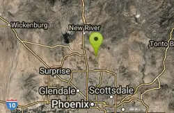
Apache Wash Trail
Phoenix, Arizona
7.4 miles SWStart west on Ocitillo to Ridgeback north till you get to the crossing of Sidewinder then head west. Keep on Sidewinder toil you come to the crossing of Octillio and head east back to...
Hike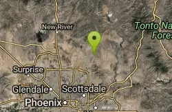
Brown Ranch Trail to Cone Mountain Trail
Scottsdale, Arizona
7.9 miles SEHike near Scottsdale, Arizona
Hike
Jane Rau Brown's Canyon Trail
Scottsdale, Arizona
7.9 miles SEThe Jane Rau Brown Canyon Trail was named after Jane Rau Brown, one of the pioneers of the McDowell Sonoran Conservancy, for her determination and passion in preserving the desert and the park....
Hike, Horseback, Mountain Bike
Pima and Dynamite Trail
Scottsdale, Arizona
7.9 miles SEPima and Dynamite is an area with a network of trails for hiking, but more popularly for mountain biking, in North Scottsdale, Arizona. The area feautures a variety of trails for...
Hike, Mountain Bike
Tower Road - Sonoran Preserve
Phoenix, Arizona
8.0 miles WShort and steep (.6 mile each way) out and back asphalt road to the radio tower.
Hike
Sidewinder-Ocotillo-West Loop
Phoenix, Arizona
8.0 miles WThis loop starts at Carefree Hwy and 7th Ave, be aware there is limited parking at the trailhead. The Ocotillo part of the trail is relatively flat and the Sidewinder part has some good...
Hike, Horseback, Mountain Bike
Pinnacle Peak Trail
Scottsdale, Arizona
8.9 miles SEPinnacle Peak is a 3.5 mile out-and-back, moderate hiking trail, that includes rock climbing routes (for experienced climbers), within the Sonoran Desert. This trail, and park, in...
Hike, Horseback, Rock Climb
Bobcat Trail - Sonoran Preserve
Phoenix, Arizona
9.7 miles SWBobcat Trail is a short, easy trail, often used for connecting to other bigger trails in the Sonoran Desert Preserve. This is a 2 mile out-and back trail. There isn't much of a parking...
Hike
Dixie Summit Trail
Phoenix, Arizona
10.6 miles SWA steep and difficult short trail using many switchbacks to get to the summit. You will be rewarded with spectacular views of the surrounding area.
Hike
Western Vista Trail
Phoenix, Arizona
10.6 miles SWFairly difficult short Trail to one of the summits on the Dixie Mountain Loop. Great views from the top as well as a birds eye view of the gravel pit below.
Hike
Dixie Mountain Loop Trail
Phoenix, Arizona
10.6 miles SWThe main loop trail at Phoenix's Sonoran Preserve provides plenty of options for either a short walk or a longer hike. The elevation gain is accumulated through small ups-and-downs along the...
Hike, Horseback, Mountain Bike 2.8 mi
Desert Tortoise
Phoenix, Arizona
10.6 miles SWAt just over a mile long, Desert Tortoise is a doubletrack connector to the Valle Verde Trail. Very good hiking area with a good range of difficulty levels. Starts with a short climb from the...
Hike, Mountain Bike
Dixie Mountain Loop with Two Summits
Phoenix, Arizona
10.6 miles SWHike, Horseback, and Mountain Bike near Phoenix, Arizona
Hike, Horseback, Mountain Bike
Hawk's Nest Trail and Dixie Mountain Loop
Phoenix, Arizona
10.6 miles SWModerate Trail providing access from the Car Park to all other trails. Directly links to Desert Tortoise Trail and Dixie Mountain Loop. Good hiking shoes/boots recommended....
Hike, Horseback, Mountain Bike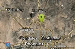
Hawk's Nest/Desert Tortoise/Dixie Mountain Loop
Phoenix, Arizona
10.6 miles SWA nice moderate trail through great desert scenery crossing creeks and twisting and turning around the hills. Provides a loop opportunity between Hawk's Nest Trail, Valle Verde Trail,...
Hike, Horseback, Mountain Bike
Union Peak Loop
Phoenix, Arizona
10.6 miles SWHike near Phoenix, Arizona
Hike


