14 Hiking Trails near Avalanche Lake
Showing Hiking Trails within 50 miles Distance miles of 16809 Going-to-the-Sun Rd, West Glacier, MT 59936, USA City, Zip, or Address
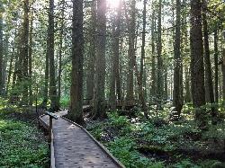
Trail of the Cedars
Apgar Village, Glacier National Park
0.2 miles NThe Trail of the Cedars is one of the most popular hikes in the park because of it offers great views without too much exertion. It is a short loop hike around Avalanche Creek in Glacier...
Hike 5.0 mi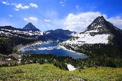
Hidden Lake
Glacier National Park
4.7 miles EThe Hidden Lake Trail in Glacier National Park is a moderate to strenuous hike that offers breathtaking views of the surrounding landscape. Located in the northwest region of Montana, the park is...
Hike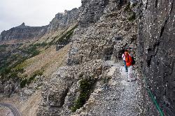
Highline Trail
Logan Pass, Glacier National Park
4.8 miles EOne of the most popular hikes in Glacier National Park. The Highline Trail is on many people's hiking lists because it showcases all of the beauty of Glacier National Park in just one hike. This...
Backpack, Hike
Clements Mountain Trail
Logan Pass, Glacier National Park
4.8 miles ELocated in Glacier National Park, Clements Mountain is a four mile round trip hike. Clements Mountain is often mistaken for Reynolds Mountain, both of which can be seen from the Logan Pass...
Backpack, Camp, Hike, Rock Climb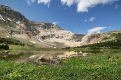
Siyeh Pass Trail
Logan Pass, Glacier National Park
7.1 miles ELIke many of the trails found throughout Glacier National Park, Siyeh Pass trail takes hikers through beautiful meadows and forests, complete with top-of-the-world views. The trail begins at Siyeh...
Backpack, Hike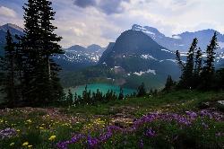
Grinnell Lake
Many Glacier, Glacier National Park
8.1 miles NEGrinnelll Lake was named after George Bird Grinnell who helped make Glacier into a national park. This lake allows visitors to see one of the remaining glaciers in the park and take in the immense...
Hike, Swim 1.4-4.6 mi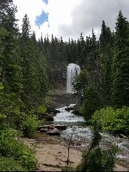
St Mary and Virginia Falls
Rising Sun, Glacier National Park
9.6 miles EVirginia Falls is one of two major waterfalls that feed into St Mary Lake. The trail is about 3.7 miles roundtrip, where visitors will see other waterfalls such as St Mary waterfall. The trail begins...
Hike 0.6 mi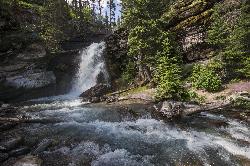
Baring Falls
Glacier National Park
10.2 miles EThe Baring Falls are named after the Baring Creek, which flows into the Middle Fork of the Flathead River. The falls themselves are a stunning sight to behold, with a 30-foot drop into a pool of...
Hike 10.5 mi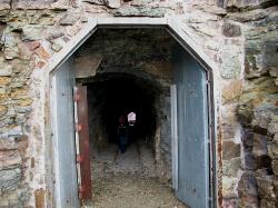
Ptarmigan Tunnel
Many Glacier, Glacier National Park
10.5 miles NEThis trail takes vistors to one of the manmade features in Glacier National Park. The trailhead can be found by taking the Iceberg Lake trailhead, and following it until the trail junction past...
Backpack, Hike 9.7 mi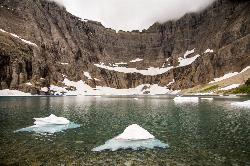
Iceberg Lake
Many Glacier, Glacier National Park
10.5 miles NEA pleasant trip into Glacier National Park, coming out to be about 9 miles round trip. The lake sits at the basin of mountains carved by glaciers thousands of years ago. Along the way, hikers will...
Backpack, Camp, Hike 11.8 mi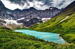
Cracker Lake Trail
Many Glacier, Glacier National Park
10.9 miles NEWhat impresses people most about this lake is the surreal turquoise color of the lake. Regardless of the beautiful mountain cliffs and forests found along the trail, Cracker lake is definitely a must...
Backpack, Camp, Hike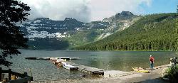
Cameron Lake
Waterton, Glacier National Park
25.5 miles NWCameron Lake is found in the Canadian portion of Glacier National Park, usually referred to as Waterton Lakes National Park. The lake is a picturesque spot to rest and relax while enjoying the...
Backpack, Camp, Hike
Jewel Basin
Kalispell, Montana
35.5 miles SBeautiful hiking area in the Montana wilderness, Jewel Basin is home to lakes with plenty of fish, and many peaks to ascend.
Backpack, Camp, Hike
Harry Harm Park
Bigfork, Montana
44.7 miles SHike near Bigfork, Montana
Hike


