


33 Hiking Trails near Arizona Snowbowl
Showing Hiking Trails within 50 miles Distance miles of 9300 N Snow Bowl Rd, Flagstaff, AZ 86001, USA City, Zip, or Address
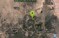
Slate Mountain Trail
Flagstaff, Arizona
12.9 miles NWDirections from Flagstaff: Drive 35 miles north on US 180 to FR 191. Turn west 2 miles to the trailhead on the right side of the road. US 180 is paved. FR 191 is graveled and suitable...
Hike
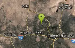
Pumpkin Trail to Bulls Basin Trail Loop
Flagstaff, Arizona
13.0 miles NWHike
Kendrick Peak Trail
Flagstaff, Arizona
13.0 miles NWHike
Red Mountain Trail
Flagstaff, Arizona
16.5 miles NWHike
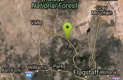
SP Crater
Flagstaff, Arizona
17.1 miles NHike 1.0 mi
Harding Springs Trail
Sedona, Arizona
22.9 miles SHarding Springs Trail is a beautiful hiking trail in Sedona, Arizona. This trail was originally one of several that provided a way for cattlemen to drive their stock in and out of Oak Creek...
Hike 0.1-0.7 mi
Cave Springs
Sedona, Arizona
23.2 miles SCave Springs Campground is a scenic campground that sits in Oak Creek Canyon. Cave Springs is nestled perfectly in the town of Sedona, giving the campground the notorious Sedona red views. Uniquely,...
Camp, Hike, Swim 0.3 mi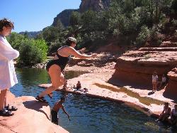
Slide Rock
Sedona, Arizona
26.9 miles SSlide Rock is one of the most popular locations in the Sedona area. Slide Rock is natures most thrilling water slides. Slide Rock is a gargantuan 80 feet long, and 2-4 feet wide. This slippery slope...
Hike, Swim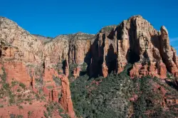
Brins Mesa Trail
Sedona, Arizona
29.2 miles SBrins Mesa Trail is located in the Coconino National Forest just at the edge of the town of Sedona. This trail will provide picturesque views of the gorgeous, geological landscape. Brins...
Hike
Devil's Bridge
Sedona, Arizona
30.2 miles SWe loved the red rock views on this hike! It's a 3.6 mile round-trip trail, on rocky/sandy ground, and is fairly easy, until the last mile, which is steep. Dozens of jeeps and ATVs passed us -...
Hike
Schnebly Hill Vista Overlook
Sedona, Arizona
30.5 miles SThe Schnebly Hill Formation is a beautiful red rock gem in Sedona, Arizona. This rock formation is considerably big, which is why it is divided into four different sections that are called...
Hike 3.4 mi
Grasshopper Point
Sedona, Arizona
30.6 miles SGrasshopper Point is a beautiful swimming hole located in Sedona, Arizona. Grasshopper Point is the perfect place to cool off in the summer after a nice hike, or a hot summer day. This swimming...
Dive, Hike, Swim
Wilson Mountain Trail
Sedona, Arizona
30.8 miles SHike near Sedona, Arizona
Hike
Midgley Bridge Trail
Sedona, Arizona
30.8 miles SHike near Sedona, Arizona
Hike 8.5 mi
Munds Wagon Trail
Sedona, Arizona
31.5 miles SMunds Wagon Trail is different from many of the other more “classic†rides around Sedona. If you come from somewhere else and are missing the feel of loose rocks...
Hike, Mountain Bike 6.0 mi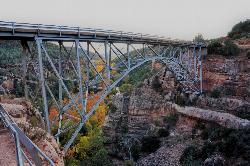
Huckaby Trail
Sedona, Arizona
32.2 miles SOn the hunt for adventure? Established in 1998, Huckaby Trail is just the adventuresome route for both avid hikers and mountain bikers. It offers up forestry of Arizona Sycamores and picturesque...
Canoe, Hike, Mountain Bike
Chavez Crossing
Sedona, Arizona
33.9 miles SChavez Crossing is a campground in Sedona, Arizona. It sits perfectly nestled in Arizona's most beautiful red rock attractions along with the grand summer sunsets. If that didn't sound...
Camp, Hike, Swim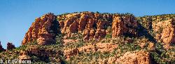
Red Rock State Park
Sedona, Arizona
35.4 miles SRed Rock in Sedona, Arizona details the beauty in the layers of sedimentary rock that has been constructed over millions of years. It is at Red Rock that you can see "Schnebly Hill...
Hike, Swim
Red Butte Trail
Williams, Arizona
40.1 miles NWDirections from Highway 64/180: Turn onto Forest Road (FR) 320. Travel east for 1.5 miles and turn left (north) onto FR 340. After traveling .75 mile on this road turn right (east) onto...
Hike
East Horseshoe Mesa Trail
Williams, Arizona
44.3 miles NWDirections from East Entrance: Drive west on East Rim Drive to Grandview Point access road. Turn right and follow the access road to the trailhead. Descend two miles on the Grandview...
Hike 7.1 mi
The Crack at Wet Beaver Creek
Rimrock, Arizona
45.4 miles SThe Crack is a popular swimming hole found by hiking the Bell Trail down to Wet Beaver Creek. After following the trail for about 3.5 miles away from the parking lot, take a detour to the left just...
Dive, Hike, Horseback, Swim
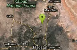
Arizona Trail
Grand Canyon Village, Arizona
45.4 miles NThe Arizona Trail, located near the Grand Canyon, is great from January through November. At 16.8 miles (one way) in distance, the trail is out and back and rated with high difficulty.
Hike, Horseback
Tonto Trail: New Hance Trail to Grandview Point
Grand Canyon Village, Arizona
46.9 miles NBackpack, Camp, Hike
Tusayan Ruin Walk Trail
Grand Canyon Village, Arizona
47.9 miles NDirections from East Entrance Station: Drive approximately 4 miles west along East Rim Drive to the Tusayan Museum.
Hike 9.1 mi
New Hance Trail
Grand Canyon Village, Arizona
48.1 miles NNew Hance Trail is a colorful hike through Red Canyon to the Colorado River. This trail is considered one of the more difficult trails in the Grand Canyon and is a challenge only prepared hikers...
Backpack, Camp, Hike
Tonto Trail from Grandview Point to South Kaibab Trailhead
Grand Canyon Village, Arizona
48.6 miles NA rigorous point-to-point backpack of four to five days; recommended for experienced Grand Canyon backpackers only. Long stretches of this scenic, lonely segment of the Tonto Trail are...
Backpack, Camp, Hike
Grandview Trail Loop
Grand Canyon Village, Arizona
48.6 miles NThis is definitely not a mountain biking trail! I am a resident of Grand Canyon and know for sure. Also use of Mtn bikes on canyon trails is illegal in the Park....
Backpack, Camp, Cross-country Ski, Hike
Grandview Point to Horseshoe Mesa Trail
Grand Canyon Village, Arizona
48.7 miles NA rewarding day hike or backpack to a wooden mesa below the South Rim.
Backpack, Hike
Tanner Trail
Grand Canyon Village, Arizona
49.2 miles NA rigorous rim-to-river backpack of three or more days, following one of the South Rim's more difficult trails. The unmaintained trail, recommended only for seasoned hikers, is...
Backpack, Camp, Hike
The Escalante Route Trail
Grand Canyon Village, Arizona
49.2 miles NThe route can be hiked in either direction, but this passage will be described from the perspective of a downcanyon hiker. Follow the Tanner Trail to the shoreline. Rocks placed at the...
Backpack, Hike
Desert View Visitor Center Trail
Grand Canyon Village, Arizona
49.5 miles NDirections from East Entrance Station: Drive westward less than a mile on East Rim Drive to reach the Desert View Visitor Center.
Hike
Blue Springs Trail
Grand Canyon Village, Arizona
49.8 miles NHike
Grandview Lookout
Grand Canyon Village, Arizona
49.9 miles NWHike


