


13 Free Cross Country Ski Trails near Big Bend Ridge Trail
first prev 1 next lastShowing Cross Country Ski Trails within 50 miles Distance miles of Forest Road 343, Ashton, ID 83420, USA City, Zip, or Address

Harriman State Park
Island Park, Idaho
7.2 miles NEHarriman State Park is found 38 miles from Yellowstone along Henry's Fork. This 11,000-acre wildlife refuge is open year round for most activities. In addition to having beautiful scenery and...
Cross-country Ski, Hike, Horseback, Mountain Bike, Snowshoe
Mesa Falls
Ashton, Idaho
9.9 miles EUpper Mesa Falls, aka Big Falls, is an absolutely awesome waterfall on the Henrys Fork of the Snake River. The falls drop 114 ft. and measure 300 ft. across. To get to the falls from the parking lot...
Cross-country Ski, Hike, Kayak 3.2-47.0 mi
Yellowstone Branch Line Trail
Ashton, Idaho
12.7 miles SEYellowstone branch line trail runs from Warm River to the Montana border totaling 39 miles. There are a few places to jump on and off the trail as well as a few smaller trails that branch off of this...
Backpack, Cross-country Ski, Hike, Horseback, Mountain Bike 0.3-0.6 mi
Bear Gulch
Ashton, Idaho
12.7 miles SEBear Gulch is an abandoned ski hill out of operation since 1969. While the vegetation is beginning to take over, there's still some great sledding to be had. It's just far enough into the...
Camp, Cross-country Ski, Hike, Sled
Teton Lakes Golf Course
Rexburg, Idaho
30.6 miles SWThis golf course is open year round, for golfing in the summers to cross country skiing in the winter. During the winter the course has over two miles of groomed cross country ski trails. You can...
Cross-country Ski, Sled
Badger Creek
Tetonia, Idaho
31.3 miles SEBadger Creek is a stream located just 13.6 miles from Ashton, in Teton County, in the state of Idaho, United States, near France, ID. Whether you’re spinning, baitcasting or fly fishing your...
Camp, Cross-country Ski, Hike, Mountain Bike, Rock Climb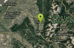
Driggs Nordic Trail
Driggs, Idaho
40.4 miles SEDistance: 3.1 miles (5km) Trail Map: Driggs_Nordic_Track_2015.pdf Grooming Report: http://tvtap.org/nordic-grooming
Cross-country Ski, Snowshoe 5.7-8.1 mi
Space Cruz
Ririe, Idaho
40.5 miles SCLOSED. This land is owned and managed by the US Forest Service and the upper portions of this route are not designated for use. As of July 2024, being caught mountain biking on PINE LOOP or THE...
Cross-country Ski, Mountain Bike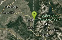
Alta Nordic Trail
Alta, Wyoming
40.6 miles SEDistance: 6.2 miles (10km) Trail Map: Alta_Nordic_Trail_2015.pdf Grooming Report: http://tvtap.org/nordic-grooming
Cross-country Ski, Snowshoe 3.8 mi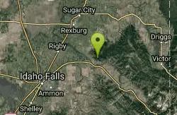
Kelly Mountain Trail
Ririe, Idaho
41.0 miles SKelly Canyon Trail is a moderate, uphill trail that can be used by hikers, mountain bikers, and ATV riders. The trail features views of hills, mountains, trees, wildflowers, and some wildlife. Dogs...
Cross-country Ski, Hike, Mountain Bike, Snowshoe 7.1 mi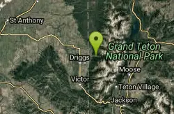
Mill Creek Trail
Moose, Wyoming
41.8 miles SEThere are two ways to do this ride, one as a loop with the Targhee road providing the bulk of the climb, or as an out and back (up the trail and back down). Keep in mind that this trail is...
Cross-country Ski, Mountain Bike, Snowshoe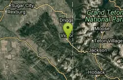
Pioneer Park Nordic Trail
Victor, Idaho
48.5 miles SEDistance: 3 miles (4.5km) Trail Map: Pioneer_Park_2015.pdf Grooming Report: http://tvtap.org/nordic-grooming
Cross-country Ski, Snowshoe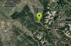
Teton Springs Trail
Victor, Idaho
49.7 miles SECLOSED. This trail is no longer accessible to the public. There is a new company which owns the resort and the loop land. Teton Springs Loop is a loop for cross-country skiing and snowshoeing. The...
Cross-country Ski, Snowshoe


