


Map of 17 Backpacking Trails in Wyoming
first prev 1 next lastShowing Backpacking Trails in Wyoming, USA City, Zip, or Address
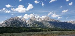
Grand Teton
Jackson Hole, Wyoming
17.6 miles N of Jackson Hole, WyomingAt 13,770 feet above sea level, the Grand Teton towers majestic over Southeastern Idaho and Western Wyoming, making it a life goal of many amateur climbers and outdoor enthusiasts. The...
Backpack, Hike, Rock Climb 0.1-6.2 mi
Darby Wind Cave
Driggs, Idaho
7.6 miles E of Driggs, IdahoDarby Wind Cave is a beautiful hike full of waterfalls, wildflowers, streams, and mountainous views. The sites you see will depend on the time of year you visit but it will always be beautiful and...
Backpack, Cave, Hike, Rock Climb 13.8 mi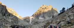
Middle Teton
Jackson Hole, Wyoming
17.6 miles N of Jackson Hole, WyomingAt 12,804 ft above sea level, the Middle Teton is a challenging and beautiful hike from the trailhead all the way to the peak. The first part of the trail is dirt trails through the trees. That...
Backpack, Hike, Rock Climb 11.9 mi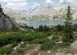
Island Lake
Pinedale, Wyoming
11.0 miles NE of Pinedale, WyomingBackpack, Hike, and Horseback near Pinedale, Wyoming
Backpack, Hike, Horseback 2.0 mi
Snow Pass Trail
Yellowstone National Park Wyoming
37.2 miles N of Yellowstone National Park WyomingSnow Pass Trail is a beautiful day hike for visitors to Yellowstone looking to escape the crowds. Located a half mile south of the Mammoth Hot Springs Upper Terraces. Parking is available at a...
Backpack, Hike 1.3-4.3 mi
Phelps Lake
Jackson, Wyoming
10.2 miles N of Jackson, WyomingThe Phelps Lake trail, located in Teton National Park, Wyoming, is in one of the most scenic locations of the park. Usually overshadowed by nearby Jenny Lake, it can often be missed by visitors of...
Backpack, Camp, Dive, Hike, Swim 0.1-7.3 mi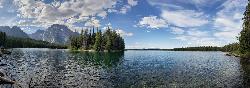
Leigh Lake
Alta, Wyoming
16.5 miles NE of Alta, WyomingEnjoy the grandeur of Grand Teton National Park just a little ways off the beaten path. Leigh Lake rests underneath the majestic Mount Moran. The waters of Leigh Lake flow almost directly into String...
Backpack, Canoe, Hike, Kayak 16.7 mi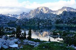
Fremont Peak
Pinedale, Wyoming
11.0 miles NE of Pinedale, WyomingFremont Peak is the third highest peak in Wyoming and straddles the boundary between Fremont and Sublette counties. It is named for American explorer John C. Fremont who climbed the peak with Charles...
Backpack, Hike 10.5-16.2 mi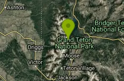
Paintbrush Canyon
Alta, Wyoming
16.6 miles NE of Alta, WyomingBeautiful trail along String Lake, Leigh Lake, and Lake Solitude. For even more solitude, scramble up the rocks to Micah Lake for a beautiful view and even fewer people. You won't find...
Backpack, Hike 6.9 mi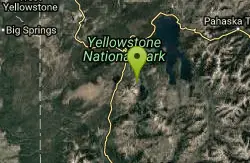
Heart Lake Trail
Grant Village, Yellowstone National Park
5.7 miles S of Grant Village, Yellowstone National ParkThe trail is very clear and leads to a moderate eight mile hike to Heart Lake. This hike has many possibilities. Day hikers need to push their time to make sure they are on the trail early to allow...
Backpack, Camp, Hike, Hot Springs 15.9-16.6 mi
Union Falls & Ouzel Pool
Grant Village, Yellowstone National Park
26.6 miles SW of Grant Village, Yellowstone National ParkBackpack, Hike, Hot Springs, and Swim near Grant Village, Yellowstone National Park
Backpack, Hike, Hot Springs, Swim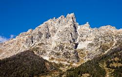
Teewinot Mountain
Jackson Hole, Wyoming
17.7 miles N of Jackson Hole, WyomingBackpack and Hike near Jackson Hole, Wyoming
Backpack, Hike 4.9 mi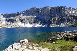
Amphitheater Lake
Alta, Wyoming
12.6 miles E of Alta, WyomingBackpack and Hike near Alta, Wyoming
Backpack, Hike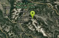
Blue Miner Lake
Jackson, Wyoming
13.5 miles NE of Jackson, WyomingBackpack and Hike near Jackson, Wyoming
Backpack, Hike 21.2-25.2 mi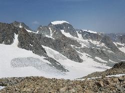
Gannett Peak
Gannett Peak, Wyoming 82513, USA
At 13,308 feet in elevation, Gannett Peak is considered to be one of the most difficult state highpoints, rivaled only by Alaska's Denali, Washington's Mount Rainier, and Montana's...
Backpack, Hike 24.3 mi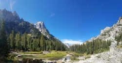
Cascade Canyon Trail
Jackson Hole, Wyoming
18.9 miles N of Jackson Hole, WyomingThis hike starts the same as the Jenny Lake trail, then after you pass the boat dock, it takes off up Cascade Canyon just to the north of Teewinot, Mount Owen, and the Grand Teton along Cascade...
Backpack, Hike 7.9 mi
Devil's Stairs
Driggs, Idaho
10.1 miles E of Driggs, IdahoJust to the West of Table Rock is this often overlooked trail less traveled by, full of beautiful meadows and beautiful views all its own. The trail begins from the same campsite as the Table Rock...
Backpack, Hike


