


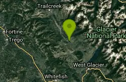
Whitefish Mountain Resort
Whitefish, Montana
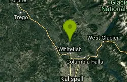
| Address: | ~Out Post Ave, Whitefish, MT 59937, USA |
| GPS: |
48°30'4.7"N 114°20'31.9"W Maps | Directions |
| State: | Montana |
| Trail Length: | 30.00 miles |
| MTB Difficulty: | Intermediate |
| Trail Type: | Shuttle |
| MTB Trail Type: | Singletrack |
Mountain Bike
The Big Mtn has some great trails and some a very technical downhill. I like to ride the main trail from the village to the summit. It's 8 miles and climbs 2000 ft through beautiful alpine forest. The trail is graded and climbs gradually with many switchbacks. It is granny gear in many spots but mostly I'm in my second ring and using my first 4 gears. Anything under 1.5 hours is good IMO but if you want to just take your time this is a great place to enjoy the spectacular views of the Flathead Valley below and Glacier Park to the east. In July and August you can stop and pick fresh huckleberries that line the trail. Once you reach the summit there is a resturant and bar with a great deck with views of the Canadian Rockies and Glacier Park. You have the option of riding the chair lift down with your bike free if you don't like downhill. (what?! are you crazy?!!!) Or you can ride the 8 mile downhill for a hell of a thrill! Also you can buy a day pass for $17 to haul you and your bike up on the chair if you just want to downhill all day. Lots of other good biking in this area as well. I lived there for 8 years........... Courtesy of Singletracks.com
More Information
Add ResourceNever modify trail features. Ride trails when they're dry enough that you won't leave ruts. Speak up when you see others on the trail and always yield to hikers, horses, and others coming uphill. Always ride on the established trail.
Read More- Plan Ahead and Prepare
- Travel & camp on durable surfaces
- Dispose of waste properly
- Leave what you find
- Minimize campfire impacts
- Respect wildlife
- Be considerate of other visitors
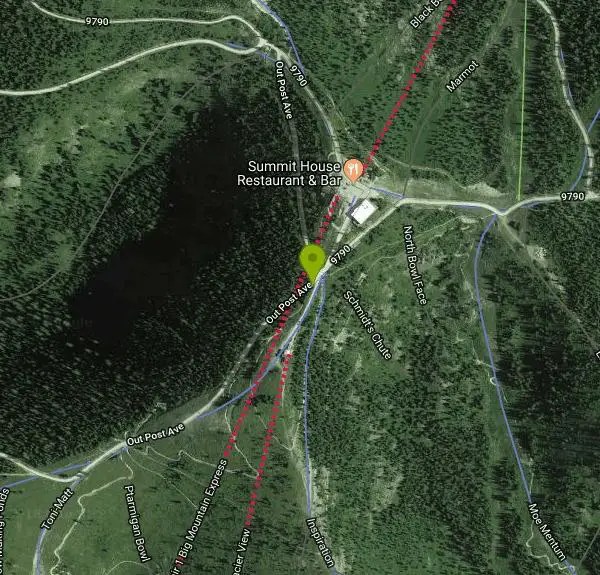
Directions
From Whitefish, Montana
- Head west on US-93 N toward Central Ave (0.1 mi)
- Turn right at the 2nd cross street onto Baker Ave (0.3 mi)
- Continue onto Wisconsin Ave (1.4 mi)
- Continue onto E Lakeshore Dr (6.3 mi)
- Slight right onto Upper Whitefish Rd (5.5 mi)
- Turn right onto 9790/NF-9790Continue to follow 9790(10.5 mi)
- Turn right to stay on 9790 (0.3 mi)
- Continue straight onto Out Post AveDestination will be on the left(115 ft)
Other Mountain Bike Trails Nearby

Summit Mountain Bike Trail #810
Whitefish, Montana
0.1 miles NThe Summit Mountain BikeTrail is 8 miles long. It begins at the base area and can also be accessed by Chair 1 (Glacier Chaser) at the summit of Whitefish Mountain Resort. This trail is...
Mountain Bike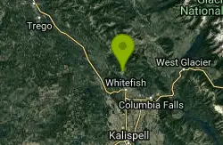
Runaway Train Trail #815
Whitefish, Montana
1.3 miles SWThe Run Away Train Trail is 2.8 miles long. It begins at the summit of Whitefish Mountain Resort and ends at the base area near Chair 1 (Glacier Chaser). This free-ride design trail is...
Mountain Bike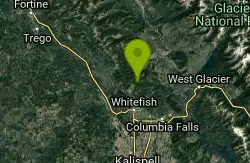
Smokey Range Nrt. Trail #270
Whitefish, Montana
1.4 miles NEThe Smokey Range Nrt. trail is 9.3 miles long. It begins at Road #316 and ends at Rd #803. The trail is open for non-motorized uses. source: fs.usda.gov
Mountain Bike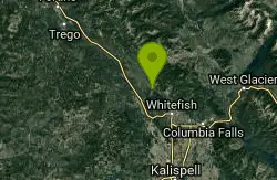
Swift Creek Trail
Whitefish, Montana
4.2 miles WThis piece of the Whitefish Trails is an out and back. Short ride to a nice overlook.
Mountain Bike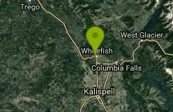
Whitefish Bikepath
Whitefish, Montana
5.9 miles SA well built bike trail that loops through the outskirts of Whitefish and passes by the city beach. Good for a quick stretch of the legs.
Mountain Bike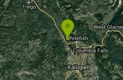
Whitefish Trail
Whitefish, Montana
6.7 miles SWThe trail goes north approx 4.5 miles, connects to a loop about 3 miles diameter, and then you head back on the same 4.5 mile trail. Incredible flowing switchbacks, fast descents, and...
Mountain Bike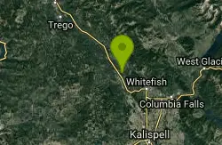
Lupfer Trailhead Loop
Whitefish, Montana
6.8 miles WLoop trail with an additional .7 mile trail up to a lookout. Very overgrown, but a nice trail for a short ride. Not much for downhill. XC could get a little workout. Great for beginners...
Mountain Bike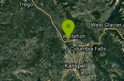
Skyles Lake Parking Lot
Whitefish, Montana
6.9 miles SWBasically it is a single track shuttle to Whitefish and Beaver lake trails.
Mountain Bike
Spencer Mountain
Whitefish, Montana
8.3 miles SWThe fire road up is a kind of stairway to heaven. It provides easy access to the top where you can access a spider web of great, narrow, singletrack downhills, some including north...
Mountain Bike
Round Meadows Trail System
Whitefish, Montana
9.1 miles WThe Round Meadows X-C Ski trails include 12 miles of easy to advance moderate nordic ski terrain. There are 7 trail loops within the Round Meadow trail system. The trailhead has ample...
Mountain Bike
Tally Lake Overlook
Whitefish, Montana
10.3 miles SWGlacier cyclery sells an amazing guide... go buy it. There is some road climbing until you hit singletrack. There are some UBER STEEP climbs in the first singletrack section, but it...
Mountain Bike
Tally Ridge Trail #458
Whitefish, Montana
10.9 miles SWTally Ridge Trail #458The Tally Ridge Trail is 3.0 miles long. It begins at the same trailhead for Trail #196 at the end of FS Rd #2924. Trail #458 intersects Trail #196 approximately...
Mountain Bike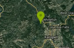
196 Stovepipe Canyon
Whitefish, Montana
10.9 miles SWThe trail Starts off as some double track, after about .5 miles a trail takes of to the right skip this trail. The next trail on the right is the trail to stove pipe canyon (196) and...
Mountain Bike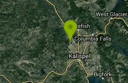
Pig Farm
Kalispell, Montana
12.4 miles SI have never seen anything like this: so many trails! And I thought i had ridden congested riding areas before, being from the midwest. Some good trails, though. Nothing's marked,...
Mountain Bike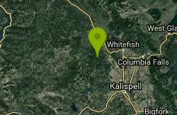
Reid Divide/trail #800 To Trail #801
Whitefish, Montana
12.5 miles SWStart climbing up 542, right on 2954, and after 11 total miles of gravel road climbing, right onto the singletrack of trail 800. Then right onto trail 801, back down to the road, and...
Mountain Bike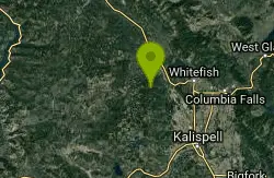
Boney Gulch Trail #801
Whitefish, Montana
12.6 miles SWThe Boney Gulch trail is 2.8 miles long. The trail is open for the following uses: hiking, mountain biking, horseback riding. The trail winds through large old growth trees with views...
Mountain Bike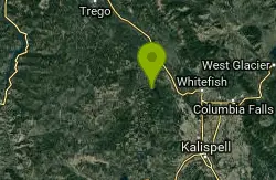
Reid Divide Fire Road Loop
Whitefish, Montana
12.8 miles SWThe trail follows FS roads, mostly good gravel tread, although the 2 mi. of Star Meadows RD is paved. Note: there is a .4 mi. bushwack from the end of FS2956 to the closest point on...
Mountain Bike
Highway 206 Ditches
Columbia Falls, Montana
13.0 miles SEIn Montana, it is completely legal to run ATV's, dirtbikes, horses, and the like in the ditches along the highways. This has actually created a rather vast network of singletrack trails...
Mountain Bike
Columbia Mtn. Loop Trail #51
Columbia Falls, Montana
13.3 miles SEThe Columbia Mtn. Loop Trail is 12.5 miles long. It begins at Berne Road and ends at Columbia Mtn. Camp Road #1155. The trail is open for the following uses: Hiking, mountain biking,...
Mountain Bike
Tally Gorge Trail #294
Whitefish, Montana
14.6 miles SWThe Tally Gorge Trail is 2.2 miles long. This trail is a non-motorized route to access trail #800. There is parking for vehicles with trailers at the undeveloped trailhead. The trail is...
Mountain BikeNearby Campsites
Logging Creek Campground
Glacier National Park
15.3 miles NELogging Creek Campground is a popular camping destination located in the beautiful Glacier National Park in Montana. With its stunning mountain views and close proximity to a variety of outdoor...
Camp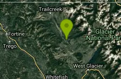
Quartz Creek Campground
Glacier National Park
16.2 miles NQuartz Creek Campground is a popular destination for campers visiting Glacier National Park in Montana. Located in the heart of the park, this campground offers a peaceful and serene setting for...
Camp
Apgar Campground
Apgar Village, Glacier National Park
16.5 miles EApgar Campground is a beautiful campsite located in the heart of Glacier National Park in Montana. Situated on the shores of Lake McDonald, this campground offers stunning views of the surrounding...
Camp
Fish Creek Campground
Glacier National Park
16.6 miles EFish Creek Campground is a popular campsite located within Glacier National Park in Montana. It offers a peaceful and picturesque setting for travelers looking to experience the beauty of the...
Camp
Sprague Campground
Glacier National Park
22.1 miles ESprague Campground is a popular destination for travelers visiting Glacier National Park in Montana. Located on the west side of the park, the campground is named after Amos Sprague, one of the first...
Camp
Bowman Lake Campground
Glacier National Park
23.5 miles NLocated in the heart of Montana's Glacier National Park, Bowman Lake Campground offers visitors the chance to experience the stunning beauty of the park's rugged landscape. With its crystal...
Camp
Avalanche Campground
Glacier National Park
26.8 miles NEAvalanche Campground is a popular destination for visitors to Glacier National Park in Montana. Located on the western side of the park, the campground is just a short drive from the Apgar Visitor...
Camp
Jewel Basin
Kalispell, Montana
29.9 miles SEBeautiful hiking area in the Montana wilderness, Jewel Basin is home to lakes with plenty of fish, and many peaks to ascend.
Backpack, Camp, Hike
Clements Mountain Trail
Logan Pass, Glacier National Park
31.5 miles NELocated in Glacier National Park, Clements Mountain is a four mile round trip hike. Clements Mountain is often mistaken for Reynolds Mountain, both of which can be seen from the Logan Pass...
Backpack, Camp, Hike, Rock Climb
Kintla Campground
Glacier National Park
34.2 miles NKintla Campground is a beautiful and peaceful campsite located in the heart of Glacier National Park in Montana. The campground is situated along the shores of Kintla Lake, which offers stunning...
Camp
Many Glacier Campground
Many Glacier, Glacier National Park
36.5 miles NECamp near Many Glacier, Glacier National Park
Camp 9.7 mi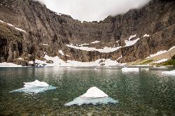
Iceberg Lake
Many Glacier, Glacier National Park
36.6 miles NEA pleasant trip into Glacier National Park, coming out to be about 9 miles round trip. The lake sits at the basin of mountains carved by glaciers thousands of years ago. Along the way, hikers will...
Backpack, Camp, Hike 11.8 mi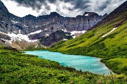
Cracker Lake Trail
Many Glacier, Glacier National Park
37.3 miles NEWhat impresses people most about this lake is the surreal turquoise color of the lake. Regardless of the beautiful mountain cliffs and forests found along the trail, Cracker lake is definitely a must...
Backpack, Camp, Hike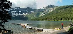
Cameron Lake
Waterton, Glacier National Park
37.8 miles NCameron Lake is found in the Canadian portion of Glacier National Park, usually referred to as Waterton Lakes National Park. The lake is a picturesque spot to rest and relax while enjoying the...
Backpack, Camp, Hike
Rising Sun Campground
Glacier National Park
39.8 miles ELocated in the eastern part of the park, the Rising Sun Campground offers breathtaking views of the surrounding mountains and forests. The campground has over 150 sites, all of which are equipped...
Camp
St. Mary Campground
Glacier National Park
44.4 miles NESt. Mary Campground is a popular campsite located in the beautiful Glacier National Park in Montana. Nestled in the heart of the park, St. Mary Campground offers breathtaking views of the surrounding...
Camp
Cut Bank Campground
Glacier National Park
44.4 miles ENestled in a beautiful forested setting along the Cut Bank Creek, Cut Bank Campground offers a peaceful and serene atmosphere for campers to enjoy. The campground has a total of 48 campsites, all...
Camp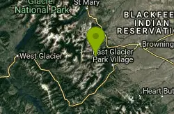
Two Medicine Campground
Glacier National Park
44.8 miles ECamp near Glacier National Park
Camp


