WCU Trails
Cullowhee, North Carolina
| Address: | ~4121 Little Savannah Rd, Cullowhee, NC 28723, USA |
| GPS: |
35°18'17.4"N 83°12'13.5"W Maps | Directions |
| State: | North Carolina |
| Trail Length: | 7.00 miles |
| MTB Difficulty: | Intermediate |
| Trail Type: | Network |
| MTB Trail Type: | Singletrack |
Mountain Bike
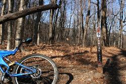
Trail is intermediate in difficulty with steep mountainside terrain. Although the elevation change from the trail's highest to lowest point is only a few hundred feet, there are lots of ups and downs.Only park in the HHS lot after 5pm or on the weekend. Park out along the road otherwise. Trailhead is on the left approximately half way up the main entrance/driveway to the Health and Human Science Building. Courtesy of Singletracks.com
Never modify trail features. Ride trails when they're dry enough that you won't leave ruts. Speak up when you see others on the trail and always yield to hikers, horses, and others coming uphill. Always ride on the established trail.
Read MoreDirections
From Cullowhee, North Carolina
- Head northwest on Old Cullowhee Rd toward Central Dr (43 ft)
- Turn left at Central Dr (171 ft)
- Continue onto Central Dr (0.3 mi)
- Turn right onto Centennial Dr (0.7 mi)
- At the traffic circle, take the 2nd exit onto State Rd 1325 (443 ft)
- Turn left onto NC-107 S (0.2 mi)
- Turn right at the 1st cross street onto Little Savannah Rd (0.9 mi)
- Turn rightDestination will be on the right(259 ft)

Other Mountain Bike Trails Nearby

Snaggy Creek Trail
Cullowhee, North Carolina
4.4 miles E5 mile climb starting at about 2300 feet and limbs steadily to 5500. Return halfway down previous route then break right and end up going down the atv trails and finally back to...
Mountain Bike
Blackrock #447
Glenville, North Carolina
13.0 miles SEBlackrock starts from the western most trailhead for Panthertown Valley off of Breedlove Road. From there it climbs steeply up and over a miniature mountain, with some options to access...
Mountain Bike
Panthertown Valley
Glenville, North Carolina
13.2 miles SEPantertown Valley is a network of trails ranging from old fire roads to double track to super tight singletrack. There's 35 miles of total trails in the valley, but bikes are limited...
Mountain Bike
Devils Elbow #448
Lake Toxaway, North Carolina
15.4 miles SEDevils Elbow trail #448 runs up to the knob of the same name and connects to trail #450 and trail #474, the main Panthertown Valley thoroughfare. Some sections are old forest road while...
Mountain Bike 1.7 mi
Flat Laurel Creek
16.7 miles E
Flat Laurel Creek is a 3.18 mile multi-use trail that is perfect for exploring on foot, horse and bike. This trail can be accessed from a parking lot on either end, making it easy to begin...
Hike, Horseback, Mountain Bike, Swim
Deep Creek Trail
Bryson City, North Carolina
17.0 miles NWThe trail appears to be an old forest service road or an old logging road. There are two out and back trails. Deep Creek and Indian Creek Falls. Deep Creek is about 2 miles one way....
Mountain Bike
Swinging Bridge
Bryson City, North Carolina
17.5 miles WThis is a relatively flat ride with one huge hill near the end. From Brush Creek Church, ride Lower Needmore to the swinging bridge on the right (about one mile from the church)....
Mountain Bike 7.1 mi
Daniel Ridge Loop
Canton, North Carolina
21.2 miles EThis is a classic, short Pisgah loop. It's moderately technical most of the way with a couple of trickier sections. Most people prefer to approach it counter-clockwise, but it can be ridden...
Hike, Mountain Bike 3.1-4.3 mi
Farlow Gap
Canton, North Carolina
21.2 miles EThis is one of the most technical downhills in Pisgah: very steep and rocky! The trail drops about 2000 ft in 3 miles then connects with the Daniel Ridge trail. The climb to the gap is long (9 miles)...
Hike, Mountain Bike 2.3 mi
Cove Creek
Canton, North Carolina
21.7 miles EAll the climbing is on gravel forest roads. Then you descend on Cove Creek Trail. There are some cool rock sections up at the top and a few rustic log bridges about mid way down but overall this is a...
Mountain Bike
Flint Ridge
Bryson City, North Carolina
22.1 miles WThe first mile or so of this trail is a series of nine switchbacks that take you up a pretty steep face of the ridge. The top of the ridge has some great views of the Nantahala river...
Mountain Bike
Tsali Right Loop
Almond, North Carolina
22.5 miles WThe Right Loop is by far my favorite Tsali trail. Start at the trailhed parking lot and follow the signs for the LEFT LOOP (that's right). After about 0.3 miles, turn right onto the...
Mountain Bike
Tsali Thompson Loop
Almond, North Carolina
22.6 miles WThompson Loop, like Mouse Branch Loop, is more technical than the Right and Left loops at Tsali. Thompson has a lot of tight twisting singletrack and like all the trails at Tsali is...
Mountain Bike
Tsali Mouse Branch Loop
Almond, North Carolina
22.6 miles WFrom the main parking area, Mouse starts with doubletrack. Head out the main road and continue in a clockwise direction. Many riders consider Mouse the most technical of the Tsali trails, but...
Mountain Bike
Tsali Recreation Area
Almond, North Carolina
22.6 miles WTsali features four singletrack loops that hug the banks of Fontana Lake. The trails are super fast and flowy singletrack with mostly moderate climbs and amazing scenery.Daily usage...
Mountain Bike 0.8 mi
Daniel Ridge Falls
Brevard, North Carolina
23.2 miles EThis waterfall in Pisgah National Forest near Brevard has multiple names: Tom's Spring Branch Falls, Daniel Ridge Falls and Jackson Falls. It’s an easy half-mile hike on the Daniel Ridge...
Hike, Mountain Bike, Swim 13.5 mi
Horse Cove Gap Loop / FS 475C
Brevard, North Carolina
23.3 miles EMaintained fire road. From the hatchery, it's 4 miles of steady elevation gain before easing and connecting to Bracken Mt. Trail. GPS map is 5.8 miles one-way, 12 miles round trip. Otherwise,...
Mountain Bike
Coontree
Brevard, North Carolina
23.3 miles EThis trail is 3.7 miles one-way. This trail is a gnarly, steep hike-a-bike in one direction and a steep, technical descent the other. Prepare to get your butt kicked!...
Mountain Bike
Butter Gap / Trail #123
Brevard, North Carolina
23.3 miles EThe right (western) fork, which is open to mountain bikes, leads to FS 471D, which some riders use as part of a large loop; otherwise, they must backtrack down Butter Gap Trail. *The portion of the...
Hike, Mountain Bike
New Vista Rd
Brevard, North Carolina
23.9 miles SEGeneral Fire road with a nice view accross the valley
Mountain BikeNearby Campsites

Mt. LeConte Lodge
Sylva, North Carolina
6.8 miles NWHigh atop Mt. LeConte in the Great Smoky Mountains National Park, LeConte Lodge® is the highest guest lodge in the eastern United States. It is situated on an open glade just below the summit of...
Camp, Hike, Horseback, Rock Climb
Davidson River Campground
Pisgah Forest, North Carolina
27.2 miles EDavidson River Recreation Area offers camping and outdoor activities for the whole family. The campground boasts several loops of shaded campsites, as well as access to hiking trails, fishing spots,...
Camp, Hike, Swim
War Woman Dell Wildlife Management Area
Clayton, Georgia
30.4 miles SWarwoman Dell Nature Trail and Becky Branch Falls Trail is a 0.8 mile out and back trail located near Clayton, Georgia that features a waterfall and is good for all skill levels. The trail is...
Camp, Hike, Horseback
Cosby Campground
Cosby, Tennessee
31.2 miles NCamp and Swim near Cosby, Tennessee
Camp, Swim
Cades Cove Campground
Townsend, Tennessee
38.2 miles NWOver 2 million visitors annually come to enjoy the scenic beauty of Cades Cove and its many historic structures. Popular activities here include hiking, biking, touring the 11-mile Cades Cove loop...
Camp
Rocky Bluff
Hot Springs, North Carolina
43.4 miles NEPlay in water in creek, shallow at times.
Camp, Hike, Swim


