4.2K Oh the Places I'll Go by tasiawhicker
first prev 1 next last
Mesa Falls
Ashton, Idaho
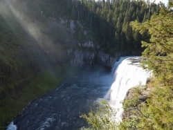
10.0 miles NE of Ashton, IdahoUpper Mesa Falls, aka Big Falls, is an absolutely awesome waterfall on the Henrys Fork of the Snake River. The falls drop 114 ft. and measure 300 ft. across. To get to the falls from the parking lot is 0.2 miles of paved walkway and several sturdy stairs with plenty of gaurdrails and handrails. There are several platforms along the route for viewing and taking photos. Catch it in the morning to see the rainbows in the lingering mist that often rises well above the platforms. There's a wheelchair accessible path that can get a pretty good view of the falls but does not go right down to it.
Lower Mesa Falls is about a mile down river from the Upper Falls. There's two great viewing options. One is from a cliff hovering 200 feet above the falls and the other is from the the Observation Site sitting 0.25 miles away and almost 500 feet above the falls. To get to the cliff above the falls, there's a trailhead on the South East end of the main parking lot. The trail is 1 mile each way (2 mile out and back) with about a 100 ft. difference in elevation (about the same as the stairs the the Upper Falls platforms). The trail goes through the woods well away from the river itself but there are no guardrails at the end when you're peering over the edge of the cliffs to see the waterfall. To see the falls from the observation site is free and the walk from your car to the lookout is only about 500 ft.
This is an Idaho State Park and there are day use fees. Passes have reciprocity with Harriman State Park which is only about 20 minutes away. Get there before 5pm to check out the old inn which has been transformed into a fun and informative visitor's center.

Blacktail Deer Creek to Yellowstone River Trail
Mammoth Hot Springs, Yellowstone National Park
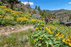
5.3 miles E of Mammoth Hot Springs, Yellowstone National ParkBlacktail Deer Creek Trail is a 7 mile out and back trail that leads to the Yellowstone River. Hikers on this trail will enjoy seeing green open fields, boulder formations and waterfalls at the Yellowstone River and Black Deer Creek. A large portion of the trail follows the creek giving hikers a beautiful view.
Hikers wishing for longer hikes will enjoy knowing that there is a suspension bridge where the trail ends that connects Blacktail Deer Creek Trail with other trails, including Yellowstone River Trail and 1Y8 Campsite Spur Trail. Hikers wishing to make this hike a two-day backpacking trip may reserve campsites near the end of the trail by the Yellowstone River.
Blacktail Deer Creek Trail passes several streams, ponds and rivers and crosses the boarder between Wyoming and Montana. This trail is considered moderately difficult because of its hilly sections, steady elevation change as it descends to the Yellowstone river, and the length of the hike.
The trailhead can be found seven miles east of Mammoth on Grand Loop Road. This trail is open in the spring, fall, and summer months and closed in the winter due to heavy snowfall.
Blacktail Deer Creek Trail is the perfect hike for hikers wishing to see a variety of natural beauties. The rivers, ponds, streams, meadows and waterfalls make every turn of this hike a breathtaking adventure.

Observation Peak Trail
Canyon Village, Yellowstone National Park
1.3 miles N of Canyon Village, Yellowstone National ParkObservation Peak Trail is one of the most famous hikes in Yellowstone National Park. The hike is an almost 10 miles there and back hike that starts and ends at the same trailhead.
Observation Peak Trail starts out at the same trailhead as Cascade Lake Trail. There is parking available at the trailhead.
Hikers on this trail can expect to enjoy forests, meadow and a beautiful view of Cascade Lake. The trail to Cascade Lake is about two miles. This is the easy part of the trail. It is well paved and has very little elevation change. At the end of this part of the hike, hikers can rest next to the beautiful Cascade Lake.
From Cascade Lake the trail splits off onto Observation Peak Trail. From the lake the trail is 2.6 miles long and ascends 1,400 feet. This is the more difficult part of the trail but ends with an incredible view from the peak of the mountain.
The trail is only open during the summer and fall, due to heavy snow in the winter and spring. During these warmer months hikers can enjoy the forests, meadows and wildflowers along the trail.
Observation Peak Trail is an incredible hike for people in Yellowstone wanting to connect with nature and see Yellowstone from above the park.

Ousel Falls
Gallatin Gateway, Montana
25.5 miles S of Gallatin Gateway, MontanaOusel Falls Park Trail is a 1.7 mile out and back trail located near Big Sky, Montana that features a waterfall. The trail is primarily used for hiking and is accessible from May until October.

Little Wild Horse & Bell Canyon
Green River, Utah
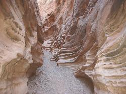
44.7 miles SW of Green River, UtahThis HIKERS ONLY loop trail is about 8 miles, with a 700 ft elevation gain. People often only hike the Little Wild Horse part, which is a 3.3 mile one way section of the trail. It's a relatively easy trail, for all ages. The LIttle Wild Horse trail is a slot canyon set in the red rock sandstone of Southern Utah and winds its way through the San Rafael Swell. Its twisty and turny and beautiful. The Bell canyon section is actually the easier trail, but not nearly as interesting. Crowds and rain can be a problem, so be respectful and watch the weather. Rain and snow runoff are very dangerous in slot canyons.
Be aware that during the wet season water can pool, so be prepared to maybe get a little wet.

Daly Creek
Gallatin Gateway, Montana
37.6 miles S of Gallatin Gateway, MontanaDaly Creek Trail is a 5.2 mile out and back trail located near Gallatin Gateway, Montana and is good for all skill levels. The trail is primarily used for hiking and is accessible from May until October.

Big Ice Cave
Bridger, Montana
26.6 miles E of Bridger, MontanaThe Big Ice Cave can be viewed by taking a short walk down an improved plank trail to the entrance portal. On a wooden platform inside the cave visitors can see the always present ice floor of the cave. There are no guided tours or speleothems. Take a sweatshirt or jacket, it may be cold inside. Bring a flashlight as there are no lights inside.


