Marcus Landslide Trail
Scottsdale, Arizona
15.6 miles NE of Scottsdale, ArizonaThe Marcus Landslide Trail is named after ASU professor Melvin Marcus, a renouned geographer, after the discovery and recognition of the interesting geographical area in 2002. More than 500,000...
Hike, Horseback, Mountain Bike, Rock Climb 2.6 mi
L.V. Yates Trail (#8)
Phoenix, Arizona
9.4 miles NE of Phoenix, ArizonaThe trail is strewn with large rocks and gulleys from recent torrential rains. Not impassable on foot, but definitely some hike-a-bike areas. Keep in mind there's no ridge hiking...
Hike, Horseback, Mountain Bike 8.3 mi
Estrella Mountains Competitive Track
Tolleson, Arizona
6.6 miles SW of Tolleson, ArizonaThe third competitive track in the Maricopa County Regional Park system, located in Estrella Mountain Regional Park, was completed in February 2000. The track consists of two loops totaling 13 miles....
Hike, Horseback, Mountain Bike 0.6 mi
Horseshoe Trail
Scottsdale, Arizona
11.7 miles N of Scottsdale, ArizonaHorseshoe trail is a short, fun singletrack with a lot of quick turns created by wash areas and rocks. It's a nice warm-up heading to Gateway Loop Trail. In some areas there are a lot of cactus,...
Hike, Horseback, Mountain Bike 13.8 mi
Butterfield to Gadsen Loop Trail
Goodyear, Arizona
4.5 miles S of Goodyear, ArizonaAs with other trails in Estrella, the trail is wide and the surface tends to be rather benign, varying from mostly smooth, to occasionally strewn with small rocks, sandy in the washes. Butterfield...
Hike, Horseback, Mountain Bike 2.9 mi
Coldwater Trail
Goodyear, Arizona
4.5 miles S of Goodyear, ArizonaThe Cold Water Trail #27 is a seldom visited, remote backcountry destination along the backdrop of the rugged Verde Rim with healthy mixed vegetation and unique geology. The trail was originally used...
Hike, Horseback, Mountain Bike 3.6 mi
Toothaker Trail
Goodyear, Arizona
4.6 miles S of Goodyear, ArizonaToothaker is an easy roller coaster of a trail. It crosses numerous washes ranging from small to large and can be a tad loose and/or rocky in some sections. The end reward is a nice view of Rainbow...
Hike, Horseback, Mountain Bike 1.0 mi
Quail Trail
Goodyear, Arizona
3.9 miles S of Goodyear, ArizonaQuail Trail is the access trail from the Nature Center to the main trail system. It is a pretty steep climb, but smooth and steady. Quail Trail is a spur trail in the Estrella Mountain...
Hike, Horseback, Mountain Bike 12.6 mi
National Trail
Phoenix, Arizona
9.1 miles SW of Phoenix, ArizonaNational Trail is the gem of South Mountain and home to the infamous Waterfall. It’s a local favorite as well as a destination trail for MTB snowbirds. Like most trails in the Sonoran...
Hike, Mountain Bike 1.0-1.2 mi
Camelback Mountain
Phoenix, Arizona
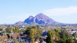
7.7 miles NE of Phoenix, ArizonaHiking After Camelback became a park in 1968, TripAdvisor advertised the hikes as one of the top 10 things to do when in Phoenix. Located right in the middle of Phoenix, Scottsdale and...
Hike, Rock Climb 2.5 mi
Hidden Valley from Buena Vista Trail
Phoenix, Arizona
7.5 miles S of Phoenix, ArizonaFor an easily accessible trail, butting right up against Phoenix’s southern border, it is truly surprising how special, quiet and natural the hike through Hidden Valley is! The path...
Hike, Mountain Bike 1.8 mi
Javelina-Beverly Canyon Loop Trail
Phoenix, Arizona
7.2 miles SE of Phoenix, ArizonaJavelina Canyon Trail does have some beautiful hills and valleys to wander through and it feels down right remote at times. I’ve found Javelina to have less traffic that Beverly as...
Hike, Horseback, Mountain Bike 1.9 mi
Ruth Hamilton Trail
Phoenix, Arizona
7.7 miles NE of Phoenix, ArizonaHike and Mountain Bike near Phoenix, Arizona
Hike, Mountain Bike 2.6 mi
Bracken Preserve
Brevard, North Carolina
1.3 miles NW of Brevard, North CarolinaThis is the main trail within Bracken Preserve. Beginning at the parking area at the end of Pinnacle Drive, and connecting with Forest Service road 475-C in Pisgah National Forest. This trail...
Mountain Bike 3.7 mi
Bradley Creek Road
Horse Shoe, North Carolina
7.5 miles NW of Horse Shoe, North CarolinaThis graded FS road gradually ascends from the Bradley Creek Trail (#351) on its way to Yellow Gap Road. Enjoy the surrounding hardwood forest as you climb - the road itself is not too exciting to...
Mountain Bike 2.3 mi
Cove Creek
Canton, North Carolina
15.7 miles S of Canton, North CarolinaAll the climbing is on gravel forest roads. Then you descend on Cove Creek Trail. There are some cool rock sections up at the top and a few rustic log bridges about mid way down but overall this is a...
Mountain Bike 13.5 mi
Horse Cove Gap Loop / FS 475C
Brevard, North Carolina
4.8 miles NW of Brevard, North CarolinaMaintained fire road. From the hatchery, it's 4 miles of steady elevation gain before easing and connecting to Bracken Mt. Trail. GPS map is 5.8 miles one-way, 12 miles round trip. Otherwise,...
Mountain Bike 7.1 mi
Daniel Ridge Loop
Canton, North Carolina
17.1 miles S of Canton, North CarolinaThis is a classic, short Pisgah loop. It's moderately technical most of the way with a couple of trickier sections. Most people prefer to approach it counter-clockwise, but it can be ridden...
Hike, Mountain Bike 7.5 mi
Hawe's Loop
Mesa, Arizona
10.6 miles NE of Mesa, ArizonaMost of the trails in the Phoenix metropolitan area were originally built by mountain bikers, and the Hawe's loop trail system and trail are no exeptions. This trail features fantastic...
Hike, Mountain Bike 21.4 mi
Spur Cross to Lake Pleasant
Cave Creek, Arizona
0.1 miles SE of Cave Creek, ArizonaStart at the Flat Tire Bike Shop and head north on Spur Cross Road. You will arrive at the Spur Cross Conservation Ranch in 3.2mi. From there enter the Maricopa Trail system and follow the signs...
Mountain Bike


