Refine Search
- hike 48
- backpack 23
- camp 21
- mountain bike 9
- horseback 9
- swim 6
- disc golf 4
- skateboard 2
- kayak 2
- rock climb 2
- cave 1
- whitewater 1
- canoe 1
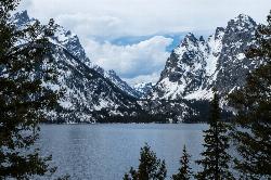
Jenny Lake Trail
Jackson Hole, Wyoming
19.7 miles N of Jackson Hole, WyomingOne of the most popular trails to visit in Grand Teton is the Jenny Lake Trail. The Jenny Lake Trail, located near Moose, Wyoming, is an easy trail that loops around the lake. Along with the sheer...
Hike 0.1 mi
Bass Lake
Bolinas, California
5.2 miles NW of Bolinas, CaliforniaHike and Swim near Bolinas, California
Hike, Swim
Roosevelt Point Trail
North Rim, Arizona
5.9 miles E of North Rim, ArizonaRoosevelt Point Trail on Grand Canyon National Park's North Rim is a 0.2 mile short, relatively flat woodland loop trail offering spectacular views. Roosevelt Point Trail on Grand Canyon National...
Hike 7.7 mi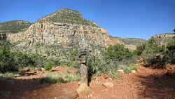
Waldron Trail
Grand Canyon Village, Arizona
4.1 miles W of Grand Canyon Village, ArizonaAn alternative to the highly strenuous Hermit Trail, the Waldron Trail splits off from the Hermit Trail 1.2 miles in and is one of the shorter trails in the canyon at only 2 miles long. Open...
Hike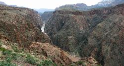
Clear Creek Trail
Grand Canyon Village, Arizona
3.1 miles E of Grand Canyon Village, ArizonaAn extended backpack trip of four to six days deep within the Grand Canyon. NOTE: The starting point for Clear Creek Trail, Bright Angel Campground, is in a remote location away from a trailhead. The...
Backpack, Camp, Hike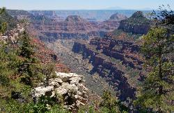
Transept Trail
North Rim, Arizona
1.2 miles S of North Rim, ArizonaThe 3.4 mile out and back Transept Trail connects Grand Canyon Lodge to the North Rim Campground, follows the rim of a side canyon called the Transept, and offers a relaxing yet moderate hike with...
Hike 0.5-0.8 mi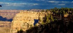
Cape Royal Trail
North Rim, Arizona
8.7 miles SE of North Rim, ArizonaCape Royal is a long peninsula extending from the North Rim out over the Grand Canyon. It offers a phenomenal view, perhaps the most sweeping view of any Grand Canyon vista. Take the short stroll to...
Hike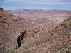
Boucher Trail to Hermit Trail Loop
Grand Canyon Village, Arizona
4.0 miles W of Grand Canyon Village, ArizonaA demanding loop trip of three to four days, tracing one of the most difficult South Rim trails. Even seasoned Grand Canyon backpackers consider the Boucher Trail to be the most difficult, hazardous,...
Backpack, Camp, Hike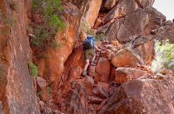
Boucher Trail
Grand Canyon Village, Arizona
4.0 miles W of Grand Canyon Village, ArizonaBoucher Trail is a 17.7 mile moderately trafficked out and back trail located near Grand Canyon, Arizona that features a river and is only recommended for very experienced adventurers. The trail is...
Backpack, Hike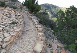
Hermit's Rest Viewpoint to Tonto Trail to Bright Angel Trail
Grand Canyon Village, Arizona
4.0 miles W of Grand Canyon Village, ArizonaHermit’s Rest Viewpoint to Tonto Trail to Bright Angel Trailhead is perfect for hiking, backpacking, walking, and trail running. The Trail takes you across a well-established portion of the...
Backpack, Camp, Hike
Hermit Trail
Grand Canyon Village, Arizona
4.0 miles W of Grand Canyon Village, ArizonaThe Grand Canyon's Hermit Trail is a scenic beauty which begins at the end of Hermit Road. The rocky trail is well-marked and less busy than the Bright Angel and North Kaibab trails. While...
Backpack, Camp, Hike 1.1 mi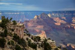
Shoshone Point Trail
Grand Canyon Village, Arizona
4.2 miles E of Grand Canyon Village, ArizonaShoshone Point Trail is a non-marked trail for hikers of all skill levels. The trail has limited views until the Shoshone Point overlook past the picnic area where astonishing canyon...
Hike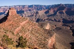
The Grand Canyon: Kaibab to Bright Angel Trail
Grand Canyon Village, Arizona
3.2 miles E of Grand Canyon Village, ArizonaExperience the Grand Canyon like few others with this unforgettable 2-3 day trip down into the canyon. If you are looking for the perfect hike in the Grand Canyon, this is it. The 2 (or 3) day hike...
Backpack, Camp, Hike 4.9 mi
Bright Angel Trail to Tonto Trail
Grand Canyon Village, Arizona
0.3 miles NW of Grand Canyon Village, Arizona"[T]he Tonto Trail offers a degree of civility not found elsewhere along the trail, and it is here that most hikers get their first exposure to the unique nature of this singular transcanyon...
Backpack, Camp, Hike
South Rim Visitor Center Trail
Grand Canyon Village, Arizona
0.8 miles E of Grand Canyon Village, ArizonaLocated near the South Rim Visitor Center of Grand Canyon National Park, this Trail is well-marked to provide a useful path for where you need to go. The trail is a connector from the Visitor Center...
Hike 3.7 mi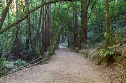
East Ridge Trail
Oakland, California
6.9 miles E of Oakland, CaliforniaThis trail is deeply tucked away up into the hills of Oakland. East Ridge is the perfect trail to deeply appreciate the beauty of the Redwoods and has many entry points. This trail weaves...
Hike 0.5-0.6 mi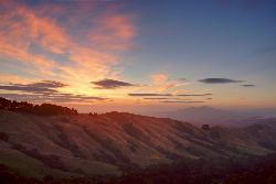
Grizzly Peak Trail
Berkeley, California
2.1 miles NE of Berkeley, CaliforniaGrizzly Peak Trail is located near La Loma Park in the Berkeley Hills section of the city of Berkeley, California and leads to an incredible lookout of the San Francisco Bay area....
Hike, Mountain Bike 4.0 mi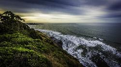
Palomarin Trail
Bolinas, California
3.7 miles NW of Bolinas, CaliforniaThis hike is about 5 miles north from Bolinas is the Palomarin Trailhead. As you hike the trail you overlook the ocean and beautiful beaches. The trail takes you up to different lakes and then...
Hike 6.3 mi
Tiyo Point Trail
North Rim, Arizona
0.5 miles N of North Rim, ArizonaThis former road is becoming increasingly overgrown by the encroaching forest. This being said, it is generally easy to follow with some blown down trees to climb over or around. There are some old...
Backpack, Camp, Hike 0.7 mi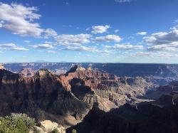
Bright Angel Point Trail
North Rim, Arizona
1.2 miles S of North Rim, ArizonaLocated at the North Rim of the Grand Canyon, the Bright Angel Point Trail is a steep, narrow, fully paved path leading to an incredible scenic viewpoint. The trail is conveniently located right next...
Hike


