Refine Search
- hike 38
- mountain bike 27
- horseback 9
- disc golf 6
- swim 5
- rock climb 4
- skateboard 2
- snowshoe 2
- cross-country ski 2
- camp 2
- backpack 2
- sled 1
- kayak 1
- canoe 1
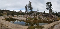
Alaska Basin
Driggs, Idaho
10.0 miles E of Driggs, IdahoThe Alaska Basin Trail is a stunning trail through the Jedediah Wilderness near Driggs, Idaho and goes East into Wyoming, just outside of Grand Teton National Park. The trail is wide...
Backpack, Hike, Horseback 1.0-1.2 mi
Maiden Pools
Tucson, Arizona
9.3 miles NE of Tucson, ArizonaOver the course of time, the Ventana Stream has exposed the canyon’s base granite, and then smoothed and formed into a series of small pools -- now called the Maiden Pools. With...
Hike, Rock Climb, Swim 3.8 mi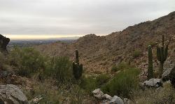
Freedom Loop Trail (#302)
Phoenix, Arizona
6.9 miles NE of Phoenix, ArizonaFreedom Trail (#302), also known as Piestewa Circumference, is a 3.8 mile, moderate loop trail. You can access this trail from all the inner trailheads. The easiest and least...
Hike 1.2 mi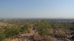
Ma-Ha-Tauk Trail
Phoenix, Arizona
6.9 miles S of Phoenix, ArizonaMa-Ha-Tauk Trail can be found in South Mountain Park in Phoenix. This is a 2.5 mile, out-and-back trail. Aside from a short section of steeper incline in the first part of the hike, this is an...
Hike, Horseback 2.3 mi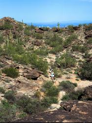
Hidden Valley Trail Via Mormon Trail
Phoenix, Arizona
6.2 miles SE of Phoenix, ArizonaHidden Valley Trail via Mormon Trail is a 2-4 mile hike, depending on the route you choose to take and how much additional exploring you do. This hike offers a natural rock tunnel, petroglyphs,...
Hike, Mountain Bike 23.0 mi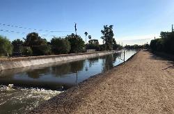
Grand Canal Trail
Phoenix, Arizona
3.6 miles NW of Phoenix, ArizonaThe Grand Canal Trail is a 23-mile long system of paved and unpaved trails located in Glendale, Phoenix and Tempe that travels through...
Hike 2.2 mi
Pilot Cove / Slate Rocks / 102
Canton, North Carolina
12.4 miles SE of Canton, North CarolinaFun descent with several stream crossings along the way. Nothing too steep but this trail doesn't get a lot of use so there are usually a few trees down along the way. Beautiful scenery and a...
Mountain Bike 3.8 mi
Kelly Mountain Trail
Ririe, Idaho
8.2 miles E of Ririe, IdahoKelly Canyon Trail is a moderate, uphill trail that can be used by hikers, mountain bikers, and ATV riders. The trail features views of hills, mountains, trees, wildflowers, and some wildlife. Dogs...
Cross-country Ski, Hike, Mountain Bike, Snowshoe 2.8 mi
Desert Tortoise
Phoenix, Arizona
20.3 miles N of Phoenix, ArizonaAt just over a mile long, Desert Tortoise is a doubletrack connector to the Valle Verde Trail. Very good hiking area with a good range of difficulty levels. Starts with a short climb from the...
Hike, Mountain Bike 3.2 mi
Kinney Creek Trail
Pocatello, Idaho
8.0 miles S of Pocatello, IdahoKinney Creek Trail is in the Caribou-Targhee National Forest near Pocatello. This is a 6.4 out-and-back trail that takes you to the Indian Mountain Summit. It gives you views of Idaho...
Hike
Holbert-Hidden Valley-Mormon Trail Shuttle
Phoenix, Arizona
6.7 miles S of Phoenix, ArizonaHolbert- Hidden Valley- Mormon Trail is a combination trail hike on the north side of South Mountain near Phoenix, Arizona. This trail is approximately 6.5 miles long, and is suitable for...
Hike, Mountain Bike
Max Delta
Phoenix, Arizona
6.5 miles S of Phoenix, ArizonaThis trails follows close to San Juan Rd. Part of the trail is rocky while other parts are well just dirt. Max Delta Trail is a 2.7 mile trail within Phoenix, Arizona on the South Mountain...
Hike
Tom Mantsch Disc Golf Course
Hendersonville, North Carolina
7.2 miles W of Hendersonville, North CarolinaVery short and mostly wide open through areas around the baseball fields and the tennis and basketball courts. Public (No Fee)
Disc Golf
Pink Beds
Pisgah Forest, North Carolina
8.6 miles NW of Pisgah Forest, North CarolinaGreat warm up/cool down trails or beginner trails for Pisgah, as they are mostly flat. The bikeable portion of this trail will dump you out on a gravel road near the South Mills River trail after...
Mountain Bike
South Mills River Trail
Canton, North Carolina
11.7 miles SE of Canton, North CarolinaThis is an easy out-and-back trail that follows the South Fork Mills River with several swinging bridge crossings that leads to the site of the old Cantrell Lodge. From the trail head, the left side...
Hike, Mountain Bike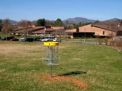
Meadowbrook Elementary Disc Golf Course
Canton, North Carolina
1.5 miles S of Canton, North CarolinaSurrounded by the beautiful Southern Appalachians. Long and short tees and dual baskets. A mix open and wooded holes. Primarily for students but open to the public after school (5pm) and on weekends....
Disc Golf
Mars Hill College Disc Golf Course
Mars Hill, North Carolina
0.2 miles W of Mars Hill, North CarolinaExcellent views, drastic elevation, tricky greens, manicured grass fairways, wooded holes and mandatories. Pack out trash. Alcohol illegal. Please be respectful. Public (No Fee)
Disc Golf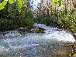
North Mills River
Mills River, North Carolina
4.8 miles W of Mills River, North CarolinaThe forest is known for its hiking and mountain biking trails, several of which are near the campground. Mills River offers excellent trout fishing, as well as tubing and swimming, which are...
Swim
Black Mountain Disc Golf
Black Mountain, North Carolina
1.0 miles SW of Black Mountain, North CarolinaIn a small park near a winding creek and scenic area. Relatively short but technical. Front 9 is links style - the back 9 have more length. Dual tees. Moderate poison ivy. Public (No Fee)
Disc Golf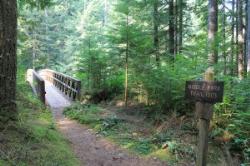
Middle Fork
Horse Shoe, North Carolina
7.8 miles NW of Horse Shoe, North CarolinaThis trail is about 8.8 miles of fire road and 2.6 miles of singletrack. There are 2 gated roads from the trailhead take the one on the right, Fletcher Creek Road (AKA The Never Ending Road). It...
Mountain Bike


