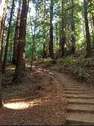
Muir Woods National Monument
Mill Valley, California
1.9 miles W of Mill Valley, CaliforniaThere are several suggested hikes on the main trail leaving from the visitors center. The longest, a loop, is about 2 miles. It is the only one that leaves the boardwalk. It has some elevation...
Hike Added on 15 Mar 2017 12.1 mi
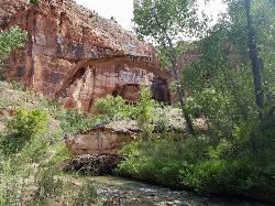
Escalante River
Escalante, Utah
1.2 miles E of Escalante, UtahHike and Horseback near Escalante, Utah
Hike, Horseback Added on 14 Mar 2017
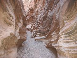
Little Wild Horse & Bell Canyon
Green River, Utah
44.7 miles SW of Green River, UtahThis HIKERS ONLY loop trail is about 8 miles, with a 700 ft elevation gain. People often only hike the Little Wild Horse part, which is a 3.3 mile one way section of the trail. It's a...
Hike Added on 2 Feb 2017
Cherry Hill Park
Orem, Utah
2.3 miles S of Orem, UtahJust south of Cherry Hill Elementary, this is a small hill for small children great and moms who are looking to avoid a well populated hill. The hill is to the south of the playground and most...
Sled Added on 10 Nov 2016
Rock Canyon Park
Provo, Utah
2.6 miles NE of Provo, UtahThis is the biggest park in Provo, Utah, with lots to do. The hills are great for sledding.
Sled Added on 10 Nov 2016 3.0 mi
Lionhead Natural Water Slide
Coolin, Idaho
20.0 miles N of Coolin, IdahoIn the lush forest just outside of Priest Lake, you’ll find a perfectly formed, natural water slide, set at just the right angle for endless hours of summer fun. Just grab a trash bag...
Hike, Swim Added on 1 Aug 2016 1.9 mi
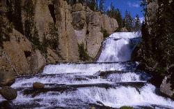
Terraced Falls
Grant Village, Yellowstone National Park
23.2 miles SW of Grant Village, Yellowstone National Park3.6 mile easy out and back trail. 430 ft Elevation gain. The trailhead is off Ashton-Flagg Ranch Road along Yellowstone's South border. Ashton-Flagg Ranch Road is closed during the winter.
Hike Added on 14 Aug 2015


