30.5K Spring Hikes by endovereric
first prev 1 next lastThe basic idea here is to find trails in lower elevations or trails with a Southern exposure. That makes Stinking Springs/Sidewinder an honorable mention because it is closed for wildlife until later in the spring despite awesome conditions.

Palisades Creek Trail / Lakes and Waterfall Canyon
Irwin, Idaho
4.4 miles E of Irwin, IdahoPalisades Creek Trail is located about 50 miles southeast of Idaho Falls and about 60 miles west of Jackson Hole WY in Swan Valley Idaho. The four mile hike up to lower Palisades Lake or the 6.2 mile...
Backpack, Camp, Hike, Horseback, Mountain Bike Added on 13 Jul 2022 0.9 mi
Hell's Half Acre Lava Walk
Blackfoot, Idaho
25.6 miles N of Blackfoot, IdahoThe Lava Trails traverse the desert of the Snake River Plain through contorted landscapes created from multiple lava flows. These Hawaiian-type lava flows are associated with the stretching of the...
Hike Added on 2 Jul 2020 3.2-47.0 mi
Yellowstone Branch Line Trail
Ashton, Idaho
7.6 miles NE of Ashton, IdahoYellowstone branch line trail runs from Warm River to the Montana border totaling 39 miles. There are a few places to jump on and off the trail as well as a few smaller trails that branch off of this...
Backpack, Cross-country Ski, Hike, Horseback, Mountain Bike Added on 2 Jul 2020 0.8 mi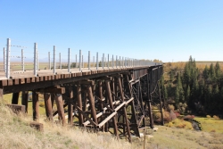
Conant Creek Pegram Truss Railroad Bridge
Ashton, Idaho
5.0 miles SE of Ashton, IdahoAs part of the Rails to Trails project, this old railroad bridge has been transformed into a very safe little viewing experience for the whole family. You can drive right up to the bridge where there...
Hike Added on 2 Jul 2020
Henry's Fork Green Way (St. Anthony Green Belt)
Saint Anthony, Idaho
0.6 miles SW of Saint Anthony, IdahoThis is a great walk along the river. While it is nestled right next to the highway, the closeness and beauty of the river flowing on the other side of the trail more than make up for it. Halfway...
Hike Added on 11 Jun 2020 0.3-0.6 mi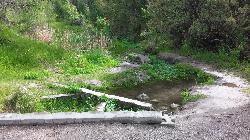
Cress Creek Nature Trail
Rexburg, Idaho
11.9 miles S of Rexburg, IdahoMeandering along the scenic South Fork of the Snake River, the beautiful 1¼ mile Cress Creek Nature Trail will lead you on a journey through sagebrush-grass communities, over juniper covered...
Hike Added on 7 May 2020 1.0-1.3 mi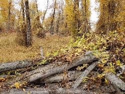
Lorenzo Bridge
Rexburg, Idaho
7.2 miles SW of Rexburg, IdahoThis is the old site of the Lorenzo Boat Launch, which has moved to the other side of the river a little further downstream. This spot sees very little traffic. There are beautiful, yet...
Airsoft, Hike, Paintball Added on 3 May 2019 0.6-2.0 mi
North Menan Butte ('R' Mountain)
Menan, Idaho
4.5 miles N of Menan, IdahoThe North Menan Butte is more commonly known to the locals and college students as R Mountain. Many kids know it better as Ou'R' Mountain. The butte is a rare and unique geological area and provides...
Camp, Cave, Hike Added on 28 Sep 2018
Hell's Half Acre Northbound Rest Stop
Blackfoot, Idaho
8.7 miles NE of Blackfoot, IdahoThis is a well maintained rest area with facilities to keep you happy as you travel through Idaho. This rest stop on Interstate 15 about 9 miles north of Blackfoot Idaho has nice picnic tables and...
Hike Added on 5 Jun 2018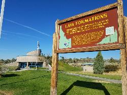
Hell's Half Acre Southbound Rest Stop
Blackfoot, Idaho
8.8 miles NE of Blackfoot, IdahoThis is a well maintained rest area with facilities to keep you happy as you travel through Idaho. This rest stop on Interstate 15 about 15 miles South of Idaho Falls has nice picnic tables and...
Hike Added on 5 Jun 2018


