Top Of The World
Cisco, Utah
| Address: | ~Top of the World Safari Rte, Cisco, UT 84515, USA |
| GPS: |
38°48'39.4"N 109°18'14.5"W Maps | Directions |
| State: | Utah |
| Trail Length: | 10.00 miles |
| MTB Difficulty: | Advanced |
| Trail Type: | Out & Back |
| MTB Trail Type: | 4x4 Trail |
Mountain Bike
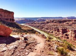
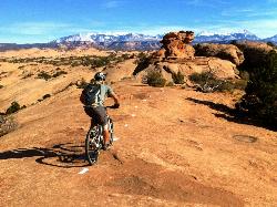
This is a 4x4 trail that is a load of fun. It is not that steep but there are lots of bike steps that you have to climb (and get to descend!). The view at the top is unbelievable. Not classic freeride or XC but definitely worth your time if you are a true MTB fan! Courtesy of Singletracks.com
More Information
Add ResourceNever modify trail features. Ride trails when they're dry enough that you won't leave ruts. Speak up when you see others on the trail and always yield to hikers, horses, and others coming uphill. Always ride on the established trail.Read More
Directions
From Cisco, Utah
- Head west on UT-128 toward Cisco Pump House Rd (2.5 mi)
- Turn left onto UT-128 W (11.8 mi)
- Turn left onto BLM 105/Top of the World Safari RteDestination will be on the left(328 ft)

Other Mountain Bike Trails Nearby

Arches NP Main Road
Moab, Utah
15.8 miles WThis is the main road through Arches National Park. Road is paved (chipseal). Most people drive through, but this makes a beautiful cycle ride. As with any riding in Moab, you must...
Mountain Bike
Porcupine Rim
Moab, Utah
17.0 miles SA great mountain biking trail, Porcupine Rim takes bikers through some of the beautiful areas of Moab. The trail is also one of the most difficult and dangerous trails in the Moab area. There can...
Mountain Bike
UPS And LPS
Moab, Utah
17.0 miles SFollow Kokopelli for about 2 miles. 2-track road gets rocky, loose and rutted out in areas, but contains fun jumps and fast action. There are a couple of short climbs. Stay on trail...
Mountain Bike
The Whole Enchilada
Moab, Utah
17.2 miles SThis trail encompasses several trails including Burro Pass, Hazard County, and Porcupine Rim. You start out at 10000ft, and climb about another 1400 to Burro Pass, then the downhill...
Mountain Bike
Fins n Things
Moab, Utah
19.2 miles SWFins & Things is primarily a double-track loop ride off the Sand Flats Road about a mile past Slickrock. Terrain is varied, with rolling fins of sandstone and rough doubletrack on...
Mountain Bike
Slickrock Trail
Moab, Utah
19.7 miles SWThese Moab trails are deceptively named for mountain bikes. This region was so named because the rock was slick for horseshoes. With mountain bike tires, you'll get insanely good grip that...
Mountain Bike
Hazard County
Moab, Utah
19.8 miles SSuper fun downhill section with cool features on top and bermed turns from the middle to the bottom. Super fast, great views, and hairpin turns through the scrub brush. One of my...
Mountain Bike
Slickrock
Moab, Utah
20.5 miles SWThis trail is probably the most well known mountain bike trail in the country. That being said, it is not necessarily the BEST trail in the country. It is definitely unique due to the...
Mountain Bike
Moab Brand Trails
Moab, Utah
20.8 miles SWGreat introduction to Moab riding. Start at the parking area for Bar M Chuckwagon and follow the signs. Ride the loop in a counter-clockwise direction (Bar M, then Bar B to Rockin'A...
Mountain Bike
Sovereign Single Track
Moab, Utah
20.9 miles WThe Sovereign trail is a part of the Sovereign trail system in Moab, Utah. This trail is a mix of slickrock and nice singletrack trail. At the beginning of the trail there will be an uphill climb...
Mountain Bike
Salt Wash
Moab, Utah
21.0 miles WSalt Wash is a much more technical route compared to the other, neighboring trail Sovereign. The Salt Wash trial includes both a mix of flowy singletrack as well as some more technical slickrock....
Mountain Bike
Prospector
Moab, Utah
21.0 miles SWThe trail has both a high and low line, with the higher being the more difficult and slightly longer of the two options. The trail is singletrack cut into the side of the hill with...
Mountain Bike
Flat Pass
Moab, Utah
21.1 miles SWThis is a rugged jeep route which bears a lot of resemblance to the traditional Porcupine Rim route. There is an initial climb of 1,000 feet in the first four miles and 1,500 ft of...
Mountain Bike
Klonzo Area
Moab, Utah
21.4 miles SWAll singletrack, most very new. Very well done. All intermediate in both technical and aerobic levels. The trails climb to the NE. Borderline is a gradual climb to Wahoo, which is a...
Mountain Bike
Moonlight Meadows & Clark Lake
Moab, Utah
21.4 miles SCow trail turned into a mountain bike trail! You'll dodge plenty of cattle during the summer but it's worth it for the green meadows, aspen groves, and short, technical bursts....
Mountain Bike
Miner's Loop
Moab, Utah
22.1 miles WMiner's Loop is a brand-new (as of April 2014) advanced loop near the Klondike Bluffs south trailhead. This entertaining trail climbs to the top of a bluff and then is a rip-roaring...
Mountain Bike
Portal Trail
Moab, Utah
22.2 miles SWVery technical with extreme exposure. There are signs that say riders were killed on the trail - likely by falling over the cliff. Do not ride this from the bottom up, but use this...
Mountain Bike
Baby Steps
Moab, Utah
22.2 miles WNewer singletrack in Moab. It follows the Klondike Bluffs trail for a bit, then spurs off. It is well signed. A combination of a little doubltrack, slickrock, and singletrack. The...
Mountain Bike
Maverick
Moab, Utah
22.3 miles SWThe Maverick trail is a short .4-mile flowy, dirt singletrack trail that connects to North 40 on both ends. When I first road at Moab Brand I initially dismissed this short section, but...
Mountain Bike
Burro Pass
La Sal, Utah
22.4 miles SThe Burro Pass trail climbs straight up from the road, gaining over a thousand vertical feet in a mile and a half. The top of Burro Pass is almost above treeline, sitting just below...
Mountain Bike


