Timothy Lake Trail
| Address: | ~NF-57, Oregon, USA |
| GPS: |
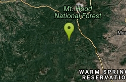
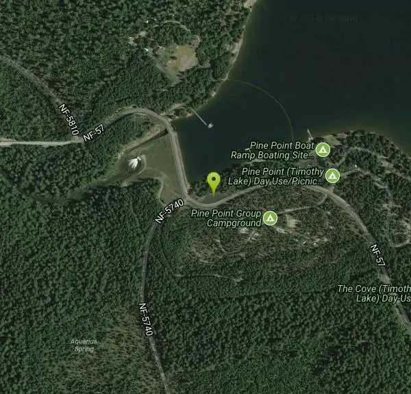
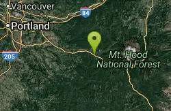
45°6'46.3"N 121°48'19.7"W Maps | Directions |
| State: | Oregon |
| Trail Length: | 15.00 miles |
| MTB Difficulty: | Beginner |
| Trail Type: | Loop |
| MTB Trail Type: | Singletrack |
Mountain Bike
Going clockwise, it starts out as a rolling, swooping single track. Fir needles, a few roots, nice. After you walk your bike two hundred yards on the Pacific Crest Trail, the trail changes to more rocky single track with steeper pitches. You cross a few roads, but there isn't much traffic up there. The part around Clackamas Lake is pretty easy--very dusty in late summer. The latter part of the ride on the east side of Timothy Lake has a few technical spots, but nothing too serious. Come out on forest road 57, cross the dam, and you're done. The trail itself can be a good workout for beginners and experience in riding the trail will vary whether you ride it clockwise or counter-clockwise. Courtesy of Singletracks.com
More Information
Add ResourceNever modify trail features. Ride trails when they're dry enough that you won't leave ruts. Speak up when you see others on the trail and always yield to hikers, horses, and others coming uphill. Always ride on the established trail.
Read More- Plan Ahead and Prepare
- Travel & camp on durable surfaces
- Dispose of waste properly
- Leave what you find
- Minimize campfire impacts
- Respect wildlife
- Be considerate of other visitors
Directions
- Get directions on Google Maps
Other Mountain Bike Trails Nearby
Wildwood Recreation Site
Mount Hood Village, Oregon
19.0 miles NWWildwood Recreation Site is located along the Mount Hood Scenic Byway near the town of Welches, Oregon. Mount Hood, Oregon's tallest mountain, beckons travelers through a forested corridor to...
Hike, Mountain Bike, Swim
Opal Creek
Lyons, Oregon
28.5 miles SWStarting from the gate at the parking area it is about 3.5 miles to get to Opal Pool. There is a slight uphill climb along the way but nothing too difficult. The "trail" is a private...
Mountain Bike
Molalla River Recreation Corridor
Molalla, Oregon
33.5 miles WThere are several rides at the Hardy Creek trail head. Deerskull is steep and singletrack. Rim trail is sweet. The huckleberry trail is the main trail and all side trails branch from...
Mountain Bike
Monument Peak Trails
Gates, Oregon
39.6 miles SWJust a few miles south of Gates, is the Monument Peak Trail System. Hikers, mountain bikers, and horse back riders will enjoy approximately 19 miles of single track trail in the...
Mountain Bike
Rabbit Hole
Gates, Oregon
39.7 miles SWRelatively new multi use trail, which doesn't see a lot of use. Can get a little choppy from horses.
Mountain Bike
Powell Butte Nature Park
Portland, Oregon
43.1 miles NWThis place is best ridden early mornings or weekdays due to lots of hikers and horse riders. Be aware of them at all times. Powell Butte has a few decent singletrack trails that are,...
Mountain Bike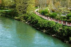
Willamette River Trail
Canby, Oregon
44.0 miles WThe Willamette River trail is a mix of both paved and natural surface trails. It is a relatively flat trail that would be perfect if you want to take a leisurely bike ride and you're not up...
Hike, Mountain Bike
Catamount Trail
Sublimity, Oregon
45.2 miles SWStraight forward uphill road on lookout mountain/ house road. Actual trail is newer single track. Roots and some technical in spots. MTB specific but hikers allowed, no equestrian....
Mountain Bike
Shelburg Falls
Stayton, Oregon
45.5 miles SWHead up the gravel road for several miles, past the lower falls, and then past the upper parking. There are multiple ways to configure loops. For the most trail, continue climbing to...
Mountain Bike
Cooks Butte
Lake Oswego, Oregon
47.6 miles NWjust a few trails that go through some nice forest right in the middle of Lake Oswego. hikers that go through there are fairly tolerant and don't ever say anything. Fun downhill to the...
Mountain Bike
Lumberyard Indoor Bike Park
Portland, Oregon
47.7 miles NWThe Lumberyard, Portland's unique indoor bike park, includes jump lines, pump tracks, skill sections and technical trail riding for beginners to experts.They also offer offer...
Mountain Bike
Upper Sidewinder
Portland, Oregon
47.9 miles NWAdvanced downhill trail with roots, rocks, and lots of corners. Courtesy of Singletracks.com
Mountain Bike
Oaks Bottom Wildlife Refuge
Portland, Oregon
48.1 miles NWThere is a popular paved commuting bikepath called the Springwater Corridor that goes along the edge of Oaks Bottom and there is also a paved connector to the Springwater Corridor that...
Mountain Bike
Iron Mountain Trail
Lake Oswego, Oregon
48.3 miles NWFrom the trailhead you can either ride straightish to fairway road. This is 1.5 track gravel & dirt. Or you can ride down and about halfway there will be a switchback. Take this and...
Mountain Bike
Terwilliger Parkway
Portland, Oregon
49.9 miles NWTerwilliger Parkway is a 99-acre, city-owned park in Portland, Oregon. This park is a great get-away from city life as there is more space than other city-parks, and activities here...
Mountain Bike