Thomaston Dam
Thomaston, Connecticut
| Address: | ~Thomaston Dam, Thomaston, CT 06787, USA |
| GPS: |
41°41'42.6"N 73°3'48.9"W Maps | Directions |
| State: | Connecticut |
| Trail Length: | 0.00 miles |
| MTB Difficulty: | Beginner |
| Trail Type: | Figure 8 |
| MTB Trail Type: | 4x4 Trail |
Mountain Bike
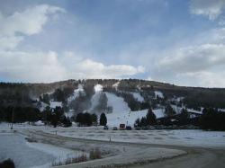
The Vista picnic area offers visitors excellent views of the dam and portions of the Naugatuck River Valley. The streamside environment is popular for fishing and upland game hunting. Riding trails are provided for seasonal trailbikes and snowmobiles. A radio-controlled model aircraft field, open to the public, is maintained by volunteers. For up-to-date information, call (860) 283-5540. Courtesy of Singletracks.com
More Information
Add ResourceNever modify trail features. Ride trails when they're dry enough that you won't leave ruts. Speak up when you see others on the trail and always yield to hikers, horses, and others coming uphill. Always ride on the established trail.
Read MoreDirections
From Thomaston, Connecticut
- Head northeast on CT-222 N toward Electric Ave (1.0 mi)
- Continue straight onto N Main St (0.5 mi)

Other Mountain Bike Trails Nearby

Sessions Woods
Burlington, Connecticut
6.2 miles NETrail system in the Sessions Woods WMA. A good mix of rock and roots making for a fun time on the bike. Trails also connect to a number of other areas near by but also include road...
Mountain Bike
Nassahegan State Forest
Burlington, Connecticut
7.4 miles NEA good network of trails in the Nassahegan State Forest. A main loop with a number of side trails. A large loop exist that will bring you past a road. Parking is Avaliable at the park...
Mountain Bike
Winding Trails
Farmington, Connecticut
11.8 miles EMajor trail complex with lots to do. Trail maps are available at stations and you will need to pay a $5 fee for parking. The trail is about 5 miles long with little technical challenge...
Mountain Bike
Middlebury Greenway
Middlebury, Connecticut
12.6 miles SThe Middlebury Greenway is to be a picturesque walking and biking trail converted from an old trolley bed that runs through Middlebury to the Waterbury town line. Great climbs,...
Mountain Bike
Mohawk Mountain State Park
Cornwall, Connecticut
15.7 miles NWmostly logging roads, can be ridden rigid. Climb to the top of mohawk mountain and back down. Lots more to be explored, this is a good 15 miles and 1.5 hours of riding.1) at the dead end first road...
Cross-country Ski, Hike, Mountain Bike
Heublein Tower
West Hartford, Connecticut
15.8 miles NEMix of single trail, double trail and gravel roads. Go counterclockwise. Beautiful views from Heublein Tower.
Mountain Bike
Steep Rock
Washington, Connecticut
16.2 miles SWFrom Judd's Bridge, follow the road towards Washington and Steep Rock, go straight on the road that is perpendicular to the bridge. Follow it up into a curve and on the left there is a house with...
Hike, Mountain Bike
Gilbert Mountain / Winsted Woods
Winchester, Connecticut
16.3 miles NThere used to be a race here and many of the trail markings are still there but a lot of washout has happened and you'll need to look for the newer connecting single track for the...
Mountain Bike
Larkin State Bridal Trail
Southbury, Connecticut
16.5 miles SThis is a multi-Use Trail: bicycling, mountain biking, hiking, cross country skiing and horseback riding, in fact it's popular horse back riding trail, so watch out for those road...
Mountain Bike
Cheshire Lock 12
Cheshire, Connecticut
16.8 miles SEPaved hiking, running, and biking. There is small unpaved shoulder.
Mountain Bike
Penwood State Park
Simsbury, Connecticut
17.4 miles NEAn extensive trail system envelopes this hill top park with many scenic views of the Farmington River Valley. There's single track that traverses within inches of 200 foot cliffs....
Mountain Bike
Brooksvale Park And Naugatuck State Forest
Hamden, Connecticut
18.2 miles SEBrooksvale Park is a nice for the beginner rider but its also the gateway into the Naugatuck State Forest, which has awesome single track, great climbs, and plenty of stuntry. The...
Mountain Bike
Central
Simsbury, Connecticut
18.3 miles NEone huge drop and plenty of jumps usually lots of people there not many non bikers trail is always changing
Mountain Bike
George C. Waldo State Park
Southbury, Connecticut
19.7 miles SWFamily Friendly: trying to do some of the ramps would be fun for kids. Dogs: Leashed Once you park, go through the gate and the red trail starts on the left shortly after you go into the...
Mountain Bike
Sunny Valley
Bridgewater, Connecticut
20.8 miles SWNetwork of trails offering serious climbs and very technical singletrack.
Mountain Bike
Carpenter's Falls
Granby, Connecticut
21.0 miles NEDO not head down the trail to the left it is for hiking/walking only. Ride up the hill till you hit pavement. Mostly a really rough dirt road passable by some suvs, but with a few...
Mountain Bike
Upper Paugussett State Forest
Newtown, Connecticut
21.2 miles SWTrail along the water from the boat ramp is ueber technical but gets worse once past the "Kissing Oaks" (two oak trees that have grown into one another). From there, you can follow the...
Mountain Bike
Lower Paugussett State Forest
Newtown, Connecticut
21.5 miles SBlue trail does a 6.5 mile loop of extremely technical trail. Other trails interconnect through here including a forest/logging road, as well as connections to the Iriquois Gas Line...
Mountain Bike
Dingle Brook Trail
Brookfield, Connecticut
22.1 miles SWNetwork of old ATV trails and now Equestrian Trails. Good work out.
Mountain Bike
Cowles Park
East Granby, Connecticut
22.1 miles NEVery well maintained trails with a great variety: some downhill, some hill ups and downs, flat technical sections, and fire roads. Just a fun wide range of trails. Would go back any...
Mountain Bike


