


74 Things to do near Thompson, Utah
first prev 1 2 3 4 next lastShowing results within 50 miles Distance miles of Thompson, UT 84540, USA City, Zip, or Address
Mega Steps
10.1 miles S
A fun trail built as a section of the Klondike Bluffs system utilized to complete a loop out of Baby Steps - EKG or Little Salty. From the trailhead there is a short sandy section to...
Mountain Bike
Klondike Bluffs
10.1 miles S
The Klondike Bluffs area is now a complex trail system featuring a myriad arrangement of 4x4 roads and singletrack/slickrock bikes-only trails. These trails climb the sides of the...
Mountain Bike
Miner's Loop
Moab, Utah
13.6 miles SMiner's Loop is a brand-new (as of April 2014) advanced loop near the Klondike Bluffs south trailhead. This entertaining trail climbs to the top of a bluff and then is a rip-roaring...
Mountain Bike
Baby Steps
Moab, Utah
13.8 miles SNewer singletrack in Moab. It follows the Klondike Bluffs trail for a bit, then spurs off. It is well signed. A combination of a little doubltrack, slickrock, and singletrack. The...
Mountain Bike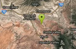
Arches NP Main Road
Moab, Utah
14.4 miles SEThis is the main road through Arches National Park. Road is paved (chipseal). Most people drive through, but this makes a beautiful cycle ride. As with any riding in Moab, you must...
Mountain Bike
Hidden Canyon-blue Hills Loop
17.3 miles S
The trail makes a loop utilizing the Hidden Canyon 4x4 road and other 4x4 roads and the Blue Hills road. Trail is best ridden as a clockwise route. A downloaded GPS track to your GPS...
Mountain Bike
Monitor & Merrimac/Courthouse Pasture
Moab, Utah
17.5 miles SGreat trail, did this ride while on a guided tour in 2004. There are some great scenery views along the trail including dinosaur bones, wildlife, rock formations along with slickrock...
Mountain Bike
Fiery Furnace
Moab, Utah
17.7 miles SEA fun place to go hiking within Arches National Park. The Fiery Furnace area is a permit only area, with several ranger-led tours available. Hiking permits are required in order to enter, as well...
Hike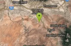
Bartlett Wash
17.9 miles S
The trail is easy aerobic and can be as technical as you like. The official trail is fairly short but there is plenty to explore. Follow the trial west and then cruise along the North...
Mountain Bike
Salt Wash
Moab, Utah
19.1 miles SSalt Wash is a much more technical route compared to the other, neighboring trail Sovereign. The Salt Wash trial includes both a mix of flowy singletrack as well as some more technical slickrock....
Mountain Bike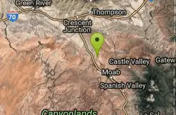
Sovereign Single Track
Moab, Utah
19.1 miles SThe Sovereign trail is a part of the Sovereign trail system in Moab, Utah. This trail is a mix of slickrock and nice singletrack trail. At the beginning of the trail there will be an uphill climb...
Mountain Bike

Bar M Loop
Moab, Utah
22.0 miles SThis trail is easy, it is an excellent one to introduce a newcomer to our sport and the riding found around Moab (I took my 11yr old son and he had a blast, he wants to keep going back...
Mountain Bike
Maverick
Moab, Utah
22.0 miles SThe Maverick trail is a short .4-mile flowy, dirt singletrack trail that connects to North 40 on both ends. When I first road at Moab Brand I initially dismissed this short section, but...
Mountain Bike
Rockin' A
Moab, Utah
22.1 miles SThis trail is part of the Moab Brands Mtn. Bike Trails and connects to other trails in the system. There are various ways to reach Rockin' A. Grab a map or check out the maps posted at...
Mountain Bike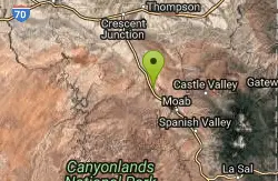
North 40
Moab, Utah
22.2 miles SThe North 40 is a mix of rock and dirt singletrack. Rocky sections are fun to climb and descend and include painted marks to show the way. Great for advanced and advanced intermediate...
Mountain Bike
Deadman's Ridge
Moab, Utah
22.2 miles SNot a fast trail by any means, Deadman's Ridge is probably the most technical trail of this network so far. A mix of slickrock and hard pan this is a great option for those riders...
Mountain Bike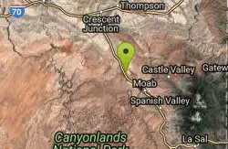
Circle O Trail
Moab, Utah
22.2 miles SIt is 100% slickrock, on top of Entrada sandstone. Once you get in there, you will see the painted bike tire trail marker. Some sections the painted trail marks has worn and blended...
Mountain Bike
Big Lonely
Moab, Utah
23.4 miles SIntermediate ride over a sandstone ridge, then cross-country travel on dirt with intermittent sandstone outcrops. Average 3% grade. Several short stretches exceed 15% and one 30 ft long...
Mountain Bike
Coney Islands
Moab, Utah
23.4 miles SDifficulty - Intermediate ride with some technical difficulty. Average 6% grade with some short 20% descents and climbs. High point 5610 ft and low point is 5230 ft....
Mountain Bike
Big Mesa
Moab, Utah
23.4 miles SBig Mesa forms a 9-mile loop when combined with Coney Island and Big Lonely, or an 18-mile loop when combined with the entire Navajo Rocks Trail System. This segment of trail contains...
Mountain Bike


