248 Things to do near Tetonia, Idaho
Showing results within 50 miles Distance miles of Tetonia, ID, USA City, Zip, or Address

Badger Creek
Tetonia, Idaho
3.3 miles NBadger Creek is a stream located just 13.6 miles from Ashton, in Teton County, in the state of Idaho, United States, near France, ID. Whether you’re spinning, baitcasting or fly fishing your...
Camp, Cross-country Ski, Hike, Mountain Bike, Rock Climb
Driggs Nordic Trail
Driggs, Idaho
6.6 miles SEDistance: 3.1 miles (5km) Trail Map: Driggs_Nordic_Track_2015.pdf Grooming Report: http://tvtap.org/nordic-grooming
Cross-country Ski, Snowshoe 3.9 mi
Three Wookie Trail
Driggs, Idaho
6.8 miles SMountain Bike near Driggs, Idaho
Mountain Bike
Teton Valley Disc Golf Course
Driggs, Idaho
7.0 miles SEEnjoy 360-degree mtn views from this city park that also features a skateboard area. This course is on your way to the Grand Targhee course. Public (No Fee)
Disc Golf 0.1-0.2 mi
Driggs Bike and Skate Park
Driggs, Idaho
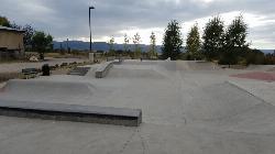
7.2 miles SEThis is a great concrete skatepark and small mountain bike park with great features, both natural and wooden. There's a great pavilion right next to the skatepark and parking lot. While...
Mountain Bike, Skateboard
Alta Nordic Trail
Alta, Wyoming
7.4 miles SEDistance: 6.2 miles (10km) Trail Map: Alta_Nordic_Trail_2015.pdf Grooming Report: http://tvtap.org/nordic-grooming
Cross-country Ski, Snowshoe
Twin Creek Trail
Driggs, Idaho
8.3 miles SWThe Twin Creek trail is 2.3 miles long. It begins at Trail 6195 and ends at Trail 6219. source: fs.usda.gov
Mountain Bike
Sharks Belly
Driggs, Idaho
8.5 miles SWTrail system can start from Channel lock or Bovine. Channel Lock is an easier climb than Bovine. This description and mileage starts at the Channel Lock trail, forest service boundary marker. Take...
Mountain Bike
Southbound
Driggs, Idaho
8.5 miles SWTrail starts by going up the Channel lock trail. At the top of Channel Lock go right onto the Southbound trail. Trail will loop back to Channel lock which you take back to your car. Trail is...
Mountain Bike
Channel Lock
Driggs, Idaho
8.5 miles SWTrail is a little over 1 mile uphill. Recommended route up to access the larger Horseshoe canyon trail system. Makes a nice downhill with twists. Gets its name from the deep ruts made from cows....
Mountain Bike
Grand Targhee Resort
Moose, Wyoming
8.7 miles SESpectacular Teton mountain course at 8000' elevation. Discs in Activity Center. Head bartender in resort's Trap Bar is the course pro. Course open when snow is gone; usually June to...
Disc Golf
Spring Creek Trail
Alta, Wyoming
8.7 miles SEThis trail starts at the remains of the historic Rapid Creek Ranger Station. The trail heads east following an old road. After crossing Rapid Creek, the trail climbs up to a ridge...
Mountain Bike
Cold Springs
Moose, Wyoming
8.8 miles SETrail is easiet down as a loop but can be done as a shuttle as well. Take a right into Teton Canyon and park at the first big parking lot on the left. About 50 yards from Ski Hill rd....
Mountain Bike
Probation And Burg Bumper
Tetonia, Idaho
9.0 miles SWThe Probation part of the trail is the steepest downhill in the area. Has multiple bridges and log jumps in the short mile down. The Burg portion of the trail is uphill with some...
Mountain Bike 4.5 mi
Aspen Trail
Alta, Wyoming
9.0 miles SEAspen Trail (tr 034) is single track trail for 4.35 miles along 6,800 ft contour to Darby Canyon (tr 012). Spring Creek Trail (tr 032) is double track trail for 3.68 miles to end. The trail starts...
Hike, Mountain Bike
Horseshoe Canyon
Tetonia, Idaho
9.1 miles SWHorseshoe Canyon is one of the closest trail systems to the town of Driggs, Idaho. This network doesn't have a ton of climbing or descending, but the smooth, swooping singletrack with a...
Mountain Bike
Horseshoe Trails
Driggs, Idaho
9.1 miles SWMountain Bike near Driggs, Idaho
Mountain Bike
Bovine
Driggs, Idaho
9.1 miles SWBovine trail is part of a larger system. You can use it to access more trails or make it your end destination from other trailheads. It is a steep climb but returns the favor with a fast downhill....
Mountain Bike 0.6 mi
Packsaddle Lake
Tetonia, Idaho
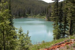
9.3 miles WPacksaddle is one of the less well known lakes/trails in the area. If you've got a good offroad vehicle, you can probably make it all the way to the end of the road, otherwise, it's just an...
Dive, Hike, Mountain Bike, Snowshoe, Swim 7.1 mi
Mill Creek Trail
Moose, Wyoming
9.4 miles SEThere are two ways to do this ride, one as a loop with the Targhee road providing the bulk of the climb, or as an out and back (up the trail and back down). Keep in mind that this trail is...
Cross-country Ski, Mountain Bike, Snowshoe


