


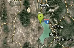
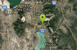
227 Things to do near Saratoga Springs, Utah
first prev 1 2 3 4 5 6 7 8 9 10 next lastShowing results within 50 miles Distance miles of Saratoga Springs, UT, USA City, Zip, or Address
Saratoga Hills
Saratoga Springs, Utah
0.9 miles NWFirst 3 holes very short. Open and flat. Please minimize noise and do not litter. Private (No Fee)
Disc Golf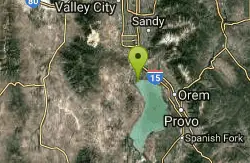
Saratoga Hot Springs
Saratoga Springs, Utah
1.6 miles NThe Saratoga Hot Springs are a wonderful place to visit in every season. The water is always around 100 degrees Fahrenheit, perfect for soaking away the winter cold. This is a wonderful place to...
Hike, Hot Springs 0.2 mi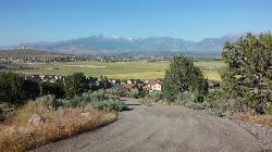
Kiowa Valley Path
Eagle Mountain, Utah
3.4 miles WAt 0.3 miles, this short little hike is almost more of a quick dog walk but kids seem to enjoy the lizards and rabbits that frequent the path. The lizards seem to enjoy basking in the heat of the...
Hike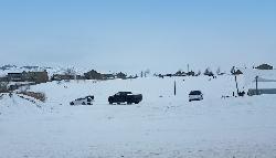
Silver Lake Ampitheater
Eagle Mountain, Utah
3.4 miles NWA clear favorite in Eagle Mountain right off Pony Express Parkway.
Sled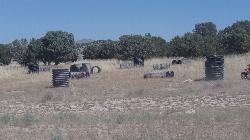
Eagle Mountain Paintball Field
Eagle Mountain, Utah
3.7 miles WJust south of the Eagle Mountain trailhead, there's a great outcropping of bushes and brush that's been built up as a paintball field with a bunch of corrugated culvert pipe. There's a...
Airsoft, Paintball 0.4-0.5 mi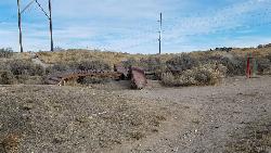
Mountain Ranch Bike Park
Eagle Mountain, Utah
4.3 miles NWMountain Ranch Bike Park takes great advantage of that otherwise unusable strip of land underneath large power lines. There is tons of single track thoughout the area but the bike park offers...
Mountain Bike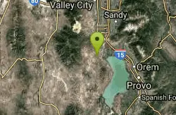
Sandpiper Hill
Eagle Mountain, Utah
4.7 miles WThis is a great hill big enough to deal with just about any crowd it might get. It's a long slope that'll keep your kids going but doesn't get too insanely fast that you need to worry...
Sled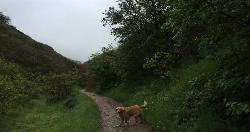
Dry Creek Trail Park
Lehi, Utah
6.0 miles NESpread out along creek. Trees and water come into play - some long walks between holes but well marked for navigation. Public (No Fee)
Disc Golf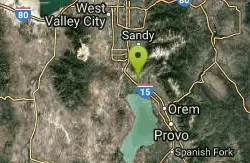
300 East Lehi Lot
Lehi, Utah
6.4 miles NEThis is a huge lot with a lot of terrain. There's a couple of easily accessible hills and plenty more that could be played on.
Sled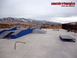
Pony Express Skatepark
Eagle Mountain, Utah
6.6 miles WSkateboard near Eagle Mountain, Utah
Skateboard
Shelley Elementary
American Fork, Utah
6.7 miles NESled near American Fork, Utah
Sled
Evergreen Park
American Fork, Utah
7.5 miles NESled near American Fork, Utah
Sled
Art Dye Disc Golf Park
American Fork, Utah
7.6 miles NETechnical with a variety of lengths. Plays mostly in trees with tight fairways and minor elevation. Tees are brick tiles, except #13 (rubber), and #12 and #15 (dirt). Course Map at 1st tee. Public...
Disc Golf
Beacon Hill Park Disc Golf
Highland, Utah
10.1 miles NEIncredible views of Utah Valley, Utah Lake, and the surrounding Rockies. Nestled on a large expanse of natural fields at the base of Hog Hollow Canyon, the course has a (usually) dry creek and a few...
Disc Golf 1.3 mi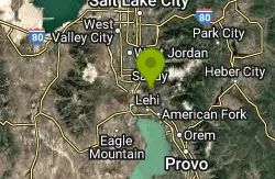
Eagle Crest Trail
Draper, Utah
10.4 miles NEagle Crest trail is a beginner level trail mountain bike in Draper, Utah along the north side of Traverse Mountain. From the trail, riders can see the Salt Lake Valley, the Northern end of Utah...
Hike, Mountain Bike
Utah Valley University
Orem, Utah
10.6 miles EVery short course (all holes less than 200') on the south end of campus. Water comes into play. Holes near the baseball diamond. Bring the map to help with navigation. Public (No Fee)
Disc Golf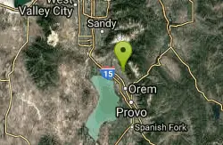
Bonneville Shoreline Trail - Cedar Hills to Grove Creek Canyon
Pleasant Grove, Utah
10.6 miles EThe Cedar Hills to Grove Creek Canyon portion of the Bonneville Shoreline Trail is an intermediate level trail. There are some flat spots that are on old dirt roads, as well as single track...
Mountain Bike
Grove Creek Trail
Pleasant Grove, Utah
10.7 miles EThe Grove Creek Trail falls from the upper shoulder of Mount Timpanogos down Grove Creek Canyon to Pleasant Grove. It's usually ridden as a shuttled downhill -- because the climb up this...
Hike, Mountain Bike
Oak Canyon Junior High
Lindon, Utah
10.9 miles ESled near Lindon, Utah
Sled
G Mountain Trail
Pleasant Grove, Utah
11.0 miles EThe trail starts at Kiwanis Park which is south of the 'G' at the end of Battle Creek Road. The trail starts out a little steep for about .25 mile and the very last bit is a...
Hike


