


14 Things to do near Long Creek, Oregon
first prev 1 next lastShowing results within 50 miles Distance miles of Long Creek, OR 97856, USA City, Zip, or Address
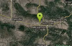
Mount Vernon Hot Springs
Mount Vernon, Oregon
18.2 miles SHot Springs near Mount Vernon, Oregon
Hot Springs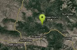
Davis Creek / Trail #244
Prairie City, Oregon
22.5 miles EThe majority of the trail is in moderate to heavy timber with only a few scenic vistas. Evidence of old mining and timber activities are visible from the trail.The roads to the southern...
Mountain Bike
Blackeye / Trail #243
27.0 miles E
This trail leads to Vinegar Hill-Indian Rock Scenic Area. Its high use period is in the fall during big game hunting seasons. via fs.usda.gov
Mountain Bike
Long Glade - Blue
Canyon City, Oregon
32.5 miles SLaid out through open Ponderosa pines and mountain meadows. More open meadow holes than the Yellow course on site. As much as a 60' elevation on some holes. Two water hazards may come into play...
Disc Golf
Long Glade - Yellow
Canyon City, Oregon
32.5 miles SLaid out through open Ponderosa pines using some meadows with as much as 45' elevation on some holes. Two water hazards may come into play. Several holes are next to OB fence lines. Both right...
Disc Golf
Blue Mountain Hot Springs
Prairie City, Oregon
36.0 miles SEA private hot springs steeped in history. From carnivals to holistic center and known as the former home of famed Winchester Firearms owner, Blue Mountain Hot Springs may or may not be available...
Hot Springs
Lehman Hot Springs Cabins
Ukiah, Oregon
37.4 miles NEHot Springs near Ukiah, Oregon
Hot Springs
Sunshine Flat / Trail #369
Prairie City, Oregon
38.9 miles SEThis shared use trail begins along the ridge top,and has many openings in the forest offering good views of the surrounding area. The trail goes through a couple of grassy clearings,...
Mountain Bike
Starvation / Trail #374
Prairie City, Oregon
43.5 miles SETrail provides tie through route from the Strawberry Mountain Wilderness to the Glacier Mountain area. The trail travels through wooded areas the majority of the time and has areas in a...
Mountain Bike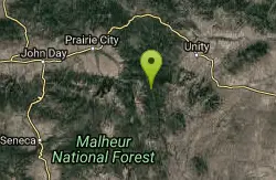
Horseshoe / Trail #363
Prairie City, Oregon
43.6 miles SEThe trail begins as a narrow dirt road, narrowing to a shared use trail after about 3/4 of a mile. You may encounter motorized users.The trail climbs abruptly up and continues to be...
Mountain Bike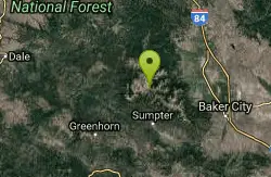
North Powder River / Trail #1632
Baker City, Oregon
44.6 miles ELight use trail open to mountain bikes.
Mountain Bike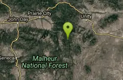
Sheep Creek / Trail #371
Prairie City, Oregon
45.9 miles SEThis shared use trail follows along Sheep Creek. The trail is mostly timbered offering scenic views of the area at the top. Carry water or treatment method to avoid contamination. This...
Mountain Bike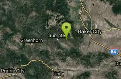
Elkhorn Crest National Recreation Trail #1611
Baker City, Oregon
49.1 miles EThe Elkhorn Crest Trail (#1611) was established as a National Recreation Trail in 1979. It is the highest trail in the Blue Mountains and runs along the Elkhorn Mountain ridgeline...
Mountain Bike
Twin Lakes
Baker City, Oregon
49.9 miles EThe Twin Lakes Trailhead is a small facility located on the southern end of the Elkhorn Mountains. This is the lower access route into Twin Lakes. This facility has no amenities and is...
Mountain Bike


