


Map of 64 Things to do near Green River, Utah
first prev 1 2 3 4 next lastShowing results within 50 miles Distance miles of Green River, UT, USA City, Zip, or Address
Navajo Rocks
Moab, Utah
34.1 miles SENavajo Rocks is a brand-new trail system that, as of when this description was written (May 1, 2014), is less than a week old. Presently, only phase 1 has been opened, which consists of...
Mountain Bike
Chisholm
Moab, Utah
34.7 miles SEFor intermediate riders. Slickrock, ledges, dirt; slightly technical. Crosses gas pipeline, Mineral Bottom Road and Hwy313. Average grade about 3%.The RideThis trail connects Horsethief...
Mountain Bike
Getaway
Moab, Utah
35.2 miles SEGetaway is located near Bull Run and 7-Up on the upper end of Gemini Bridges Road. This singletrack can be used as an alternate start to Mag 7, looped with the 4x4 road, or ridden as an...
Mountain Bike
Mag 7
Moab, Utah
35.2 miles SEThis is a series of 7 trails ("Magnificent 7") which make up a new (mostly) single-track incarnation of the classic Gemini Bridges shuttle descent. The seven trails are: Bull Run,...
Mountain Bike
Bar M Loop
Moab, Utah
35.3 miles SEThis trail is easy, it is an excellent one to introduce a newcomer to our sport and the riding found around Moab (I took my 11yr old son and he had a blast, he wants to keep going back...
Mountain Bike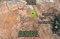
7 Up
Moab, Utah
35.3 miles SEThe map and description is for a one way ride from Magnificent 7 / 7 Up trailhead down to the Monitor/Merrimac parking overlook on Highway 191. Note that the ride can be done in either...
Mountain Bike
Rockin' A
Moab, Utah
35.5 miles SEThis trail is part of the Moab Brands Mtn. Bike Trails and connects to other trails in the system. There are various ways to reach Rockin' A. Grab a map or check out the maps posted at...
Mountain Bike
Maverick
Moab, Utah
35.6 miles SEThe Maverick trail is a short .4-mile flowy, dirt singletrack trail that connects to North 40 on both ends. When I first road at Moab Brand I initially dismissed this short section, but...
Mountain Bike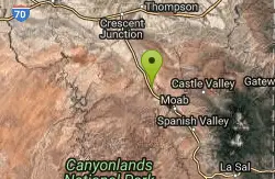
North 40
Moab, Utah
35.6 miles SEThe North 40 is a mix of rock and dirt singletrack. Rocky sections are fun to climb and descend and include painted marks to show the way. Great for advanced and advanced intermediate...
Mountain Bike
Deadman's Ridge
Moab, Utah
35.6 miles SENot a fast trail by any means, Deadman's Ridge is probably the most technical trail of this network so far. A mix of slickrock and hard pan this is a great option for those riders...
Mountain Bike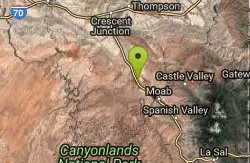
Circle O Trail
Moab, Utah
35.6 miles SEIt is 100% slickrock, on top of Entrada sandstone. Once you get in there, you will see the painted bike tire trail marker. Some sections the painted trail marks has worn and blended...
Mountain Bike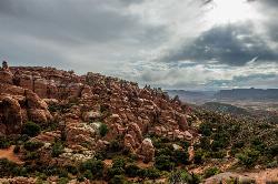
Fiery Furnace
Moab, Utah
36.4 miles SEA fun place to go hiking within Arches National Park. The Fiery Furnace area is a permit only area, with several ranger-led tours available. Hiking permits are required in order to enter, as well...
Hike
Gold Bar Rim
Moab, Utah
37.9 miles SEJeep trail that has sand and many step ups. Follow the signs and cairns. Follow the blue dots, or the Gold Spike jeep trail after you reach the rim. You can connect this trail to...
Mountain Bike
White Rim Trail
Moab, Utah
39.9 miles SThe White Rim Trail is Utah's ultimate multi-day party trail. The trail is a 103-mile loop on jeep road through Canyonlands National Park. Technically, this trail is fairly easy. But...
Mountain Bike
Long Canyon 4x4 Road
Moab, Utah
41.4 miles SEYeah, it's a 4x4 road, but few cars venture up it, and it's one heck of a workout along a beautiful canyon--is there any canyon in the area that isn't beautiful? At one point, there is...
Mountain Bike
Portal Trail
Moab, Utah
41.6 miles SEVery technical with extreme exposure. There are signs that say riders were killed on the trail - likely by falling over the cliff. Do not ride this from the bottom up, but use this...
Mountain Bike
Dead Horse Point State Park
Moab, Utah
41.8 miles SEDead Horse Point State Park is elevated at 5,900 feet and is known for it's old tales and legends. Mountain biking and camping are sure to keep outdoors enthusiasts busy here!...
Mountain Bike
Moab Area
Midway, Utah
43.1 miles SESwim near Midway, Utah
Swim
Rockstacker
Moab, Utah
43.1 miles SEAfter climbing Amasa Back there will be a jct. to the Pothole Arch trail which will take you to the start of Rockstacker. This is a very technical trail with a hike a bike entry. Only...
Mountain Bike
Prospector
Moab, Utah
43.1 miles SEThe trail has both a high and low line, with the higher being the more difficult and slightly longer of the two options. The trail is singletrack cut into the side of the hill with...
Mountain Bike


