


42 Things to do near Arimo, Idaho
first prev 1 2 3 next lastShowing results within 50 miles Distance miles of Arimo, ID, USA City, Zip, or Address
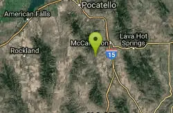
Garden Creek Gap
McCammon, Idaho
7.5 miles WGarden Creek Gap is the defile Garden Creek cuts through as it flows toward Marsh Creek on the east side of the Bannock Range after draining a sizable chunk of territory on the west side of those...
Cross-country Ski, Hike, Horseback, Rock Climb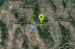
Lava Lion's Club Disc Golf Course
Lava Hot Springs, Idaho
8.8 miles NEVery tight and challenging - at the edge of the Portneuf River. Open, with long downhill and uphill throws, cliffs, and huge river hazards. Get map from website #2 - tees not installed yet. Public...
Disc Golf
Hawkins Reservoir Campground
Arimo, Idaho
8.8 miles W14 campsites on a small impoundment, which despite its size, attracts a great deal of wildlife. Spring through fall, plovers, sandpipers and geese frolic in the mudflats and swim in the waters....
Camp, Canoe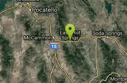
Lava Hot Springs Disc Golf Course
Lava Hot Springs, Idaho
9.1 miles NELong and open with a fun variety of elevation changes, mature trees and river hazards. Be sure to get map at web site - no tees installed yet. Public (No Fee)
Disc Golf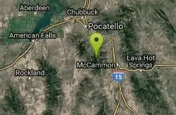
Scout Mountain Campground
Pocatello, Idaho
13.3 miles NWScout Mountain Campground is located on beautiful Scout Mountain at an elevation of 6,900 feet, just 13 miles south of Pocatello, Idaho. Scout Mountain is part of the Mink Creek area, a popular...
Camp, Hike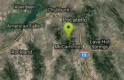
East Fork Crestline
Pocatello, Idaho
14.1 miles NWHead up the singletrack after about 0.6 miles look for a T which will take you to a paved road. Ride up the paved road by a campground and onto the East Fork ATV trail.East Fork ends...
Mountain Bike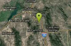
Driveway Canyon Trail
Inkom, Idaho
14.8 miles NWMotorcycle traili. source: fs.usda.gov
Mountain Bike
East Fork Mink Creek Trail
Pocatello, Idaho
16.3 miles NWIf it's early in the season and you're anxious to dust off the skis, the East Fork Road is a good starting place. The East Fork road to Justise Park Rec Area joins the Bannock Highway about...
Cross-country Ski, Hike, Horseback, Mountain Bike
South Fork Of Mink Creek Trail
Pocatello, Idaho
16.3 miles NWCross Country Ski, Hike, Mountain Bike, and Snowshoe near Pocatello, Idaho
Cross-country Ski, Hike, Mountain Bike, Snowshoe
West Fork Mink Creek Trail
Pocatello, Idaho
16.9 miles NWA popular trail in the Eastern Idaho area for horseback riding, hiking, and mountain biking. The trail is a little over three and a half miles of single track riding. For the majority of the trail...
Hike, Horseback, Mountain Bike
Valve House Draw
Pocatello, Idaho
16.9 miles NWThis trail is a motorized, doubletrack trail, as well as a great place to go hiking. For the most part, the trail is all uphill through a forest. There are some technical sections of the route as...
Cross-country Ski, Hike, Horseback, Mountain Bike
Slate Mountain Trail
Pocatello, Idaho
17.0 miles NWTrail is open to cross-country skiing, snowshoeing, mountain biking, horse riding, hiking. source: fs.usda.gov
Mountain Bike
Cherry Springs
Pocatello, Idaho
17.4 miles NWJust a short distance from Pocatello, the Cherry Springs Nature Area has thick green vegetation, an abundance of birds and viewing other wildlife. Take a picnic and a camera and head out on the...
Hike 3.2 mi
Kinney Creek Trail
Pocatello, Idaho
18.0 miles NWKinney Creek Trail is in the Caribou-Targhee National Forest near Pocatello. This is a 6.4 out-and-back trail that takes you to the Indian Mountain Summit. It gives you views of Idaho...
Hike
Slate Mountain/Gibson Jack Trail
Pocatello, Idaho
20.8 miles NWThe Gibson Jack trail offers great views of Southeastern Idaho and a favorite trail among moutain bikers. This trail is a continuation of the West Fork Mink Creek trail and takes travelers further...
Hike, Horseback, Mountain Bike
Gibson Jack/west Fork
Pocatello, Idaho
21.0 miles NWThe West Fork is a mix of single/doubletrack with some fun rock spots and good scenery throughout. After climbing about 1500' in elevation, it's all downhill on singletrack on the...
Mountain Bike
Sunnyside Cliffs at Ross Park
Pocatello, Idaho
22.9 miles NWThe routes on the Sunny Side can be identified by a number at the bottom of the climbs. The number is close to where the rope should hang for a given climb. These numbers were put up years ago and...
Rock Climb
Shady Side Cliffs at Ross Park
Pocatello, Idaho
23.2 miles NWThe routes on the Shady Side can be identified by a number on top of the cliff as well as on the face at the bottom of the climbs. The number is close to where the rope should hang for a given...
Rock Climb
Upper Ross Park
Pocatello, Idaho
23.4 miles NWOn grass with elevation and large trees that force a variety of throws. Alt. pins throughout the seasons. Public (No Fee)
Disc Golf
Ross Park
Pocatello, Idaho
23.5 miles NWOn grass with elevation and large trees that force a variety of throws. Alt. pins throughout the seasons. Public (No Fee)
Disc Golf


