


241 Things to do near Waterfall Loop
first prev 4 5 6 7 8 9 10 11 12 13 next lastShowing results within 50 miles Distance miles of Forest Rd 887, Ririe, ID 83443, USA City, Zip, or Address

Reunion Flat Campground
Alta, Wyoming
32.8 miles ECamp near Alta, Wyoming
Camp 4.0 mi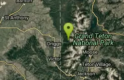
Quakie Ridge
Moose, Wyoming
32.9 miles ETrail starts at the base ski area on a service road then heads out on nice single track. Trail winds through meadows of wildflowers. Some minor altitude gain along the trail. The...
Mountain Bike 2.1 mi
Buffalo Soldier
Moose, Wyoming
32.9 miles ETrail is a nice loop, all singletrack, with about 300' of elevation gain. Trail is about 1.8 miles one way. You can also use it as a connector to Mill Creek or lightning loop. Buffalo...
Mountain Bike 1.1 mi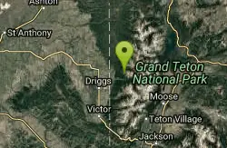
More Cowbell
Moose, Wyoming
33.0 miles EThis singletrack trail winds through aspens, high alpine meadows and old growth conifers.
Mountain Bike 1.9 mi
Perm-a-grin
Moose, Wyoming
33.0 miles EPerma Grin is guaranteed to fix a smile on your face indefinitely! This swooping, flowing, smooth singletrack descends the hillside above Rick's Basin.
Mountain Bike 0.6-4.0 mi
Grand Targhee XC Park
Moose, Wyoming
33.0 miles EMountain Bike
Big Elk Campground
Irwin, Idaho
33.1 miles SEBig Elk Creek Campground is a very versitile campground with plenty of activities to keep busy. Campgrounds are available, with three group sites that include picnic tables and campfire rings. There...
Camp 13.8 mi
Big Elk Creek
Irwin, Idaho
33.1 miles SEBig Elk Creak Campground is a very versitile campground with plenty of activities to keep busy. Campgrounds are available, with three group sites that include picnic tables and campfire rings. There...
Backpack, Camp, Canoe, Hike, Horseback, Kayak 23.8 mi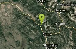
Big Elk Creek Trail
Irwin, Idaho
33.1 miles SENon-motorized trail open to MTB. source: fs.usda.gov
Mountain Bike 1.7 mi
Rick's Basin
Driggs, Idaho
33.2 miles EMountain Bike near Driggs, Idaho
Mountain Bike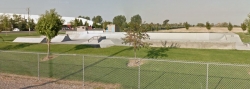
James Simpson Skatepark
Shelley, Idaho
33.3 miles SWSkateboard near Shelley, Idaho
Skateboard
Falls River, Lower Run
Ashton, Idaho
33.4 miles NEFall River rises on the Madison and Pitchstone plateaus in the southwest corner of Yellowstone National Park, Wyoming and flows approximately 64 miles (103 km) to its confluence with the Henrys Fork...
Whitewater

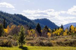
Teton Canyon Campground
Alta, Wyoming
34.3 miles ETeton Canyon is the start of several great adventures, including the Alaska Basin Trail, Table Rock, Devil's Stairs, and the Teton Crest. The campground offers a perfect basecamp to get an...
Camp 3.8-6.4 mi
Table Rock / Table Mountain
Driggs, Idaho
34.4 miles EAt 11,300 feet, Table Mountain is possibly the most beautiful climb this side of the Tetons and offers what may well be the very best view of the Grand Tetons. It's just far enough away...
Camp, Hike 15.0-18.4 mi
Alaska Basin
Driggs, Idaho
34.5 miles EThe Alaska Basin Trail is a stunning trail through the Jedediah Wilderness near Driggs, Idaho and goes East into Wyoming, just outside of Grand Teton National Park. The trail is wide...
Backpack, Hike, Horseback 7.9 mi
Devil's Stairs
Driggs, Idaho
34.5 miles EJust to the West of Table Rock is this often overlooked trail less traveled by, full of beautiful meadows and beautiful views all its own. The trail begins from the same campsite as the Table Rock...
Backpack, Hike
North Bingham County Park
Shelley, Idaho
34.6 miles SWWell kept park. Public (No Fee)
Disc Golf
Fuzzy Bunny/Power Line Jumps/Parallel
Wilson, Wyoming
34.7 miles EThis is a steep, fast, rugged downhill trail with some freeride features that are also "ride-around-able." At the end of Fuzzy Bunny, look for Power Line Jumps off the Old Pass Road...
Mountain Bike 3.2-47.0 mi
Yellowstone Branch Line Trail
Ashton, Idaho
35.2 miles NEYellowstone branch line trail runs from Warm River to the Montana border totaling 39 miles. There are a few places to jump on and off the trail as well as a few smaller trails that branch off of this...
Backpack, Cross-country Ski, Hike, Horseback, Mountain Bike
Warm River Campground
Ashton, Idaho
35.3 miles NEWarm River Campground is located nine miles northeast of Ashton, Idaho, along the slow-moving Warm River at an elevation of 5,200 feet. Willows line the riverbanks and pine trees offer partial...
Camp


