83 Things to do near Walhalla Ruins
first prev 1 2 3 4 5 next lastShowing results within 50 miles Distance miles of Cape Royal Rd, North Rim, AZ 86052, USA City, Zip, or Address
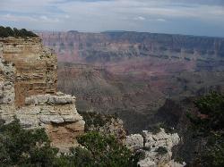
Walhalla Overlook
North Rim, Arizona
0.1 miles SWHistory unfolds as you explore Walhalla Overlook on the North Rim of the Grand Canyon, with views of the Unkar Delta, farmland of the ancient people who once lived here.
Hike 0.8 mi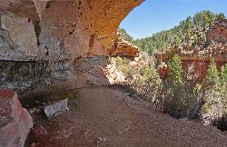
Cliff Springs
North Rim, Arizona
0.7 miles SWStarting just down the hill from the Cape Royal Overlook, the trail immediately heads down into a small valley, passing the granary ruin in a few hundred feet. The valley descends into a side canyon...
Hike 0.5-0.8 mi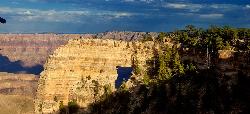
Cape Royal Trail
North Rim, Arizona
0.9 miles SWCape Royal is a long peninsula extending from the North Rim out over the Grand Canyon. It offers a phenomenal view, perhaps the most sweeping view of any Grand Canyon vista. Take the short stroll to...
Hike
Cape Final
North Rim, Arizona
0.9 miles NThere are plenty of trails on the Grand Canyon's North Rim that have great views, but there may not be a hike more pleasant and more rewarding than the Cape Final Trail. As part of a full...
Camp, Hike
Roosevelt Point Trail
North Rim, Arizona
5.9 miles NRoosevelt Point Trail on Grand Canyon National Park's North Rim is a 0.2 mile short, relatively flat woodland loop trail offering spectacular views. Roosevelt Point Trail on Grand Canyon National...
Hike 0.7 mi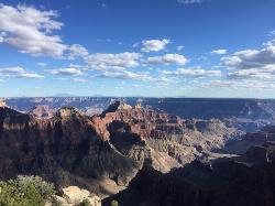
Bright Angel Point Trail
North Rim, Arizona
7.6 miles NWLocated at the North Rim of the Grand Canyon, the Bright Angel Point Trail is a steep, narrow, fully paved path leading to an incredible scenic viewpoint. The trail is conveniently located right next...
Hike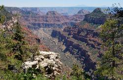
Transept Trail
North Rim, Arizona
7.6 miles NWThe 3.4 mile out and back Transept Trail connects Grand Canyon Lodge to the North Rim Campground, follows the rim of a side canyon called the Transept, and offers a relaxing yet moderate hike with...
Hike 1.9 mi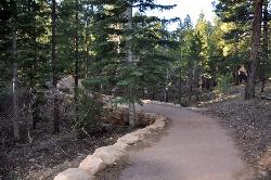
Bridle Trail
North Rim, Arizona
7.7 miles NWThe Bridle Path located at the Grand Canyon's North Rim connects the Grand Canyon Lodge with the North Kaibab Trailhead and is lined with large rocks. The Bridle Path trail is located in the...
Hike, Horseback
Tanner Trail
Grand Canyon Village, Arizona
8.5 miles SEA rigorous rim-to-river backpack of three or more days, following one of the South Rim's more difficult trails. The unmaintained trail, recommended only for seasoned hikers, is...
Backpack, Camp, Hike
The Escalante Route Trail
Grand Canyon Village, Arizona
8.5 miles SEThe route can be hiked in either direction, but this passage will be described from the perspective of a downcanyon hiker. Follow the Tanner Trail to the shoreline. Rocks placed at the...
Backpack, Hike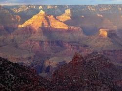
Rim-to-Rim: North Kaibab to Grand Canyon Village
North Rim, Arizona
8.6 miles NWFour days across the Grand Canyon you will never forget! There is a secret to a Grand Canyon rim-to-rim hike: Take four days to do it, even if you can do it in one. I have friends who go South to...
Backpack, Camp, Hike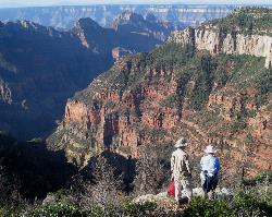
Uncle Jim Trail
North Rim, Arizona
8.6 miles NWDirections from North Rim Entrance: Drive southward along North Rim Drive to the North Kaibab Trailhead. Turn left into the parking area and locate the trailhead on the eastern side of the lot.
Backpack, Camp, Hike
Rim-to-Rim: North to South Kaibab Trail
North Rim, Arizona
8.7 miles NWArizona Office of Tourism, 2702 N. 3rd St., Suite 4015 , Phoenix, AZ, 85004, Phone: 888-520-3434, Fax: 602-240-5432, [email protected]
Camp, Hike, Horseback
Phantom Ranch to Ribbon Falls on North Kaibab Trail
North Rim, Arizona
8.7 miles NWCamp, Hike

North Kaibab Trail to Colorado River
North Rim, Arizona
8.7 miles NWThe North Kaibab Trail to Colorado River Trail is perfect for experienced hikers. The trail contains many elevation changes and is very steep. The trail is well maintained and well marked so you can...
Backpack, Camp, Hike
North Kaibab Trail to Supai Tunnel
North Rim, Arizona
8.7 miles NWThis is a half-day out-and-back hike traverses below the rim on the North Rim’s only maintained Inner Canyon trail. The North Kaibab Trail is the North Rim’s only maintained trail, lying...
Backpack, Hike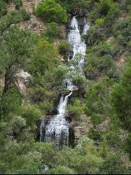
North Kaibab Trail to Roaring Springs
North Rim, Arizona
8.7 miles NWThe North Kaibab to Roaring Springs trail is a well-shaded hike which is downhill on the way out. The trail provides places to stop all along the way. The views are beautiful and perfect for...
Backpack, Hike 9.1 mi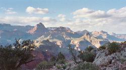
New Hance Trail
Grand Canyon Village, Arizona
8.9 miles SNew Hance Trail is a colorful hike through Red Canyon to the Colorado River. This trail is considered one of the more difficult trails in the Grand Canyon and is a challenge only prepared hikers...
Backpack, Camp, Hike
Desert View Visitor Center Trail
Grand Canyon Village, Arizona
9.0 miles SEDirections from East Entrance Station: Drive westward less than a mile on East Rim Drive to reach the Desert View Visitor Center.
Hike 6.3 mi
Tiyo Point Trail
North Rim, Arizona
9.0 miles NWThis former road is becoming increasingly overgrown by the encroaching forest. This being said, it is generally easy to follow with some blown down trees to climb over or around. There are some old...
Backpack, Camp, Hike


