25 Things to do near Upper Calf Creek Falls
first prev 1 2 next lastShowing results within 50 miles Distance miles of VH56+QW Boulder, UT, USA City, Zip, or Address
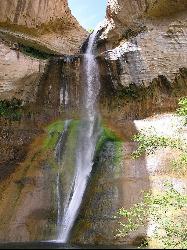
Lower Calf Creek Falls
Boulder, Utah
4.7 miles SLower Calf Creek Falls is a beautiful and popular destination located in the Grand Staircase-Escalante National Monument in southern Utah. The falls are a series of cascading waterfalls that flow...
Hike, Swim
Calf Creek Campground
Boulder, Utah
4.7 miles SCamp, Dive, and Swim near Boulder, Utah
Camp, Dive, Swim 12.1 mi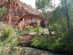
Escalante River
Escalante, Utah
9.8 miles SWHike and Horseback near Escalante, Utah
Hike, Horseback
Neon Canyon and Golden Cathedral
Escalante, Utah
22.0 miles SEThe Golden Cathedral is a unique hiking destination within lower Neon Canyon in the Grand Staircase-Escalante area. The Cathedral is locates just over 3/4 of a mile up Neon Canyon from its confluence...
Backpack, Canyoneer, Hike 3.7 mi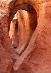
Peek-a-boo Gulch
Escalante, Utah
29.0 miles SEPeek-a-boo Gulch is located in the scenic Grand Staircase National Monument near Escalante, Utah and adjacent to Spooky Gulch. It is not to be confused with Red Slot Canyon AKA Peekaboo....
Hike 4.9 mi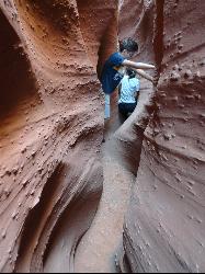
Spooky Gulch
Escalante, Utah
29.0 miles SESpooky Gulch, located near Escalante, Utah, is a short slot canyon hike near the Grand Staircase National Monument. There are parts of the slot canyon that are so narrow, you may wonder if you...
Hike
The Rim Rock DGC
Torrey, Utah
31.3 miles NChallenge your abilities amongst slick rock spires and canyons of pinyon pine. Lodging available at the Inn. . Private (No Fee)
Disc Golf
Capitol Reef
Torrey, Utah
32.0 miles NESwim near Torrey, Utah
Swim
The Rim Rock Disc Golf Course
Torrey, Utah
32.2 miles NChallenge your abilities amongst slick rock spires and canyons of pinyon pine. Lodging available at the Inn. Get course directions there to help with navigation. Private (No Fee)
Disc Golf
Capitol Reef Fremont Falls
Torrey, Utah
33.2 miles NEThe Fremont River Waterfall was created in 1962 when the river was rerouted to accommodate the construction of State Highway 24. At the time of construction, the waterfall area was outside of the...
Swim 20.4 mi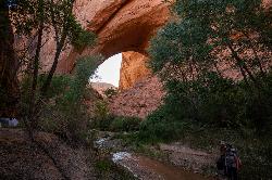
Coyote Gulch
Escalante, Utah
38.7 miles SECoyote Gulch is a natural slot canyon near Escalante, Utah, Bryce Canyon National Park, and Lake Powell State Park. Coyote Gulch is any backpacker's paradise with a flowing river, many places to...
Backpack, Canyoneer, Hike 0.1-0.3 mi
Mossy Cave
Tropic, Utah
39.4 miles WMossy Cave Trail is perfect for Bryce Canyon Visitors who want to experience the wonderful rock formations, like the Hoodoos, without steep and strenuous climbing. This trail is just over a mile and...
Hike 7.6 mi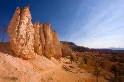
Fairyland Loop Trail
Bryce, Utah
41.4 miles WFairyland Loop Trail is one of the most scenic hikes available in Bryce Canyon. Hiking this loop allows you to see many of Bryce Canyon’s well-known sights from several...
Hike
Mueller Park
Caineville, Utah
42.4 miles NEIn Bountiful's Mill Creek Canyon is the Mueller Park trail, a great lower-altitude alpine ride. Riders do this trail as a 7-mile out-and-back to Big Rock, a 13-mile out-and-back to Rudy's...
Hike, Mountain Bike 0.5-5.4 mi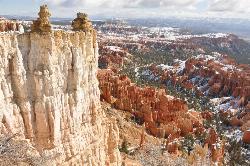
Rim Trail
Bryce, Utah
42.8 miles WRim Trail is a wonderful way for hikers to explore the breathtaking views of Bryce Canyon from above the canyon. The trail curves around the park allowing hikers to view the spectacular, red rock...
Hike
North Campground
Bryce, Utah
42.8 miles WNorth Campground is one of the two main campgrounds in Bryce Canyon National Park. The campground is open to RV and tent campers. Thirteen RV sites available for reservation and 86 RV and tent sites...
Camp 2.3 mi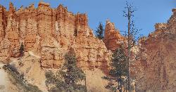
Queens Garden Trail
Bryce, Utah
42.8 miles WThe Queen's Garden Trail is the hike to see the wonders of Bryce Canyon's main amphitheater from all angles. Starting at Sunrise Point, you'll have a great view from the rim before...
Hike 1.8 mi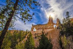
Tower Bridge
Bryce, Utah
43.0 miles WTower Bridge is a unique and uncrowded trail in Bryce Canyon. Tower Bridge gets its name from the prominent rock formation the trail leads to. The rock formation resembles London Bridge and is a...
Hike 1.2 mi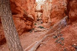
Navajo Trail
Bryce, Utah
43.1 miles WNavajo Trail explores the main amphitheater of Bryce Canyon National park in a short but winding hike. The hike begins at Sunset Point and splits off into a loop. The loop can be taken in either...
Hike 1.6 mi
Hat Shop
Bryce, Utah
43.1 miles SWHat Shop Trail is a moderately difficult hike with the view of some delicately balanced rock formations. These rock formations are where the Hat Shop Trail got its name. Huge gray boulders can be...
Hike


