


232 Things to do near Tom's Thumb to Bell Pass
first prev 2 3 4 5 6 7 8 9 10 11 next lastShowing results within 50 miles Distance miles of McDowell Sonoran Preserve, 18333 N Thompson Peak Pkwy, Scottsdale, AZ 85260, USA City, Zip, or Address

Clay Mine Trail
Cave Creek, Arizona
15.3 miles NWClay Mine Trail is a 1.6 mile out-and-back, beginner friendly trail in Cave Creek Regional Park. This is a trail that is very close to the Visitor Center. It's not too difficult but there...
Hike
Desert Trails Bike Park
Mesa, Arizona
15.4 miles SEHike and Mountain Bike near Mesa, Arizona
Hike, Mountain Bike
Conocido Park
Phoenix, Arizona
15.5 miles WMostly flat grassy holes with trees in play. Dual tees. Requires hyzers, anhyzers, rollers and tubes. Play backwards for 18. Alt. pins vary difficulty. Public (No Fee)
Disc Golf 2.0 mi
Loma and Canal Trails
Tempe, Arizona
15.5 miles STrails open to mountain biking and hiking that wind through the Papago Park in Tempe, Arizona. The Loma Trail winds around lots of uphill and downhill paths, and leads to a park with a small lake and...
Hike, Mountain Bike 4.9 mi
Tempe Town Lake Trail
Tempe, Arizona
15.5 miles SOn the lake's south side, the trail connects Arizona State University's main Tempe campus with Tempe Beach Park, as well as the Tempe Marketplace retail mecca. A newer extension on the...
Hike
Hayden Butte And Tempe Town Lake Trail
Tempe, Arizona
16.0 miles SHike near Tempe, Arizona
Hike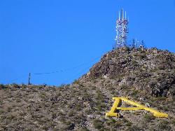
'A' Mountain at Hayden Butte
Tempe, Arizona
16.1 miles S'A' Mountain aka Hayden Butte, is a popular hike in downtown in Tempe, Arizona. This hike located partially on Arizona State University's campus, is a short, easy walk, though it's...
Hike
Bobcat Trail - Sonoran Preserve
Phoenix, Arizona
16.2 miles NWBobcat Trail is a short, easy trail, often used for connecting to other bigger trails in the Sonoran Desert Preserve. This is a 2 mile out-and back trail. There isn't much of a parking...
Hike

Tower Road - Sonoran Preserve
Phoenix, Arizona
16.5 miles NWShort and steep (.6 mile each way) out and back asphalt road to the radio tower.
Hike
Sidewinder-Ocotillo-West Loop
Phoenix, Arizona
16.5 miles NWThis loop starts at Carefree Hwy and 7th Ave, be aware there is limited parking at the trailhead. The Ocotillo part of the trail is relatively flat and the Sidewinder part has some good...
Hike, Horseback, Mountain Bike
Reed Skatepark
Mesa, Arizona
17.2 miles SThis nineteen acre outdoor concrete skatepark is fairly big. It features an intermediate level street course, a combi pool, hips, and a large beginners area. For more information call Mesa Reed...
Skateboard
Deem Hill
Phoenix, Arizona
17.4 miles WThe trail starts out going north around the mountain then heads uphill and gives you some good inclines with switch backs. Total incline is approximately 650'. The trail is rocky and...
Mountain Bike
Deem Hills East Trail
Phoenix, Arizona
17.4 miles WDeem Hills is one of the newer parks in Phoenix to open (2010) and as such a lot of people still don't know it's there. This means that it has much more of a secluded feel then some of...
Hike
Palisade to Basalt to Circumference Trail Loop
Phoenix, Arizona
17.4 miles WHike near Phoenix, Arizona
Hike
Deem Hills Inner Loop
Phoenix, Arizona
17.4 miles WHike and Mountain Bike near Phoenix, Arizona
Hike, Mountain Bike
Pass Mountain
Mesa, Arizona
17.6 miles SEMultiple loop options and trails with various degrees of difficulty. Beginners/novices will enjoy Moonrock and Blevins trails while experts will enjoy Pass Mt and the Cat Peaks loops. I...
Mountain Bike
Pebble Beach
Mesa, Arizona
17.7 miles EPebble Beach is a popular place to go tubing and swimming with designated picnic areas. It's located along the Salt River in Cibola National Forest. The reason the Salt River is so salty is...
Swim
East Maricopa Floodway
Mesa, Arizona
18.0 miles SEWith a primary entrance located at the intersection between Main Street and Higley Road, the East Maricopa Floodway provides riding to cyclists and mountain bikers. The surface of the floodway...
Mountain Bike 23.0 mi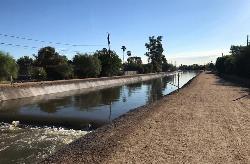
Grand Canal Trail
Phoenix, Arizona
18.3 miles SWThe Grand Canal Trail is a 23-mile long system of paved and unpaved trails located in Glendale, Phoenix and Tempe that travels through...
Hike
Emerald Park
Mesa, Arizona
18.4 miles SMost holes feature open grassy fairways with limited trees. Pond in play on couple of holes. Alt. pin locations. Play backwards for 18 (bring the map). Practice basket south of the basketball court....
Disc Golf


