237 Things to do near Tibble Fork
first prev 1 2 3 4 5 6 7 8 9 10 next lastShowing results within 50 miles Distance miles of Tibble Fork Dam, Provo, UT 84604, USA City, Zip, or Address

Tibble Fork Reservoir
Provo, Utah
0.1 miles NThere isn't one specific sledding run at this location. There's a great parking lot and hills above and below. It all depends on what kind of speed and excitement you're looking for....
Sled
Bear Canyon Loop
Provo, Utah
2.1 miles SA route for the thrill seeker, the Bear Canyon Loop is an advanced mountain biking route. This a challenging route and should be done only by those who know how to handle their bike on steep rocky...
Mountain Bike 1.6-14.1 mi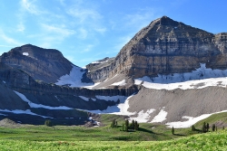
Mount Timpanogas
Provo, Utah
3.4 miles SMt. Timp, as the locals call it, is the 2nd highest mountain in the Wasatch range (only Mt. Nebo is higher). What sets "Timp" apart is its location. It towers over the Provo, Orem, Pleasant...
Camp, Hike, Horseback, Swim
Timpanooke
Provo, Utah
3.4 miles SThis is a great trail. Intermediate tech and moderate aerobic. It winds through pine forests and grass meadows. Start by heading down the Timpanooke section of the Great Western Trail...
Mountain Bike
Ridge Trail #157
Provo, Utah
3.8 miles SEThis trail is 15.7 miles in length and is commonly referred as the backbone of the American Fork Canyon trail system, because it connects several loop routes along the northern portion of the...
Mountain Bike 1.5 mi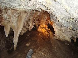
Timpanogas Cave
Provo, Utah
4.1 miles SWKnown for it's colorful cave decorations, the Timpanogas cave attracts numerous visitors per year, is steep but it's paved so that visitors can access the cave. To access the cave, visitors...
Backpack, Cave, Hike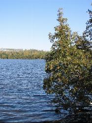
White Pine Lake
Sandy, Utah
4.5 miles NWWhite Pine Canyon has long been the subject of intense controversy between advocates of wilderness and ski resort owners. The original boundaries of Lone Peak Wilderness Area, created in 1977, were...
Hike, Mountain Bike
American Fork Twin Peaks
Provo, Utah
4.9 miles NAmerican Fork Twin Peaks is the highest mountain on the Little Cottonwood Canyon ridge. The summit is the prominent peak overlooking the Snowbird ski resort. A short approach hike...
Hike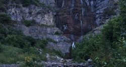
Stewart Falls
Provo, Utah
5.7 miles SStewart Falls is found nestled in the forest along the east side of Mt. Timpanogos. Fed by a glacier on the mountain, the crystal clear falls will leave visitors refreshed on a warm summer day. Those...
Hike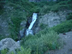
Timpanogos Falls
Provo, Utah
5.7 miles SEOne of the many waterfalls in the Mt Timpanogos area, Timpanogos Falls is a lesser known and visited waterfall. The trail for Timpanogos Falls departs from the same parking lot as Stewart Falls,...
Hike
Rodeo Down
Alpine, Utah
5.9 miles WBlack Dog. Trail winds from the middle of Corkscrew down to Flank and River, just south of the water tank. Some technical aspects, length 0.5 miles with 300 vertical feet elevation...
Mountain Bike
Sugarloaf Peak
Alta, Utah
6.0 miles NSugarloaf Peak is an easily reached 11,000 ft. summit which overlooks Albion Basin, Secret Lake, and much of Utah's Alta ski resort. The easy terrain and relatively high trailhead elevation...
Hike 1.7 mi
Schoolhouse Springs Trail
Alpine, Utah
6.0 miles WSchoolhouse Springs trail has an elevation trail at 5,300 ft. It's located at the end of the town of Alpine. It features a lake and there's a number of activities including horse-back...
Hike, Mountain Bike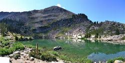
Cecret (Secret) Lake
Alta, Utah
6.3 miles NCecret (pronounced "Secret") Lake is a beautiful lake located among alpine meadows in Little Cottonwood Canyons Albion Basin. Some folks spell Secret Lake as Cecret Lake, but the USGS...
Hike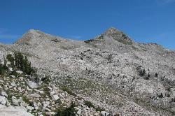
Pfeiferhorn Peak
Provo, Utah
6.8 miles NThe Pfeifferhorn is a majestic peak, which is located east of Salt Lake City, Utah in the Wasatch mountain range. It's easy access, proximity to alpine lakes and short trail make it a popular...
Backpack, Hike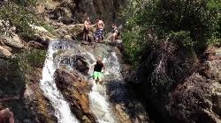
Alpine Rock Water Slide
Alpine, Utah
6.8 miles WCLOSED. The land has been sold and the new owner has closed off the waterslide to the public. The Alpine Waterslide is a natural waterslide that surprisingly does not hurt your backside. However,...
Swim
Archie's Loop
Sundance, Utah
7.1 miles SEArchie's Loop Trail, a 2.2 mile stretch of mountain biking/hiking trail, recently opened up totally new country. The intermediate-level trail runs from Scott's Pond loop to connect with...
Mountain Bike
Lisa Falls
Sandy, Utah
7.6 miles NWLisa Falls is a great place to climb Spring through Fall, any time of day. The base is well shaded by trees and offers many flat places to belay, or just hang out and relax. The roaring waterfall...
Hike, Rock Climb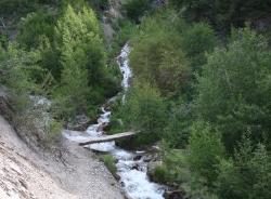
Grove Creek Trail
Pleasant Grove, Utah
8.0 miles SWThe Grove Creek Trail falls from the upper shoulder of Mount Timpanogos down Grove Creek Canyon to Pleasant Grove. It's usually ridden as a shuttled downhill -- because the climb up this...
Hike, Mountain Bike 0.7 mi
Great White Icicle
Sandy, Utah
8.0 miles NWThe Great White Icicle is located in Little Cottonwood Canyon just outside of Salt Lake City, Utah. It is a climbing area that is a frozen waterfall in the winter and a cascading waterfall...
Hike, Rock Climb


