


117 Things to do near Tamassee DAR School
first prev 1 2 3 4 5 6 next lastShowing results within 50 miles Distance miles of 9507 Cherokee Foothills Scenic Hwy, Tamassee, SC 29686, USA City, Zip, or Address
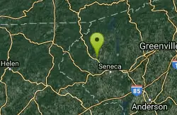
Sertoma Field
Walhalla, South Carolina
7.2 miles SA well designed course with amazing scenery and many different elevations. Water in play on holes 1, 5, 6, 7 and 18. This course is a must play!. Public (No Fee)
Disc Golf
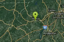
Shaver Recreation Center
Seneca, South Carolina
14.1 miles SRolling hills, tight course through the woods. Tree cover varies from brush to large hardwoods. Alt. long pins on 7 holes. Public (No Fee)
Disc Golf
Todd Creek Falls
Central, South Carolina
14.5 miles SEShort hike to Todd Creek Falls - a nice falls and pool at the bottom, though sometimes a little muddy. Pool is deep and has some gradual entry points on the sides....
Swim
Cashiers Area
Woodleaf, North Carolina
14.6 miles NSwim near Woodleaf, North Carolina
Swim
Moonshine Falls Area
Bishopville, South Carolina
14.7 miles NESwim near Bishopville, South Carolina
Swim 1.3 mi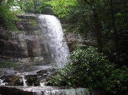
Rainbow Falls
Lake Toxaway, North Carolina
15.1 miles NRainbow Falls is one of the most spectacular waterfall settings in the Blue Ridge Mountains of North Carolina. This 150-ft. tall waterfall is impressive, especially after rainy weather that swells...
Hike, Swim 1.0 mi
Hidden Falls
Lake Toxaway, North Carolina
15.1 miles NHidden Falls is a serene family-friendly swimming hole in Pisgah National Forest just down river from the towering Rainbow Falls. It's on the Horsepasture River "hidden" just a few...
Hike, Swim 1.4 mi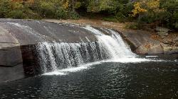
Turtleback Falls
Lake Toxaway, North Carolina
15.3 miles NTurtleback Falls was named for its domed shape, similar to the back of a turtle. It's also called "umbrella falls" for the same reason. Visitors slide down Turtleback as the...
Backpack, Hike, Swim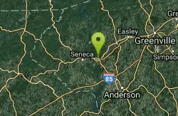
Mountain View Park Disc Golf Course
Clemson, South Carolina
16.3 miles SEWooded course with slight rolling hills on the peninsula of a Lake Hartwell Park. Public (No Fee)
Disc Golf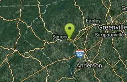
The Course at University Beach
Seneca, South Carolina
16.3 miles SEA few holes in the woods, mostly long and open. Course has pro and am tees on each hole. Public (No Fee)
Disc Golf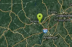
University Beach
Seneca, South Carolina
16.3 miles SEJust down from Clemson University on University Beach. Open holes with slight rolling hills. Public (No Fee)
Disc Golf
Grand Central Station
Central, South Carolina
17.9 miles SELengthy course on 37 acres. A railroad theme honors Central's railroad heritage. There is a total of around 100' in elevation with a large creek at the bottom. A few holes are in the open...
Disc Golf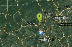
Grand Central Station Disc Golf Course
Central, South Carolina
17.9 miles SEThis course was well thought out and a lot of love and care have obviously gone into making it a great course in the Clemson Area. It's a long course that makes you throw several shots for distance,...
Disc Golf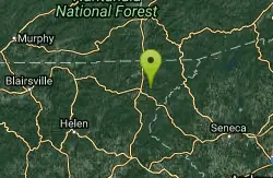
War Woman Dell Wildlife Management Area
Clayton, Georgia
18.6 miles WWarwoman Dell Nature Trail and Becky Branch Falls Trail is a 0.8 mile out and back trail located near Clayton, Georgia that features a waterfall and is good for all skill levels. The trail is...
Camp, Hike, Horseback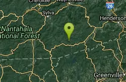
Devils Elbow #448
Lake Toxaway, North Carolina
19.5 miles NDevils Elbow trail #448 runs up to the knob of the same name and connects to trail #450 and trail #474, the main Panthertown Valley thoroughfare. Some sections are old forest road while...
Mountain Bike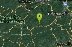
Panthertown Valley
Glenville, North Carolina
20.2 miles NPantertown Valley is a network of trails ranging from old fire roads to double track to super tight singletrack. There's 35 miles of total trails in the valley, but bikes are limited...
Mountain Bike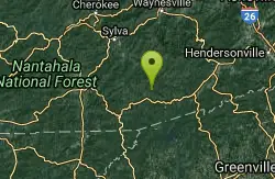
Blackrock #447
Glenville, North Carolina
20.2 miles NBlackrock starts from the western most trailhead for Panthertown Valley off of Breedlove Road. From there it climbs steeply up and over a miniature mountain, with some options to access...
Mountain Bike
Clemson U. Outdoor Lab
Pendleton, South Carolina
20.3 miles SEVery short holes winding through camp. Targets marked by numbered plaques. Private. Private (No Fee)
Disc Golf
Eagle Creek at Clayton
Clayton, Georgia
21.9 miles WVery flat recreational course with only a few trees. Great for new and younger players. Built in the flood plain of an old school property along a good sized creek. Dual tees. Public (No Fee)
Disc Golf
New Vista Rd
Brevard, North Carolina
23.2 miles NEGeneral Fire road with a nice view accross the valley
Mountain Bike


