49 Things to do near Standish Hickey Area
first prev 1 2 3 next lastShowing results within 50 miles Distance miles of Edison Lake Rd, Lakeshore, CA 93634, USA City, Zip, or Address
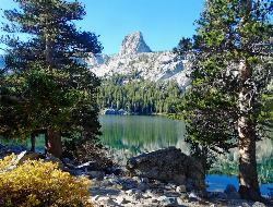
Crystal Crag
Mammoth Lakes, California
19.2 miles NVisible from all the lakes around, Crystal Crag stands tall and is a popular place to rock climb and go mountaineering. It stands at 10,100 ft in elevation, and includes a North Ridge and a South...
Rock Climb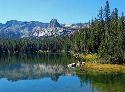
Crystal Lake
Mammoth Lakes, California
19.2 miles NUnlike many hikes in the Sierra's, Crystal lake can be done as a day hike and as the perfect way to get away for a bit. As hikers make their way to the lake, they will see the monolith Crystal...
Camp, Hike
Crowley Lake Campground
Crowley Lake, California
21.9 miles NENestled amidst the stunning Eastern Sierra region, Crowley Lake BLM Campground near Benton, California, is a hidden gem waiting to be discovered by nature enthusiasts and camping aficionados. With...
Camp
Volcom Brothers Skatepark
Mammoth Lakes, California
22.0 miles Nthis park looks good thanks to Volcom for the pictures.
Skateboard
The Rock Tub Hot Springs
Whitmore Hot Springs, California
25.0 miles NENestled amidst the breathtaking landscapes of Mammoth Lakes, California, lies a hidden gem that beckons seekers of relaxation and natural beauty. The Rock Tub Hot Springs, a serene and rejuvenating...
Hot Springs
Crowley Lake
Mammoth Lakes, California
25.3 miles NENestled in the picturesque landscape near Benton, California, Crowley Lake stands as a hidden gem, known not only for its breathtaking natural beauty but also for the intriguing geological formations...
Hike, Swim 0.4 mi
Crowley Lake Stone Columns
Mammoth Lakes, California
25.4 miles NENestled in the picturesque landscape of California's Eastern Sierra region lies Crowley Lake, a reservoir with a captivating secret beneath its surface – the Crowley Lake Stone Columns....
Hike
Wild Willy's Hot Spring
Mammoth Lakes, California
26.7 miles NEWild Willy's Hot Springs, also known as Crowley Hot Springs, is a spring located in Long Valley. Long Valley is home to one of the highest concentrations of geothermal surface water in...
Camp, Hot Springs
Hot Creek
Mammoth Lakes, California
27.0 miles NCLOSED. Entering the water is now prohibited at this location. This note came in 2008:"I noticed your report of swimming in Hot Creek near Bishop, Calif. I was there in 2006 and it was closed to...
Swim 5.5 mi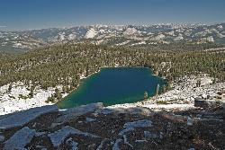
Ostrander Lake
Wawona, California
35.7 miles NWOstrander Lake is a long, 11.4 mile hike just behind Sentinel Dome. Unlike most of Yosemite's summer hikes, the trail to Ostrander Lake is open during the winter for people to ski through....
Hike, Swim 2.5 mi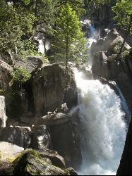
Chilnualna Falls
Wowana, Yosemite National Park
37.5 miles NWLocated near the southern entrance of the valley, Chilnualna Falls is one of the lesser known waterfalls in Yosemite. The hike is about 8 miles round trip and takes you to the upper part of the...
Hike 1.7 mi
Mono Meadow
Yosemite West, Yosemite National Park
39.1 miles NWThe hike through Mono Meadow is the best way to get a view of Mt. Starr King, Clarke Range, and Half Dome all at once. It's about a three mile round trip hike towards Yosemite backcountry. It...
Hike 1.9 mi
Half Dome
Yosemite Valley, Yosemite National Park
39.6 miles NWHalf Dome is the most popular and difficult hike in Yosemite Valley. The trail is about 14 miles long with an elevation gain of 4800 feet. There are cables to help you scale up to the summit once you...
Hike 0.4-2.1 mi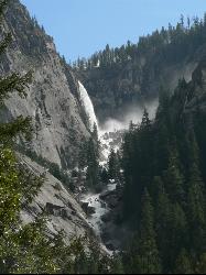
Illilouette Falls
Yosemite West, Yosemite National Park
40.0 miles NWIllilouette Falls Trail is a 4 mile hike down to Illilouette Creek, where there is a footbridge, a great view of Illilouette Falls, and several benches for onlookers to stop, rest, and...
Hike 3.6 mi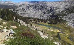
Lyell Canyon
Wawona, California
40.3 miles NWLyell Canyon is a breezy, 8 mile hike through the Tuloumne Meadows of Yosemite. While it is a little bit of a longer hike, the total elevation gain is about 200 feet, making it pretty flat and...
Hike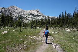
Elizabeth Lake
Wawona, California
40.7 miles NWElizabeth Lake is a gorgeous lake tucked underneath the High Sierras in Yosemite. It's about a 4.8 mile hike to reach it, with an elevation gain of 1000 feet. Even though it's not super long,...
Hike, Swim 1.9-2.9 mi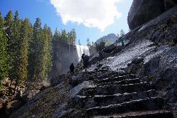
Mist Trail
Yosemite National Park
40.7 miles NWThe mist trail is a small breakoff from the John Muir Trail through Yosemite National Park. It's called the mist trail because of the heavy amount of mist that hikers walk through as Vernal and...
Backpack, Hike 0.5 mi
McGurk Meadow
Yosemite National Park
41.0 miles NWMcGurk Meadow is a short, 0.8 mile hike through one of Yosemite's wildflower meadows. The trail is fairly flat, about 100 feet of elevation gain, and it doesn't require too much effort,...
Hike
Element YMCA Skate Camp
Miramonte, California
41.0 miles SSkateboard near Miramonte, California
Skateboard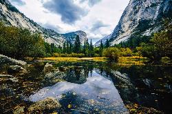
Mirror Lake
Yosemite Valley, Yosemite National Park
41.1 miles NWMirror Lake is a seasonal lake situated in a secluded corner of the beautiful Yosemite Valley. The lake sits at the base of Half Dome and allows a different perspective of the famous monolith....
Backpack, Hike, Swim


