


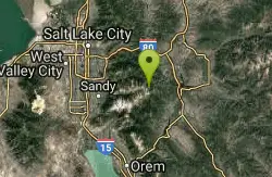
257 Things to do near Silver Lake (Big Cottonwood)
Showing results within 50 miles Distance miles of Silver Lake Recreation Center, Salt Lake City, UT 84121, USA City, Zip, or Address
Brighton Lakes Loop
Salt Lake City, Utah
0.3 miles SThe Brighton Lakes loop is a never ending challenge, from the time you start to climb, to the wild and hair raising descent down the Lake Mary trail! The ride takes you past 4...
Mountain Bike
Scott's Bypass
Brighton, Utah
1.6 miles EScott's Bypass begins right off the top of Guardsman's Pass and bypasses some of the gravel road on the way up to the top of Pinecone and the Wasatch Crest Trail. In and of itself,...
Mountain Bike
Jupiter Peak Road
Salt Lake City, Utah
1.6 miles EGrind up from Guardsman Pass Road, passing the top of the Park City's Jupiter lift, and then out a ridge with amazing views both north and south. At the end, you can walk up to the very...
Mountain Bike
Wasatch Crest
Salt Lake City, Utah
1.6 miles EThe Wasatch Crest Trail (GWT) is probably one of the best, if not the very best, singletrack trail in Utah! I prefer to do this ride as an out and back, starting at Millcreek Canyon's Big Water...
Hike, Mountain Bike
Prospect Ridge / Ontario Ridge
Salt Lake City, Utah
1.7 miles EProspect Ridge runs from Daly Grind down to Prospect Avenue. This is a steep, rocky descent that is almost fall line-style, straight down the mountain to town. By Park City standards,...
Mountain Bike
Shadow Lake Trail
Salt Lake City, Utah
2.1 miles NEShadow Lake Trail in Park City provides a very scenic biking experience to cruise along. There are many fantastic biking opportunities in this high-altitude alpine area. You can ride the Shadow...
Mountain Bike
Dead Tree
Park City, Utah
2.5 miles EDead Tree is a .52 mile singletrack trail that connects to Jupiter Peak Road and the Apex trail. This is a high-alpine trail with some great singletrack.
Mountain Bike
Cecret (Secret) Lake
Alta, Utah
3.0 miles SWCecret (pronounced "Secret") Lake is a beautiful lake located among alpine meadows in Little Cottonwood Canyons Albion Basin. Some folks spell Secret Lake as Cecret Lake, but the USGS...
Hike
Sugarloaf Peak
Alta, Utah
3.3 miles SWSugarloaf Peak is an easily reached 11,000 ft. summit which overlooks Albion Basin, Secret Lake, and much of Utah's Alta ski resort. The easy terrain and relatively high trailhead elevation...
Hike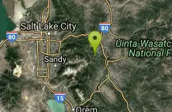
Keystone
Park City, Utah
3.6 miles NEThe Keystone Trail runs for about 1.5 miles from the Jupiter access road, past a junction with the Apex trail, to the Meadow road. This is an intermediate singletrack trail....
Mountain Bike
Apex
Park City, Utah
3.6 miles NEThe Apex Trail is close to two miles long, and it descends on loamy dirt through the high aspens down from the Dead Tree Trail, past the Jupiter Access Road, past the Keystone Trail, to...
Mountain Bike
Empire Link
Park City, Utah
3.6 miles NEThe Empire Link trail runs for about 1.5-ish miles from the Mid Mountain trail, Past John's 99, to Sam's. This trail is chock-full of bermed switchbacks to rail, roots to pop off of,...
Mountain Bike
Link
Park City, Utah
3.7 miles NELink is a singletrack trail that serves as a crucial 1-mile (ish) "link" between many other trails, including, but not limited to: Mid Mountain, John's 99, Ore Cart, and Speed Bag....
Mountain Bike
Webster
Park City, Utah
3.7 miles NEWebster alternates from singletrack to doubletrack to singletrack and back again to doubletrack over its approx. 1.5-mile length. Webster junctions with numerous other trails, including...
Mountain Bike
Pinecone Ridge
Park City, Utah
3.8 miles NEPinecone Ridge is one of the newest trails in Park City, built in 2012. Many people use it to climb from the town of Park City up to the renowned Wasatch Crest Trail, as it is now the...
Mountain Bike
Mojave
Park City, Utah
3.8 miles NEMojave is a twisty singletrack through the high aspens that begins just off of the Crescent high speed quad lift. It leads down to the Mid Mountain trail.
Mountain Bike
Steps
Park City, Utah
3.9 miles NEThe Steps is an advanced trail running through some of Park City's ski runs. During the summer this trial can be taken as a connecting trail or a stand alone ride. It is singletrack and...
Mountain Bike
Spruces Campground
Salt Lake City, Utah
3.9 miles NWCamping isn't free. See USDA.gov for details. If you know the coordinates of the sledding hill here, please comment.
Camp, Sled
Payroll
Park City, Utah
3.9 miles EPayroll is less than a mile long, but it is a rowdy .67 miles! Payroll features some massive berms, swoops, plenty of rocks, kickers, doubles, a few sizeable drops, and another scoop of...
Mountain Bike
Billy's Bypass
Park City, Utah
4.0 miles NEBilly's Bypass is a short .21-mile connector that connects Sweeney's, Crescent Mine Grade, Jenni's, and Moose.
Mountain Bike


