67 Things to do near School House Gulch
first prev 1 2 3 4 next lastShowing results within 50 miles Distance miles of 884 E School House Gulch Rd, Prescott, AZ 86303, USA City, Zip, or Address

Wolf Creek Falls
Sedona, Arizona
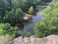
2.4 miles SWWolf Creek Falls is a wonderful space to explore and be immersed in nature. With it's six miles of trails, beautiful waterfalls and two campgrounds this is the perfect place to spend a...
Camp, Hike, Swim
Mike Fann Skatepark
Prescott, Arizona
4.0 miles NMike Fann Community Skate Park Park/Lake Information Summer Hours: 7:00 AM - 10:00 PM Winter Hours: 7:00 AM - 10:00 PM Free parking The Mike Fann Community Skate Park is located at the corner of E...
Skateboard
Little Yeager Canyon Trail #533
Prescott Arizona
20.5 miles NEThis is where the real fun is! Trail 533 is nothing but downhill, with several dirt jumps built, in case you want to get some serious air. Take this all the way down to Highway 89A. From...
Mountain Bike 3.7 mi
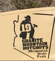
Granite Mountain Hotshots Memorial
Yarnell, Arizona
27.1 miles SWFrom the Observation Deck, you can see the Fatality Site 400’ below and the Town of Yarnell to the east. Additional interpretive signage outlines the tragic events of the Yarnell Hill Fire. A...
Hike
Riverfront Park
Cottonwood, Arizona
30.3 miles NEWinds through rich riparian area with large, mature cottonwoods. Several very narrow fairways through the trees. Deep, soft weeds, so keep a good eye on your landings. A map is really helpful. Public...
Disc Golf
Dead Horse Ranch State Park
Cottonwood, Arizona
30.5 miles NEBeginning road cyclists will find relatively flat paved roads with only a few gentle climbs and large parking areas perfect for practicing basic skills. Beginning mountain bikers will...
Mountain Bike
Raptor / Thumper / Kiln Loop
Cottonwood, Arizona
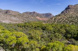
30.5 miles NEThis is another loop trail made by linking a few different trails together, this is very open terrain and the views of the valley and surrounding mountain ranges are amazing. No shade...
Mountain Bike
Black Canyon Trail - Little Pan Loop
Black Canyon City, Arizona
34.4 miles SEThe Black Canyon National Recreation Trail will be a 79-mile hiking, mountain biking and equestrian trail stretching from the Sonoran Desert lowlands in Phoenix to the high grasslands...
Mountain Bike
Sycamore Canyon
Sedona, Arizona
34.6 miles NEA very pleasant 3.5 mile round trip hike down into a canyon and along a perennial stream to several swimming holes. Bathing suits: May be optional at farther...
Swim
Black Canyon Trail
Black Canyon City, Arizona
34.6 miles SEThis discription is for the Table Mesa trail head which has 1.5 miles (N) out on the Black Canyon Trail to the Little Pan Loop. The Little pan loop will take you down to the Agua Fria...
Mountain Bike 0.1 mi
Mormons Crossing
Cornville, Arizona
36.0 miles NEMormons Crossing is a little area along Oak Creek in Cornville, Arizona. Along this creek there are several holes deep enough to swim in, some rapids, and even a rope swing. It's a great spot to...
Swim 0.4 mi
Clear Creek Campground
Camp Verde, Arizona
38.7 miles EWest Clear Creek flows along the boundary of this desert canyon country camp and is a popular place for hiking, swimming, wading and fishing. Cool water species such as smallmouth bass and green...
Camp, Hike, Swim
Long Canyon
Sedona, Arizona
40.9 miles NEThis is an easy "learner" ride. There are many fairly tricky rides in the Sedona area, so flag this one if you want any easy ride or if you have young or learning mountain bikers with...
Mountain Bike 16.9 mi
West Clear Creek Trail No. 17
Camp Verde, Arizona
42.2 miles EWest Clear Creek Trail No. 17 is a great way to reach the running waters of West Clear Creek. By far the most accessible and popular, it starts from the Bull Pen Ranch parking lot and winds down the...
Backpack, Hike, Swim
Bullpen Day Use Area
Camp Verde, Arizona
42.2 miles EBullpen has something for everyone. Whether you park here and use the trail head to start on one of several hikes that lead down West Clear Creek, or stay nearby to use the picnic areas and...
Backpack, Dive, Hike, Swim 3.0 mi
Blodgett Basin Trail No. 31
Camp Verde, Arizona
42.4 miles EBlodgett Basin Trail is one of a select few trails that shows off the riparian desert beauty unique to West Clear Creek Wilderness. The trail stretches from Bull Pen Trailhead through the canyon and...
Backpack, Hike, Swim
Beaver Creek Dispersed Camping
42.7 miles E
Free dispersed camping on the cliffs above Beaver Creek.
Camp
Special Ed
Sedona, Arizona
42.8 miles NETechy fast flowing undulating trail. You can form a loop with other trails in teh area but this trails isn not on any map
Mountain Bike
Herkenham Trail
Sedona, Arizona
43.0 miles NEThis singletrack flows down through a canyon underneath a small power line. It is full of tight corners, small drops, loose gravel here and there, rocks, sand, cactus, great views- all...
Mountain Bike
Baldwin Loop
Sedona, Arizona
43.0 miles NEThis is the loop at the end of Templeton Trail that makes a Templeton/Baldwin lollipop ride if you start at the Bell Rock Pathway. This entry describes a direct access to make the...
Mountain Bike


