


221 Things to do near Provo River
first prev 1 2 3 4 5 6 7 8 9 10 next lastShowing results within 50 miles Distance miles of Provo River Pkwy, Provo, UT 84601, USA City, Zip, or Address
Cherry Hill Park
Orem, Utah
2.7 miles NEJust south of Cherry Hill Elementary, this is a small hill for small children great and moms who are looking to avoid a well populated hill. The hill is to the south of the playground and most...
Sled
Utah Valley University
Orem, Utah
3.1 miles NVery short course (all holes less than 200') on the south end of campus. Water comes into play. Holes near the baseball diamond. Bring the map to help with navigation. Public (No Fee)
Disc Golf
Scera Park Disc Golf Course
Orem, Utah
3.9 miles NEPlays through the park and around the Scera Theater. Tees are well marked with posts. Public (No Fee)
Disc Golf
Bicentennial Park
Provo, Utah
5.0 miles EBicentennial Park is a favorite among disc golfers and families in the Provo area. The park has a 16-hole golf course, a duck pond, a playground, and a nature trail which features natural springs...
Disc Golf, Hike, Sled
Rock Canyon Park
Provo, Utah
5.1 miles NEThis is the biggest park in Provo, Utah, with lots to do. The hills are great for sledding.
Sled
Cascade Park
Orem, Utah
5.2 miles NEThis is a small hill great for mom's looking to escape the crowd and let their little ones have a good time. It's pretty short but really wide so there's plenty to share.
Sled
Riverview Park
Provo, Utah
5.3 miles NEAn object course with mostly well-marked tees and poles. There are specific rules for play at this course (see Course Media). Vintage plastic throwers particularly like this course. The 2nd hole is...
Disc Golf
Rock Canyon Disc Golf
Provo, Utah
5.3 miles NEIt is located at the mouth of Rock Canyon above BYU. It is very hilly and there are a fair amount of trees. This location is NOT FOR BEGINNERS at disc golf. At this course, there are...
Disc Golf
Y-Mountain Summit Trail
Provo, Utah
6.1 miles EY Mountain is located directly east of Brigham Young University (BYU) in Provo, Utah, United States. The Slide Canyon/Y Mountain Trail leads to a large block Y located 1.2 miles (1.9 km) from a...
Camp, Hike
Orem Cemetary
Orem, Utah
6.7 miles NESled near Orem, Utah
Sled
Squaw peak
Provo, Utah
6.9 miles NEAirsoft and Paintball near Provo, Utah
Airsoft, Paintball
Oak Canyon Junior High
Lindon, Utah
7.1 miles NSled near Lindon, Utah
Sled
South Fork of the Provo
Provo, Utah
7.4 miles NESouth Fork of the Provo is a fun, short, scenic singletrack ride. It is an ideal trail to introduce a new mountain biker to the joys of singletrack! The trail has one or two rocky...
Mountain Bike
Squaw Peak Trail
Springville, Utah
8.1 miles SEStart at Rock Canyon trailhead, ride straight up the trail, passing a green gate and subsequently 5 wooden bridges. 1/4 mile after the last bridge, take a left on "Squaw Peak Trail."...
Mountain Bike
G Mountain Trail
Pleasant Grove, Utah
8.9 miles NThe trail starts at Kiwanis Park which is south of the 'G' at the end of Battle Creek Road. The trail starts out a little steep for about .25 mile and the very last bit is a...
Hike 1.2 mi
Battle Creek Falls
Pleasant Grove, Utah
8.9 miles NBattle Creek Falls, located near Pleasant Grove, Utah, is a scenic waterfall that also has a rappelling and rock climbing area nearby. Hikers are allowed to see the falls from two view points, below...
Canyoneer, Hike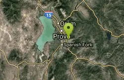
Spring Acres Arts Park
Springville, Utah
9.1 miles SEA short course - good for beginners. First 3 holes cannot be played if another event is taking place. Tee 4 plays from the stump by #3 - it's a very short hole. The rest are easy to follow. 5...
Disc Golf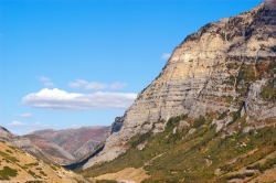
Provo Canyon
Provo, Utah
9.3 miles NEProvo Canyon is a canyon located in unincorporated Utah County, Utah, USA and Wasatch County, Utah. Provo Canyon splits between Mount Timpanogos on the north and Mount Cascade on the south. The...
Rock Climb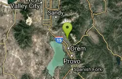
Bonneville Shoreline Trail - Cedar Hills to Grove Creek Canyon
Pleasant Grove, Utah
9.7 miles NThe Cedar Hills to Grove Creek Canyon portion of the Bonneville Shoreline Trail is an intermediate level trail. There are some flat spots that are on old dirt roads, as well as single track...
Mountain Bike
Grove Creek Trail
Pleasant Grove, Utah
9.7 miles NThe Grove Creek Trail falls from the upper shoulder of Mount Timpanogos down Grove Creek Canyon to Pleasant Grove. It's usually ridden as a shuttled downhill -- because the climb up this...
Hike, Mountain Bike


