85 Things to do near Lucky Peak Lake State Park
first prev 1 2 3 4 5 next lastShowing results within 50 miles Distance miles of E Lucky Point View Point Rd, Boise, ID 83716, USA City, Zip, or Address

Lydle Gulch - Blue
Boise, Idaho
0.6 miles NWOne of two courses above Lucky Peak Dam - an Army Corps of Engineers Recreation Area. The Blue course is the lower and less challenging of the two. Public (No Fee)
Disc Golf
Lydle Gulch - Gold
Boise, Idaho
0.6 miles NWOne of two courses above Lucky Peak Dam - an Army Corps of Engineers Recreation Area. The gold course is the upper course and the most challenging. It has one tree but you will struggle to make par....
Disc Golf
Sandy Point
Boise, Idaho
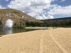
0.8 miles NWSandy Point is a beach within Lucky Peak State Park, located 8 miles southeast of Boise, Idaho. It feautures a small lake with a several amenities. The lake is mostly shallow, and cool, but...
Disc Golf, Swim
Irish Boat Ramps
Boise, Idaho
5.0 miles NEThe south ridge of Heinen is a year round scramble that starts at the edge of the reservoir, climbs steeply up an old Jeep road, then traverses up and down a series of bumps along a ridgeline in and...
Camp
Columbia Village Disc Golf Course
Boise, Idaho
5.0 miles WShort, open pitch and putt with many elevated greens. Open only to local residents. Many holes overgrown with weeds. Private (No Fee)
Disc Golf
Julia Davis Winter Course
Boise, Idaho
7.3 miles NWThe temporary 9 hole course is up for the winter. Course will be taken down March 29. GSDG has approval to try a new 9-hole course at Julia Davis during the winter months. The design is the same as...
Disc Golf 1.4 mi
Table Rock
Boise, Idaho
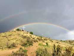
7.3 miles NWTable Rock is located directly above downtown Boise, Idaho and is part of the extreme southwestern portion of the Boise Mountains. It is recognizable by the tall white cross, that lights up. If...
Hike
Orchard / 5 Mile / Watchman
Boise, Idaho
7.9 miles NWOrchard Gulch, 5 mile Gulch, and Watchman are three interconnected trails in the upper foothills off Rocky Canyon Rd above the Military Reserve system and above Three Bears. Good...
Mountain Bike
Danskin Mountain OHV Area
Boise, Idaho
8.7 miles EThe Danskin Mountain Off-Highway Vehicle (OHV) Area encompasses 60,000 acres and provides more than 150 miles of Off-Highway Motorcycle (OHM) and All-terrain Vehicle (ATV) trails in a mountainous,...
Atv/motorcycle
Lower Hulls Gulch
Boise, Idaho
9.5 miles NWTake 8th street motorcycle trail east/ left out of the parking lot, follow to the creek about half a mile of fast downhill. Turn right just before the creek and follow Lower Hulls Gulch...
Mountain Bike
Three Bears #26, Trail #5, Fat Tire #42, Trail #4
Boise, Idaho
9.5 miles NWNice optional route in the Boise Foothills that connects Military Reserve to 8th street and upper Hulls Gulch. You're only on the very lower end of Three Bears #26 for about 1 mile...
Mountain Bike
Shane's Loop
Boise, Idaho
9.6 miles NWTake the trail that starts off along side the dirt road to start, turn up at the second parking spot from start of the trail (at the shooting range) at the top of the hill take a left,...
Mountain Bike
Fort Boise Skatepark
Boise, Idaho
9.6 miles NWSkateboard near Boise, Idaho
Skateboard
Military Reserve Trails
Boise, Idaho
9.6 miles NWThis 460 acre natural area is named for Ft. Boise and the associated military maneuvers that were performed here between the 1860's and 1940's. The area served several purposes, including...
Hike, Mountain Bike
kestrel, military connector, shanes, watchman
Boise, Idaho
10.0 miles NWhard pack, very little technical parts, narrow and steep on watchmans, some good challenging climbs
Mountain Bike
8th Street Motorcycle Trail
Boise, Idaho
10.1 miles NWThis is steep, rocky and sandy. You must be able to control your bike in sand. The motorcycles cut this trail up fairly good for the first half. Second half is more of what you would...
Mountain Bike
Ann Morrison Park Southeast
Boise, Idaho
10.3 miles NWGrassy well-maintained riverside park with flat terrain, trees, water hazards (swampy ditches). Alt. pin placements for all holes. Road tees are wheelchair-accessible, marked by paint. Summer course....
Disc Golf
Crest Line To Lower Hull's Gulch
Boise, Idaho
10.7 miles NWTrial is a nice loop that starts at Crestline and comes back around on Lower Hull's
Mountain Bike
Rhodes Park
Boise, Idaho
10.7 miles NWAsphalt, free, mini ramp, street course.
Skateboard
Kestrel, Sidewinder, Hulls Gultch
Boise, Idaho
10.8 miles NWThis trail starts out easy and becomes more difficult as you climb higher into the foothills. There are detailed marker posts along the way to guide you to the multiple loops in the...
Mountain Bike


