200 Things to do near Leigh Lake
first prev 1 2 3 4 5 6 7 8 9 10 next lastShowing results within 50 miles Distance miles of String Lake Trail, Alta, WY 83414, USA City, Zip, or Address
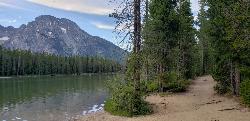
String Lake
Alta, Wyoming
0.2 miles SString Lake is a shallow lake that connects Leigh Lake and Jenny Lake at the base of Mount St. John and Rockchuck Peak. From the lakeshore, you can also take in beautiful views of Teewinot and Mt....
Canoe, Hike, Kayak, Swim 10.5-16.2 mi
Paintbrush Canyon
Alta, Wyoming
0.3 miles SEBeautiful trail along String Lake, Leigh Lake, and Lake Solitude. For even more solitude, scramble up the rocks to Micah Lake for a beautiful view and even fewer people. You won't find...
Backpack, Hike 0.3-5.1 mi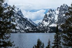
Jenny Lake Trail
Jackson Hole, Wyoming
1.9 miles SWOne of the most popular trails to visit in Grand Teton is the Jenny Lake Trail. The Jenny Lake Trail, located near Moose, Wyoming, is an easy trail that loops around the lake. Along with the sheer...
Hike 24.3 mi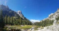
Cascade Canyon Trail
Jackson Hole, Wyoming
2.6 miles SThis hike starts the same as the Jenny Lake trail, then after you pass the boat dock, it takes off up Cascade Canyon just to the north of Teewinot, Mount Owen, and the Grand Teton along Cascade...
Backpack, Hike
Jenny Lake Campground
Jackson Hole, WY
2.6 miles SJenny Lake campground is a scenic beauty in the heart of Grand Teton National Park. It's understandable why it often fills before 8 AM during peak summer periods. It's nestled right at the...
Camp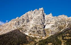
Teewinot Mountain
Jackson Hole, Wyoming
3.7 miles SBackpack and Hike near Jackson Hole, Wyoming
Backpack, Hike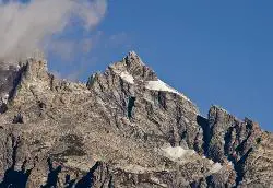
Mount Owen
Jackson, Wyoming
3.8 miles SHike near Jackson, Wyoming
Hike 13.8 mi
Middle Teton
Jackson Hole, Wyoming
3.8 miles SAt 12,804 ft above sea level, the Middle Teton is a challenging and beautiful hike from the trailhead all the way to the peak. The first part of the trail is dirt trails through the trees. That...
Backpack, Hike, Rock Climb 3.9-14.4 mi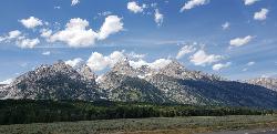
Grand Teton
Jackson Hole, Wyoming
3.8 miles SAt 13,770 feet above sea level, the Grand Teton towers majestic over Southeastern Idaho and Western Wyoming, making it a life goal of many amateur climbers and outdoor enthusiasts. The...
Backpack, Hike, Rock Climb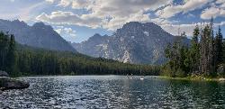
Mt. Moran
Alta, Wyoming
3.9 miles NWMount Moran (12,610 feet (3,840 m)) is a mountain in Grand Teton National Park of western Wyoming, USA. The mountain is named for Thomas Moran, an American western frontier landscape artist....
Hike 4.9 mi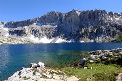
Amphitheater Lake
Alta, Wyoming
4.8 miles SWBackpack and Hike near Alta, Wyoming
Backpack, Hike 7.9 mi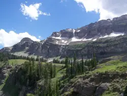
Devil's Stairs
Driggs, Idaho
9.5 miles WJust to the West of Table Rock is this often overlooked trail less traveled by, full of beautiful meadows and beautiful views all its own. The trail begins from the same campsite as the Table Rock...
Backpack, Hike 15.0-18.4 mi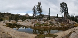
Alaska Basin
Driggs, Idaho
9.5 miles WThe Alaska Basin Trail is a stunning trail through the Jedediah Wilderness near Driggs, Idaho and goes East into Wyoming, just outside of Grand Teton National Park. The trail is wide...
Backpack, Hike, Horseback 3.8-6.4 mi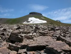
Table Rock / Table Mountain
Driggs, Idaho
9.6 miles WAt 11,300 feet, Table Mountain is possibly the most beautiful climb this side of the Tetons and offers what may well be the very best view of the Grand Tetons. It's just far enough away...
Camp, Hike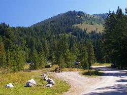
Teton Canyon Campground
Alta, Wyoming
9.7 miles WTeton Canyon is the start of several great adventures, including the Alaska Basin Trail, Table Rock, Devil's Stairs, and the Teton Crest. The campground offers a perfect basecamp to get an...
Camp
Reunion Flat Campground
Alta, Wyoming
11.2 miles WCamp near Alta, Wyoming
Camp 1.7 mi
Rick's Basin
Driggs, Idaho
11.2 miles WMountain Bike near Driggs, Idaho
Mountain Bike 0.6-4.0 mi
Grand Targhee XC Park
Moose, Wyoming
11.4 miles WMountain Bike 1.1 mi

More Cowbell
Moose, Wyoming
11.4 miles WThis singletrack trail winds through aspens, high alpine meadows and old growth conifers.
Mountain Bike 1.9 mi
Perm-a-grin
Moose, Wyoming
11.4 miles WPerma Grin is guaranteed to fix a smile on your face indefinitely! This swooping, flowing, smooth singletrack descends the hillside above Rick's Basin.
Mountain Bike


