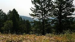
240 Things to do near Leaning Fir #169
first prev 1 2 3 4 5 6 7 8 9 10 next lastShowing results within 50 miles Distance miles of JC9F+2C Poplar, ID, USA City, Zip, or Address

Kelly Canyon/Table Rock
Ririe, Idaho
1.1 miles NWThe initial climb is soft, so you might wash out a little. There are enough roots and rocks to add some challenge to the climb and some air to the descent. The trail forks at one point,...
Mountain Bike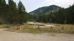
Table Rock Campground
Ririe, Idaho
1.1 miles NWTable Rock / Poison Flat Campground is located at the Caribou-Targhee National Forest which occupies over 3 million acres and stretches across southeastern Idaho, from the Montana, Utah, and Wyoming...
Camp
Lower Hawley Gulch Trail
Ririe, Idaho
1.2 miles NWThis is a singletrack biking trail in Ririe, Idaho. The trail is mainly flat with a few gradual slopes. You may have to carry your bike over obstacles such as fallen trees, logs, and small ponds....
Mountain Bike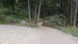
Poison Flats
Ririe, Idaho
1.5 miles NWHike near Ririe, Idaho
Hike
Wolverine Creek Trail
Ririe, Idaho
1.9 miles EThe Wolverine Creek Trail is a doubletrack trail in Ririe, Idaho. It begins at South Fork Road and ends at Wolverine trailhead. It is commonly used by dirt bikes and four wheelers. This trail is...
Mountain Bike 1.8 mi
Crystal Cruise
Ririe, Idaho
1.9 miles WThis trail uses the Crystal Cruise Nordic Trail along the Kelly Canyon ski resort boundary, taking you up to Kelly Canyon proper. It's a good climb, and a quick downhill back to the parking...
Mountain Bike 1.1 miHidden Vista / Pine Loop
Ririe, Idaho
2.0 miles NWCLOSED. This land is owned and managed by the US Forest Service and is not designated for use. As of July 2024, being caught mountain biking on this trail could recieve up to a $5000 fine and a...
Hike, Mountain Bike 5.7-8.1 mi
Space Cruz
Ririe, Idaho
2.0 miles NWCLOSED. This land is owned and managed by the US Forest Service and the upper portions of this route are not designated for use. As of July 2024, being caught mountain biking on PINE LOOP or THE...
Cross-country Ski, Mountain Bike 1.7 mi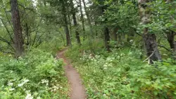
Buckskin Morgan Ridge
Ririe, Idaho
2.0 miles NWCLOSED. This land is owned and managed by the US Forest Service and is not designated for use. As of July 2024, being caught mountain biking on this trail could recieve up to a $5000 fine and a...
Hike, Mountain Bike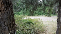
Wolf Flats Recreation Area
Ririe, Idaho
2.2 miles SWWolf Flats is a completely free, dispersed, undeveloped camping area with 25 locations to camp. Some areas are large enough to accommodate groups of 50 people.
Camp 3.8 mi
Kelly Mountain Trail
Ririe, Idaho
2.2 miles NWKelly Canyon Trail is a moderate, uphill trail that can be used by hikers, mountain bikers, and ATV riders. The trail features views of hills, mountains, trees, wildflowers, and some wildlife. Dogs...
Cross-country Ski, Hike, Mountain Bike, Snowshoe 11.9 mi
Waterfall Loop
Ririe, Idaho
2.6 miles NTrail is a mixture of single track, forest road and double track. Provides a variety of scenery. About 1400 feet of elevation change throughout the trail.GPS is a must unless you are going with...
Mountain Bike 0.6-2.2 mi
Fish Creek Area
Ririe, Idaho
3.1 miles NCLOSED. This land is owned and managed by the US Forest Service and is not designated for use. As of July 2024, being caught mountain biking on this trail could recieve up to a $5000 fine and a...
Hike, Mountain Bike
Kelly Canyon Loops
Ririe, Idaho
3.1 miles NThis mountain bike trail near Kelly Canyon Ski Area has several options available. Highlights are the views in all directions from the top of the mountain. Trails: Waterfall...
Mountain Bike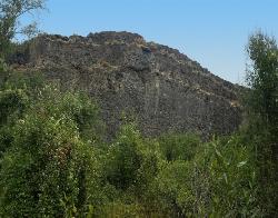
South Park
Ririe, Idaho
3.2 miles SWRock Climb near Ririe, Idaho
Rock Climb
The Arcane
Ririe, Idaho
3.3 miles ERock Climb near Ririe, Idaho
Rock Climb
Kelly Canyon
Ririe, Idaho
3.4 miles NWThe trail switchbacks up Kelly Mountain, hitting two brief red-line climbs before you get up on the top. The famed "Shale Chute" is back there somewhere (so this is part of the route for...
Mountain Bike 1.7 mi
Randy's Cow Trail / Ken's Corner
Ririe, Idaho
3.5 miles NWThis trail descends from the fence corner at the West end of Batman and continues down to Lyon's Creek Parking just off Lyon's road. The top of this trail is only a couple hundred yards from...
Mountain Bike 0.3 mi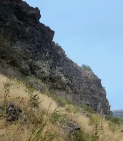
Pointless Crag
Ririe, Idaho
3.6 miles WNO MORE BOLTING as of 5/2012 requested by the Bureau of Land Management. The BLM has asked us NOT to park on the road below the cliff. Please use the obvious parking area next to the river...
Rock Climb 2.1 mi
Batman
Ririe, Idaho
3.6 miles NWThis trail features rolling terrain, and multiple short, steep downhill sections followed by short steep uphill sections. This trail follows the fence line. Watch out for cows (and cow droppings)...
Mountain Bike


