


57 Things to do near Kokopelli Trail
first prev 1 2 3 next lastShowing results within 50 miles Distance miles of Unnamed Road, Cisco, UT 84515, USA City, Zip, or Address
Westwater Mesa / Overlook
Thompson, Utah
2.1 miles SWScenic trails that mostly follow the Colorado River canyon rim. Singletrack is used by motorcycles, but is surprisingly solid. There are a few junctions along the way that can be...
Mountain Bike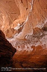
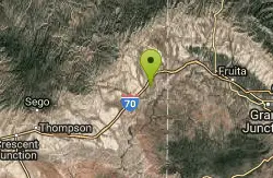
Mee Canyon Alcove
Mack, Colorado
8.9 miles EThe Mee Canyon Alcove is a beautiful and unique feature in the Colorado Plateau. It is believed to be the largest alcove in the plateau, measuring 300 ft deep, 200 ft wide, and 80 ft high. The...
Cave
Fruita Riverfront Park Disc Golf Course
Fruita, Colorado
19.6 miles ERocky riverbed - desert terrain. Elevation, arroyos, trees and shrubs. A variety of long and short holes, tunnel shots and unique holes. with super views of the Colorado River, CO National Monument...
Disc Golf
Little Salt Wash Park
Fruita, Colorado
21.4 miles EOn natural terrain - short, tight and technical, weaving in and out of cottonwood, willow, Russian olive and tamarisk trees as it meanders along Little Salt Wash. Errant throws not forgiven. Added...
Disc Golf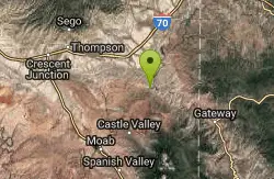
Top Of The World
Cisco, Utah
25.6 miles SWThis is a 4x4 trail that is a load of fun. It is not that steep but there are lots of bike steps that you have to climb (and get to descend!). The view at the top is unbelievable....
Mountain Bike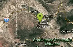
Andy's Tunnel
Grand Junction, Colorado
28.7 miles EAndy's tunnel is a cool place to retreat while hiking in the area. it is probably about 50 feet long and most of it is big walking pasage
Cave, Hike
Westlake Park
Grand Junction, Colorado
29.5 miles EAll but 5 baskets have been pulled (1,2,3,8 and 9). Public (No Fee)
Disc Golf
Watson Island DIsc Golf Course
Grand Junction, Colorado
30.7 miles ERight beside the Botanical Gardens. Surrounded by water. Bring map to help navigate. Public (No Fee)
Disc Golf
Gateway Canyons Resort Disc Golf
Gateway, Colorado
33.5 miles SIn Cottonwood gallery, near the Dolores River. Challenging with good variety. Private (No Fee)
Disc Golf
Matchett Park
Grand Junction, Colorado
33.7 miles EOpen dirt course with elevation, cliffs, and thick brush surrounding creek. Difficult to play when muddy. Public (No Fee)
Disc Golf
Little Creek/ Corral Fork
34.5 miles SE
Doesn’t look like this world class singletrack gets ridden much. Little Creek was overgrown and difficult to follow in a few places. Ride up Little Creak about 1 mile...
Mountain Bike
Arches NP Main Road
Moab, Utah
36.1 miles SWThis is the main road through Arches National Park. Road is paved (chipseal). Most people drive through, but this makes a beautiful cycle ride. As with any riding in Moab, you must...
Mountain Bike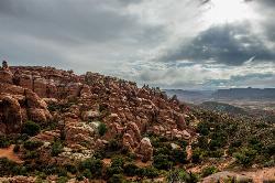
Fiery Furnace
Moab, Utah
37.2 miles SWA fun place to go hiking within Arches National Park. The Fiery Furnace area is a permit only area, with several ranger-led tours available. Hiking permits are required in order to enter, as well...
Hike
Mega Steps
40.5 miles SW
A fun trail built as a section of the Klondike Bluffs system utilized to complete a loop out of Baby Steps - EKG or Little Salty. From the trailhead there is a short sandy section to...
Mountain Bike
Riverbend Park
Palisade, Colorado
41.0 miles EChallenging - in a beautiful and secluded location. Plays through cottonwoods along the Colorado River. Multiple pin positions. Dual tees on 11 holes. Water hazards with mosquitoes - bring...
Disc Golf
Klondike Bluffs
41.2 miles SW
The Klondike Bluffs area is now a complex trail system featuring a myriad arrangement of 4x4 roads and singletrack/slickrock bikes-only trails. These trails climb the sides of the...
Mountain Bike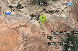
Miner's Loop
Moab, Utah
41.3 miles SWMiner's Loop is a brand-new (as of April 2014) advanced loop near the Klondike Bluffs south trailhead. This entertaining trail climbs to the top of a bluff and then is a rip-roaring...
Mountain Bike
Baby Steps
Moab, Utah
41.4 miles SWNewer singletrack in Moab. It follows the Klondike Bluffs trail for a bit, then spurs off. It is well signed. A combination of a little doubltrack, slickrock, and singletrack. The...
Mountain Bike
The Whole Enchilada
Moab, Utah
42.5 miles SThis trail encompasses several trails including Burro Pass, Hazard County, and Porcupine Rim. You start out at 10000ft, and climb about another 1400 to Burro Pass, then the downhill...
Mountain Bike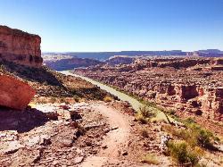
Porcupine Rim
Moab, Utah
42.6 miles SA great mountain biking trail, Porcupine Rim takes bikers through some of the beautiful areas of Moab. The trail is also one of the most difficult and dangerous trails in the Moab area. There can...
Mountain Bike


