


21 Things to do near Indian Creek, South Fork
first prev 1 2 next lastShowing results within 50 miles Distance miles of 22 S Fork Rd, Happy Camp, CA 96039, USA City, Zip, or Address

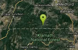
Happy Camp Area
Happy Camp, California
4.1 miles SESwim near Happy Camp, California
Swim
The Eddy
Happy Camp, California
4.1 miles SEA popular swimming hole for families found along a tributary of the Klamath River. Tubing is also possible in this swimming area and makes a great spot to visit on a summer day. Happy Camp is a...
Swim
Elk Creek Holes
Happy Camp, California
9.9 miles SEThese swimming holes are found along the Elk Creek. If willing to hike around and explore, there are several different spots that visitors can stop and take a swim.
Swim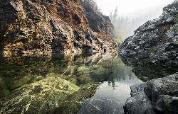
Clear Creek
Happy Camp, California
11.7 miles SClear creek, as the name suggests, has some of the best swimming holes in the area. The water remains crystal clear and isn't too crowded in the summer months. There are two areas to go...
Swim
Vertical Horizons Treehouse Paradise
Cave Junction, Oregon
17.0 miles NWPublic (No Fee)
Disc Golf
Applegate Area
Princeton, Oregon
19.7 miles NESwim near Princeton, Oregon
Swim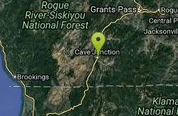
Cave Junction Ray Gerber Skatepark
Cave Junction, Oregon
22.5 miles NWConcrete, free, mini ramp, pads, street course
Skateboard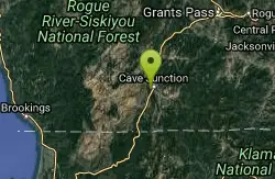
Illinois River Forks State Park
Cave Junction, Oregon
22.6 miles NWThe terrain is flat and mostly open with some trees. Some long holes. Innovative large concrete tees - the toe board embedded 2' from the front prevents following through off the tee. Great...
Disc Golf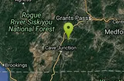
Lake Selmac
Selma, Oregon
27.1 miles NVery technical, through trees with some elevation. #9 throws across a portion of the lake from a peninsula. Back 9 has alt. pin locations. Maps on site at bulletin board. Public (No Fee)
Disc Golf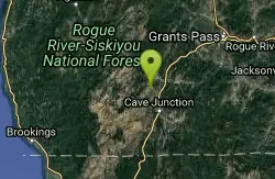
Illinois Hidden Access
Selma, Oregon
28.6 miles NWSwimming place at foot of 30 foot falls popular with Rogue River runners and Rogue River Trail Hikers. This is usually visited as part of a longer hiking or river trip, but can be accessed by an 9...
Camp, Hike, Mountain Bike, Swim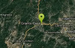
Riverside Park
Grants Pass, Oregon
38.5 miles NIn manicured old growth park on the Rogue River. Mown grass fairways. Arrows in homemade baskets to next tee. Maps in box on course sign. Playground, athletic fields, boat ramp and picnic shelters....
Disc Golf
Beachfront Park Disc Golf Course
Crescent City, California
40.2 miles WLightly wooded, multi-use park setting with modest elevation changes. One hardened sand tee, three of rubber and the balance are concrete. Ceramic arrows embedded in concrete below baskets point to...
Disc Golf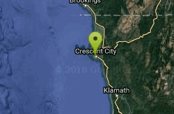
Joe Hamilton Elementary
Crescent City, California
40.8 miles WGood for beginners and for approach practice - hole between 200' and 300' weave through trees and open space. Concrete and woodchip areas OB. School year use - weekdays after 5:30pm. Public...
Disc Golf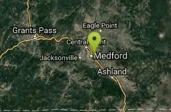
Medford Skate Park
Medford, Oregon
42.6 miles NEHuge snake run, fun box, bowls. This place will have the whole enchalada when it opens. The day we visited a couple kids were poaching the park, but luckily the...
Skateboard
Southern Oregon University
Ashland, Oregon
43.4 miles NEOn the campus. Private (No Fee)
Disc Golf
Gold Hill Sports Park
Gold Hill, Oregon
43.4 miles NERugged terrain. Course map helps with navigation. Public (No Fee)
Disc Golf
Pilot Rock
Ashland, Oregon
46.1 miles EVisible from much of the Shasta Valley in northern California, and parts of Oregon’s Rogue Valley, Pilot Rock provides viewers with a look at the inside of a volcano. Over time, the exterior...
Hike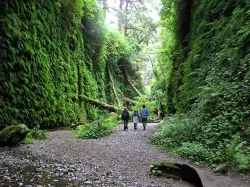
Fern Canyon
Orick, California
46.6 miles SWFern Canyon is one of the best 1-mile hikes that you can do in California! This unforgettable location was featured in Steven Spielberg's film, Jurassic Park: The Lost...
Hike
Indian Mary Park
Merlin, Oregon
46.8 miles NWell-manicured, on rolling hills near Rogue River. Dual tees. Maps/scorecards at booth. Imported trees, camping and disc sales. Public (No Fee)
Disc Golf
Lower Table Rock
Medford, Oregon
47.0 miles NEThe Lower Table Rock trail is a moderate hike/climb and gains about 800 feet of elevation in just over 2.7 miles. This area was originally part of an area signed into a treaty by the Rogue River...
Hike


