


116 Things to do near Indian Creek Campground Yellowstone
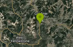
first prev 1 2 3 4 5 6 next lastShowing results within 50 miles Distance miles of Indian Creek Campground Road, Yellowstone National Park, WY 82190, USA City, Zip, or Address
Bunsen Peak Loop Bike Trail
Yellowstone National Park, Wyoming
3.5 miles NBunsen Peak Loop Bike Trail is a challenging trail that follows several service roads around Bunsen Peak. This 10 mile loop has a total elevation change of 1,120 feet, with several miles of the trail...
Mountain Bike 7.8 mi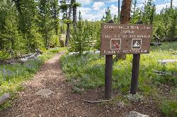
Osprey Falls Trail
Mammoth Hot Springs, Yellowstone National Park
3.6 miles NOsprey Falls Trail is an 8 mile out and back trail near Mammoth Hot Springs that provides hikers with a variety of stunning views, including ravines and a waterfall. Hikers begin this hike...
Hike 4.0 mi
Bunsen Peak Trail
Mammoth Hot Springs, Yellowstone National Park
3.6 miles NBunsen Peak Trail is a 4.6 mile hike to the peak of Mount Bunsen. This is an out and back trail and is considered moderately difficult because of the 1,300 foot climb in elevation. ...
Hike 2.0 mi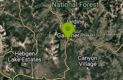
Snow Pass Trail
Yellowstone National Park Wyoming
5.5 miles NSnow Pass Trail is a beautiful day hike for visitors to Yellowstone looking to escape the crowds. Located a half mile south of the Mammoth Hot Springs Upper Terraces. Parking is available at a...
Backpack, Hike 5.3 mi

Beaver Ponds Trail
Mammoth, Yellowstone National Park
6.5 miles NBeaver Ponds Trail is a wonderful short hike accessible from Mammoth Hot Springs. The trail forms a loop between the two trailheads available at Mammoth Hot Springs. The loop is just over 5 miles...
Hike 8.1 mi
Sepulcher Mountain Trail
Mammoth Hot Springs, Yellowstone National Park
6.6 miles NSepulcher Mountain Trail is an 11 mile loop trail from Mammoth Hot Springs to the peak of Sepulcher Mountain. This is a challenging hike with a 3,500 foot ascent to the 9,652 foot peak. The...
Hike 0.1-5.2 mi
Mammoth Hot Springs
Mammoth, Yellowstone National Park
6.6 miles NMammoth Hot Springs is a unique sight in Yellowstone National Park. The soft limestone in this area allowed the water to form colorful terraces. The extremely hot running water is clear and smooth,...
Camp, Hike 4.0 mi
Lava Creek Trail
Mammoth Hot Springs, Yellowstone National Park
6.8 miles NLava Creek Trail is a 4.2 mile hike where hikers can enjoy walking along the scenic Lava Creek. The trail passes Undine Falls and the Gardner River. Undine Falls is a beautiful 60 foot...
Hike
Mammoth/Gardiner Back Road
Mammoth Hot Springs, Yellowstone National Park
6.9 miles NThe only road open in Yellowstone National Park is Highway 89 at Gardiner, Montana to park Headquarters at Mammoth Hot Springs and from Mammoth Hot Springs to Silver Gate and Cooke City, Montana.
Hike, Mountain Bike
Mammoth Hot Springs Campground
Mammoth Hot Springs, Yellowstone National Park
6.9 miles NMammoth Hot Springs Campground is the only campground in Yellowstone that is open to campers year-round. Campsites cannot be reserved and are available on a first come first served basis. It is...
Camp 0.8 mi
Wraith Falls Trail
Mammoth Hot Springs, Yellowstone National Park
6.9 miles NEWraith Falls Trail is a less than 1 mile there and back hike that can be taken in under an hour. This is a wonderful family friendly hike that is easy for hikers of all levels. The hike leads...
Hike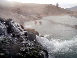
Boiling River
North Entrance, Yellowstone National Park
8.0 miles NThe Boiling River is created where a large hot spring enters the Gardner River, allowing the hot and cool waters to mix into a temperature comfortable enough to bathe in. The natural hot tub makes a...
Hot Springs, Swim 7.4 mi
Blacktail Deer Creek to Yellowstone River Trail
Mammoth Hot Springs, Yellowstone National Park
8.6 miles NEBlacktail Deer Creek Trail is a 7 mile out and back trail that leads to the Yellowstone River. Hikers on this trail will enjoy seeing green open fields, boulder formations and waterfalls at the...
Hike 7.9 mi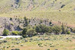
Rescue Creek Trail
Mammoth Hot Springs, Yellowstone National Park
9.7 miles NRescue Creek Trail is an 8 mile hike that crosses the Montana/Wyoming boarder. This double trail makes for a leisurely hike through beautiful hills and colorful yellow green grasslands. This trail,...
Hike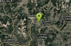
Forces of the Northern Range
Mammoth, Yellowstone National Park
9.8 miles NEThis short 1/2 mile boardwalk located on the Blacktail Deer Plateau between Mammoth Village and Tower Junction will open your eyes and educate you about forces of nature that have sculpted the land...
Hike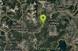
Norris Campground
Norris, Yellowstone National Park
10.1 miles SNorris campground is centrally located in Yellowstone National Park and offers a good spot for those planning to visit many of the most famous features in Yellowstone. Norris is a relatively short...
Camp 3.8 mi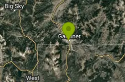
Abandoned Railroad Bed Bike Trail
Gardiner, Montana
10.5 miles NThe Abandoned Railroad Bed Bike Trail, otherwise known as Shortline Trail, is a easily accessible bike trail found just inside the North Entrance of Yellowstone National Park. This bike trail follows...
Mountain Bike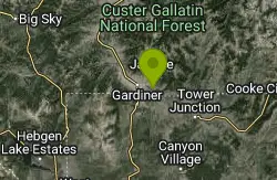
Coyote Creek Trail
Gardiner, Montana
10.6 miles NEnear Gardiner, Montana
Ice Lake Trail
Norris, Yellowstone National Park
12.4 miles SEThis is a short trail leading to a pretty, tree-lined lake, across ground covered by a lattice of fallen pine trunks from the 1988 fires. The entire trail went through areas burned by the fires of...
Hike 1.5-3.8 mi
Little Gibbon Falls
Norris, Yellowstone National Park
12.8 miles SEIce Lake and Little Gibbon Falls Loop is a 4.5 mile loop trail located near Yellowstone National Park, Wyoming. The trail is good for all skill levels and primarily used for hiking, but there are...
Camp, Canoe, Hike


