


234 Things to do near Indian Bend Bike Trail
first prev 3 4 5 6 7 8 9 10 11 12 next lastShowing results within 50 miles Distance miles of 10901 N 92nd St, Scottsdale, AZ 85260, USA City, Zip, or Address
Freestone Park
Gilbert, Arizona
16.7 miles SEMostly flat and open. The last couple of holes play around the Rec Center, making use of OB parking lot and some trees. Practice basket. Public (No Fee)
Disc Golf
Freestone Skatepark
Gilbert, Arizona
16.9 miles SEThis 23,000-square-foot Site Design Group-built concrete park is rumored to rival the companys masterpiece in Chandler, Arizona. Freestone features a street plaza and two bowls. As an added bonus,...
Skateboard
Buckhorn Campground Nature Trail
Apache Junction, Arizona
17.0 miles SECamp and Hike near Apache Junction, Arizona
Camp, Hike 2.3 mi
Hidden Valley Trail Via Mormon Trail
Phoenix, Arizona
17.4 miles SWHidden Valley Trail via Mormon Trail is a 2-4 mile hike, depending on the route you choose to take and how much additional exploring you do. This hike offers a natural rock tunnel, petroglyphs,...
Hike, Mountain Bike
Riparian Preserve at Water Ranch Trail
Gilbert, Arizona
17.5 miles SEThe Riparian Preserve is an urban park with a series of loop trails surrounding seven ponds stocked with fish and birds. It is located at 2757 E. Guadalupe Road, Gilbert AZ. Several...
Canoe, Hike
Tempe Skatepark
Tempe, Arizona
17.5 miles SPark has a really fun bowl section, also a couple nice kinked rails and some stairs, weird lines but really fun.
Skateboard 21.4 mi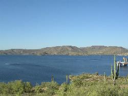
Spur Cross to Lake Pleasant
Cave Creek, Arizona
17.5 miles NStart at the Flat Tire Bike Shop and head north on Spur Cross Road. You will arrive at the Spur Cross Conservation Ranch in 3.2mi. From there enter the Maricopa Trail system and follow the signs...
Mountain Bike
Cave Creek Park
Cave Creek, Arizona
17.5 miles NMultiple singletrack loops, just explore and find what works best for you. Watch out for hikers and horses.
Mountain Bike 1.5 mi
Moon Rock Loop
Apache Junction, Arizona
17.5 miles SELocated within the larger Usery Mountain Regional Park, the Moon Rock loop is a fast and smooth trail that adds 1.3 miles to the more famous Blevins Trail. Although the Moon Rock loop is not known as...
Hike, Horseback, Mountain Bike
Thunderbird-Paseo
Glendale, Arizona
17.6 miles WIn a drainage canal with mostly side hill pins. Starts and ends at playground/restroom area. A range of difficulty - with some length and uphill approaches. Pack water. Some tees are on blacktop...
Disc Golf
Usery Mountain Regional Park
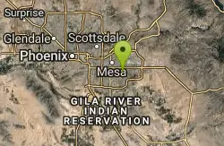
Mesa, Arizona
17.6 miles SEThere are many miles of two-way single-track trails in the park at several levels of difficulty. The Pass Mountain Trail should challenge intermediate to advanced riders. The Cat Peaks...
Mountain Bike 1.7 mi
Levee Trail
Mesa, Arizona
17.7 miles SELocated within the Usery Mountain Regional Park, the Levee trail is named so because it mostly follows the top of levee, running parallel to a large section of the channel trail and a Phoenix...
Hike, Horseback, Mountain Bike
Glendale Canal
Glendale, Arizona
17.8 miles WHike, Horseback, and Mountain Bike near Glendale, Arizona
Hike, Horseback, Mountain Bike
Cat Peaks - Blevin - Moonrock
Apache Junction, Arizona
17.8 miles SEFollow Blevins trail 0.6 miles, the entrance to the Moonrock loop will be on your right, marked by a brown sign and arrow. Take this loop (around 1.4 miles) until it returns to Blevin's...
Mountain Bike
Bobcat Trail - Sonoran Preserve
Phoenix, Arizona
17.9 miles NWBobcat Trail is a short, easy trail, often used for connecting to other bigger trails in the Sonoran Desert Preserve. This is a 2 mile out-and back trail. There isn't much of a parking...
Hike

Foothills Skate Court Glendale
Glendale, Arizona
17.9 miles WThis park looks really fun especially for the intermediate skater, some great bowls.Check it out for sure.
Skateboard
Pebble Beach
Mesa, Arizona
17.9 miles EPebble Beach is a popular place to go tubing and swimming with designated picnic areas. It's located along the Salt River in Cibola National Forest. The reason the Salt River is so salty is...
Swim
Crismon Wash Trail
Mesa, Arizona
18.0 miles SEThe Crismon Wash Trail is 1.8 mile trail that is accessible from the south at the Crismon road trailhead. It is also accessible from the Blevins train to the north. There are several...
Hike, Horseback, Mountain Bike
Deem Hill
Phoenix, Arizona
18.2 miles NWThe trail starts out going north around the mountain then heads uphill and gives you some good inclines with switch backs. Total incline is approximately 650'. The trail is rocky and...
Mountain Bike
Deem Hills East Trail
Phoenix, Arizona
18.2 miles NWDeem Hills is one of the newer parks in Phoenix to open (2010) and as such a lot of people still don't know it's there. This means that it has much more of a secluded feel then some of...
Hike


