


45 Things to do near Horse Butte
first prev 1 2 3 next lastShowing results within 50 miles Distance miles of 21845 Butte Ranch Rd, Bend, OR 97702, USA City, Zip, or Address
Arnold Ice Cave
Bend, Oregon
0.3 miles SEThis trail travels from Coyote Loop Trail #3962.0 to Swamp Wells Campground. The Skeleton Cave Trail #3963.1 and the Fuzztail Butte Trail #3965 are accessed from this trail....
Mountain Bike
Coyote Loop Trail
Bend, Oregon
0.7 miles SOpen sage and sparse forest with vistas of the Three Sisters to the northwest. source: fs.usda.gov
Mountain Bike
Swamp Wells Trail
Bend, Oregon
1.7 miles EThis trail extends from near Horse Butte, just south of Bend, to the north rim of Newberry Caldera. source: fs.usda.gov
Mountain Bike
Boyd Cave Trail
Bend, Oregon
4.3 miles SEOpen sage and sparse forest with vistas of the Three Sisters to the west and Newberry Buttes to the south. source: fs.usda.gov
Mountain Bike
Bend Skatepark
Bend, Oregon
5.4 miles NWBowl, concrete, free, street course
Skateboard
Horse Ridge Recreation Area
Bend, Oregon
6.9 miles NWExcellent riding.
Mountain Bike
Entrada Loop Trail
Bend, Oregon
7.2 miles NWNice for day hiking, or as a mountain bike connector to either the Tumalo Trail System or the Deschutes River Trail. source: fs.usda.gov
Mountain Bike
Seventh Mountain Resort
Bend, Oregon
8.2 miles WFamily friendly resort course. Plays through well manicured park-like grounds. Tees identified by numbered yellow posts. Well defined OB. Please be cautious of other guests. Recreation Center offers...
Disc Golf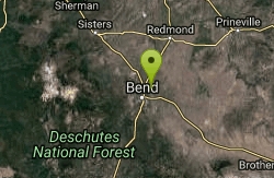
Pine Nursery
Bend, Oregon
8.2 miles NBeautiful views of the Cascades. Mostly flat, though natural lava outcroppings offer subtle elevation changes. The foliage is mostly junipers, sage brush and thick desert grasses. Baskets are...
Disc Golf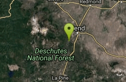
Inn Loop
Bend, Oregon
8.6 miles WA moderately easy ride through some nice stands of lodgepole pine and ponderosa pine.Mileposts:0.0 - Trailhead parking lot at junction of FS roads 46 and 41. Head out on FS road 41.0.6...
Mountain Bike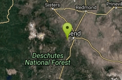
Phil's Trail
Bend, Oregon
8.8 miles NWSince this is the namesake for the entire trail system and the oldest trail in the area, I kind of expected a blown-out doubletrack. That is entirely NOT the case! COTA has done an...
Mountain Bike
Ben's Lower
Bend, Oregon
8.9 miles NWBen's is about 7 miles long one-way, and is split into basically two portions. The lower portion is all two-way, flowy cross country trail, but the upper section of Ben's is...
Mountain Bike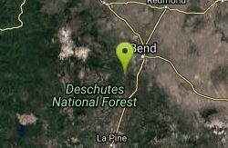
Catch and release
Bend, Oregon
9.3 miles WMost of Catch and release is a nice flowing single track that is easy to ride. At the south end there are some rock sections that add a little fun to the route. This is a great way to...
Mountain Bike
Storm King
Bend, Oregon
9.5 miles WA fun trail by itself however is mainly used as access too or in conjunction with others as loop routes etc. Running N-S across the face of the Mtn slope there is not a lot of climbing...
Mountain Bike
Whoops
Bend, Oregon
14.3 miles WWhoops is a renowned flow/jump trail in the Bend area that connects to Ben's of the Phil's Area on the Eastern End and then the Swede Ridge loop on the Western End (with a connection...
Mountain Bike
Skyliners
Bend, Oregon
14.4 miles WSkyliners is a 3.2-mile intermediate singletrack trail that runs from the Skyliner's trailhead to a junction with Whoops and Ben's trail, which is the corner of the Phil's Area Trail...
Mountain Bike
Phil's Area
Bend, Oregon
14.4 miles WUpdate 7/22/13 by mtbgreg1:The Phil's Area Trail System is the go-to trail system for mountain biking in Bend. Even the other trails in the region that aren't actually part of the...
Mountain Bike
Tumalo Creek
Bend, Oregon
14.5 miles WThe Tumalo Creek Trail is 3.5 miles one-way and parallels Skyliner road. Starting at the Skyliner trailhead, the trail runs up near the road on the ridge side to the Tumalo Falls...
Mountain Bike
Tumalo Trail System
Bend, Oregon
14.5 miles WMassive trail system located west of Bend in the national forest.
Mountain Bike
Tiddlywinks
Bend, Oregon
15.0 miles WTiddlywinks starts at the snow park trailhead (see Google Maps location) and has a short, rolling climb, and then begins to descend! Most of this trail is a gradual, rolling descent...
Mountain Bike


