229 Things to do near Grove Creek Trail
first prev 1 2 3 4 5 6 7 8 9 10 next lastShowing results within 50 miles Distance miles of E Grove Creek Dr, Pleasant Grove, UT 84062, USA City, Zip, or Address

Ridge Trail #157
Provo, Utah
6.3 miles NEThis trail is 15.7 miles in length and is commonly referred as the backbone of the American Fork Canyon trail system, because it connects several loop routes along the northern portion of the...
Mountain Bike
Utah Valley University
Orem, Utah
6.6 miles SVery short course (all holes less than 200') on the south end of campus. Water comes into play. Holes near the baseball diamond. Bring the map to help with navigation. Public (No Fee)
Disc Golf
Squaw peak
Provo, Utah
6.8 miles SEAirsoft and Paintball near Provo, Utah
Airsoft, Paintball
Archie's Loop
Sundance, Utah
7.0 miles EArchie's Loop Trail, a 2.2 mile stretch of mountain biking/hiking trail, recently opened up totally new country. The intermediate-level trail runs from Scott's Pond loop to connect with...
Mountain Bike
Beacon Hill Park Disc Golf
Highland, Utah
7.2 miles NWIncredible views of Utah Valley, Utah Lake, and the surrounding Rockies. Nestled on a large expanse of natural fields at the base of Hog Hollow Canyon, the course has a (usually) dry creek and a few...
Disc Golf
Provo River Parkway Trail
Provo, Utah
7.3 miles EThis isn't quite as much mountain biking as it is an easy downhill bike ride. The whole trail is paved. One of the best ways to do it is to take two vehicles and park one at Will's Canyon...
Hike, Mountain Bike
300 East Lehi Lot
Lehi, Utah
7.5 miles WThis is a huge lot with a lot of terrain. There's a couple of easily accessible hills and plenty more that could be played on.
Sled
Cherry Hill Park
Orem, Utah
7.8 miles SJust south of Cherry Hill Elementary, this is a small hill for small children great and moms who are looking to avoid a well populated hill. The hill is to the south of the playground and most...
Sled
Dry Creek Trail Park
Lehi, Utah
7.8 miles WSpread out along creek. Trees and water come into play - some long walks between holes but well marked for navigation. Public (No Fee)
Disc Golf 1.7 mi
Schoolhouse Springs Trail
Alpine, Utah
7.8 miles NSchoolhouse Springs trail has an elevation trail at 5,300 ft. It's located at the end of the town of Alpine. It features a lake and there's a number of activities including horse-back...
Hike, Mountain Bike
Tibble Fork
Provo, Utah
8.0 miles NEThis trail is advanced tech and strenuous aerobic. This trail involves a few miles of riding on the pavement. Start by heading back down to the intersection with the South Fork of American Canyon and...
Mountain Bike
Tibble Fork Reservoir
Provo, Utah
8.2 miles NEThere isn't one specific sledding run at this location. There's a great parking lot and hills above and below. It all depends on what kind of speed and excitement you're looking for....
Sled
Rock Canyon Park
Provo, Utah
8.4 miles SEThis is the biggest park in Provo, Utah, with lots to do. The hills are great for sledding.
Sled
Rock Canyon Disc Golf
Provo, Utah
8.5 miles SEIt is located at the mouth of Rock Canyon above BYU. It is very hilly and there are a fair amount of trees. This location is NOT FOR BEGINNERS at disc golf. At this course, there are...
Disc Golf
Alpine Rock Water Slide
Alpine, Utah
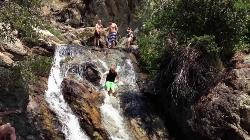
8.6 miles NWCLOSED. The land has been sold and the new owner has closed off the waterslide to the public. The Alpine Waterslide is a natural waterslide that surprisingly does not hurt your backside. However,...
Swim
Mercer Hollow Trail
Draper, Utah
9.3 miles NWMercer Hollow Trail is primarily used to bomb down the southern flanks of the ridge the Corner Canyon Trails sit on. It's filled with berms, rock features, rollers, and sweet, sweet...
Hike, Mountain Bike 1.3 mi
Eagle Crest Trail
Draper, Utah
9.4 miles NWEagle Crest trail is a beginner level trail mountain bike in Draper, Utah along the north side of Traverse Mountain. From the trail, riders can see the Salt Lake Valley, the Northern end of Utah...
Hike, Mountain Bike
Provo River
Provo, Utah
9.7 miles SThe Provo River is one of Utah's 'Urban Fisheries'.The Provo River is located in Utah County and Wasatch County, Utah, in the United States. It rises in the Uinta Mountains at Washington...
Canoe 1.7 mi
Jacob's Ladder Trail
Sandy, Utah
9.9 miles NWJacobs Ladder trail has an elevation trail of 5,700 ft. and the most popular trailhead out of the five trails in Lone Peak. It's located near a large area on the right side of the road...
Hike, Mountain Bike 0.2-1.8 mi
Lone Peak
Draper, Utah
10.0 miles NWEstablished in 1978 and located southeast of Salt Lake, Lone Peak is one of the taller peaks in the Wasatch range along the Wasatch Front. It has 5 main trailheads: Jacobs Ladder via Corner Canyon...
Hike, Mountain Bike, Rock Climb


