


149 Things to do near Glendale Open Space Trail
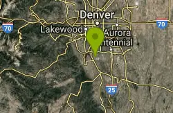
first prev 1 2 3 4 5 6 7 8 next lastShowing results within 50 miles Distance miles of 12300 S Havana St, Castle Rock, CO 80108, USA City, Zip, or Address
Bluffs Regional Park Trail
Lone Tree, Colorado
2.7 miles NThis is a multi-use trail made of crushed gravel. There are no technical features at all, but it is good for a lunchtime lap or for a couple of laps after work. It's also good for...
Mountain Bike
East-West Regional Trail
Littleton, Colorado
4.0 miles NW-- "This is the first leg of the East-West Regional Trail that will connect Chatfield State Park with the Town of Parker. The trail winds through grasslands and oak bluffs including...
Mountain Bike
Highlands Point
Highlands Ranch, Colorado
5.4 miles NWThe section of trails at Highlands Point can be accessed from Mountain Vista High School or via the East-West Regional trail parking lot on Griggs rd. Note that all but two of these...
Mountain Bike
David A. Lorenz DG Course
Highlands Ranch, Colorado
6.1 miles NWRolling field slopes toward creek with sagebrush, cactus and other local plant life throughout the park - wear long pants and boots. Creekside brush will devour discs!
Disc Golf
Plum Creek Park
Littleton, Colorado
7.8 miles WThis is the shortest single track ever but it is a good trail for beginners and practice for the big stuff. It is a little sandy and slightly downhill. There ar5e a few small turns but...
Mountain Bike
ThunderRidge High School
Highlands Ranch, Colorado
8.2 miles WLaid out in the back of a high school. Mostly grass. Tees on either asphalt or concrete. Good elevation change with some blind holes. On school property - no play while school is in session. Public...
Disc Golf
Phillip S. Miller Park
Castle Rock, Colorado
8.5 miles SPark at the Miller Activity Center parking lot (or start on sidewalk just off the Plum Creek Parkway entrance) and join the trail at the base of the "mini incline" stairs (200 steps to...
Mountain Bike
Bayou Gulch Bike Park
Parker, Colorado
8.5 miles SEThis is a bike park. There are two "loop" tracks, one beginner and one intermediate, as well as 3 intermediate flow trails.
Mountain Bike
Memmen Ridge Open Space
Castle Rock, Colorado
8.5 miles SThis is a very nice close to town peaceful trail with great views and good trails.
Mountain Bike
Redstone Skatepark
Littleton, Colorado
9.2 miles NWsnake run concrete free
Skateboard
Runyon Elementary School
Littleton, Colorado
9.5 miles NWVery short unmarked practice course with overlapping fairways. Private (No Fee)
Disc Golf
Cherry Creek
Denver, Colorado
9.6 miles NAlthough technically, this is a bike path, there are extended sections of singletrack that dart in and out of it with some surprisingly technical spots. For maximum...
Mountain Bike
Village Greens Park
Greenwood Village, Colorado
9.7 miles NAt the north end of the park. Not many trees but a creek comes in play on a few holes on the back 9. Restrooms are between the baseball fields south of the course. Public (No Fee)
Disc Golf
Matney Park
Castle Rock, Colorado
10.1 miles SFlat and open. Cross Lantern Circle for 4 - 18. Public (No Fee)
Disc Golf
Arapahoe Community College
Littleton, Colorado
11.3 miles NWVery short and flat campus course with a good variety of shots. Accuracy is key here. Be careful of pedestrians. Tees marked on ground with purple paint - bring map to navigate. Public (No Fee)
Disc Golf
Cornerstone Skatepark
Littleton, Colorado
11.4 miles NWPark features a six-foot-high, sixteen-foot-wide halfpipe, a street area with a six-foot wedge, three-foot spine, three-foot quarterpipe, five-foot quarterpipe, sixteen-foot grindrail, and a...
Skateboard
Colorado Trail: Waterton To South Platte
Littleton, Colorado
11.9 miles W*Note: Waterton Canyon will be closed for for two extended periods in 2010 and 2011: 8/2/2010 - 12/3/2010 and 2/28/2011 - 12/31/2011. Alternate access to the first section of the...
Mountain Bike
Indian Creek Loop
Littleton, Colorado
11.9 miles WThe first and last 6 miles of this trail are on the gravel road that goes through Waterton Canyon, meaning your total off-road trail distance will be about 17 miles (29 miles total)....
Mountain Bike
Colorado Trail
Littleton, Colorado
12.1 miles WAmazing singletrack, killer views, and lung busting elevation - what more could you ask for? Portions of the Colorado Trail are off limits to bikes so you'll need to detour around each...
Mountain Bike
Front Range Christian School Disc Golf Course
Littleton, Colorado
12.7 miles NWA family friendly course open to the community outside of school hours. The course starts at the main school parking lot on the east side of the campus next to the athletic building. It continues...
Disc Golf


